Dear all
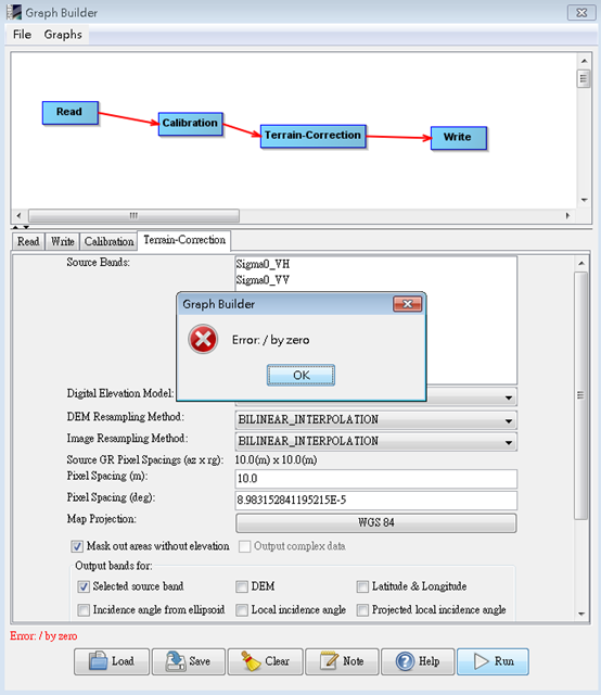
I am working with S1 GRD images, but I got error message when I set Terrain-correction’s Map Projection in EPSG:4326.
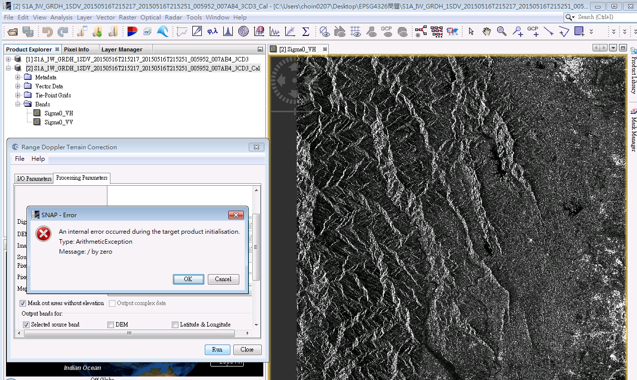
“/by zero error” shows when I do Terrain-correction (EPSG:4326),
I know there is a already a similar discussion on the forum by-zero-error-and-sarsim-terrain-correction-error-during-graph-building
but the discussion stop in thomakra’s post:
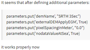
However, it works if I specify the mapProjection string as:
GEOGCS[“WGS84(DD)”,
DATUM[“WGS84”,
SPHEROID[“WGS84”, 6378137.0, 298.257223563]],
PRIMEM[“Greenwich”, 0.0],
UNIT[“degree”, 0.017453292519943295],
AXIS[“Geodetic longitude”, EAST],
AXIS[“Geodetic latitude”, NORTH]]
So … Can EPSG:4326 work correctly in Terrain-correction ? or Is there any difference between WGS(DD) and EPSG:4326
MY IMAGE: Subset SA1_IW_GRDH_1SDV
MY WORKFLOW: Read -> Calibration -> Terrain-Correction -> Write
which steps?
Regardless of what steps I used before, it always got the “\by zero” error When I change the map projection to “EPSG:4326”,
In this post, I only test “EPSG: 4326” by following the steps below
Calibration -> Terrain-Correction -> Write
Dear ABraun
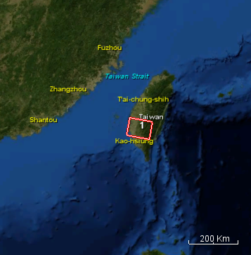
My study area is in Taiwan,
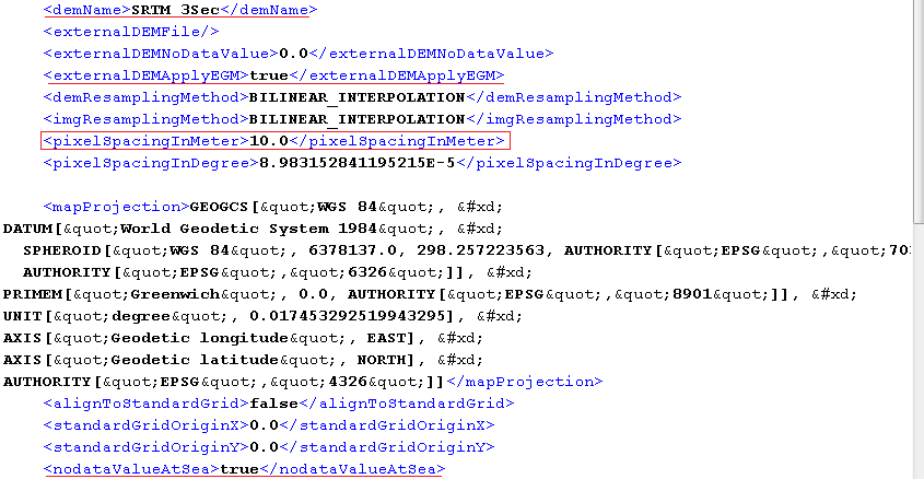
I have tried SRTM 3Sec, SRTM 1Sec HGT and External DEM(20mDEM get from Naional Web) before. All of them can work normally in WGS84(DD).
I compare the GPF_Parameter_Files(XML) that create from SNAP Graph Builder with forum suggestions you provide.
Only “pixelSpacingInMeter” is different
Hello, I’m sorry to hear that you have stumbled about this problem.
Can you reproduce this error and attach the log file here.
I hope that I can see the stack trace, to identify where this error occurs.
You can find the log file by selecting from the menu Help / Show Log Directory. Make sure to reproduce the error first and then attach the messages.log file.
Could you have a look at the output product of the calibration step?
Is it of zero size, maybe? The error happens at a location in the code where I wouldn’t expect it. Maybe something is wrong with the input of the Terrain-Correction.