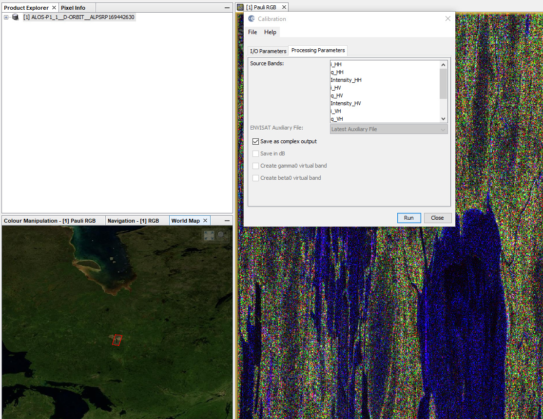
I am trying to Calibrate the AlosPalsar image for Polarimetric decomposition but while calibrating it is recommended to save the calibration as complex and I cannot see that option to select. Please help.
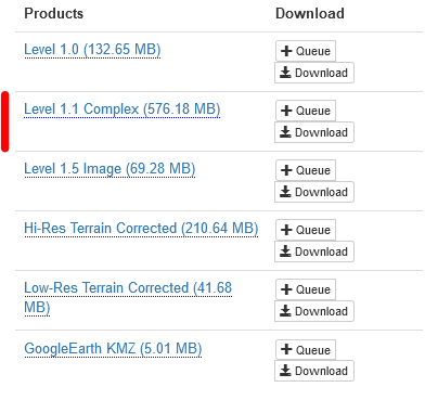
Note: I downloaded the ALOSPALSAR images from ASF and downloaded them in both high resolution and terrain corrected as well as 1.5 Complex.
Regards,
Azmery
For polarimetric analysis you should download the Level 1.1 SLC data:
If you import it via File > Import > SAR sensors > ALOS PALSAR CEOS you will find the complex calibration chekbox
A full workflow of calibrating (here: to Sigma0) and terrain correction is demonstrated here: http://step.esa.int/docs/tutorials/ALOS%20PALSAR%20Orthorectification%20Tutorial.pdf
2 Likes
@azmery90 Please note in the said tutorial the following recommendation - “Even after deskewing, the product will have a significant positional error. For missions such as
ALOS-1 and ERS where the product timing and orbit data are not accurate enough, it is
recommended to use the SAR Simulation Terrain Correction.”
Enjoy
3 Likes
Thank you so much but I was wondering if I want to perform polarimetric decomposition do I need to deskew and terrain correct the image ?
ALOS PALSAR requires deskewing at some point as well as terrain correction. But you can do all polarimetric analyses and, as final steps, perform them in the end to conserve all pixel values as best as possible.
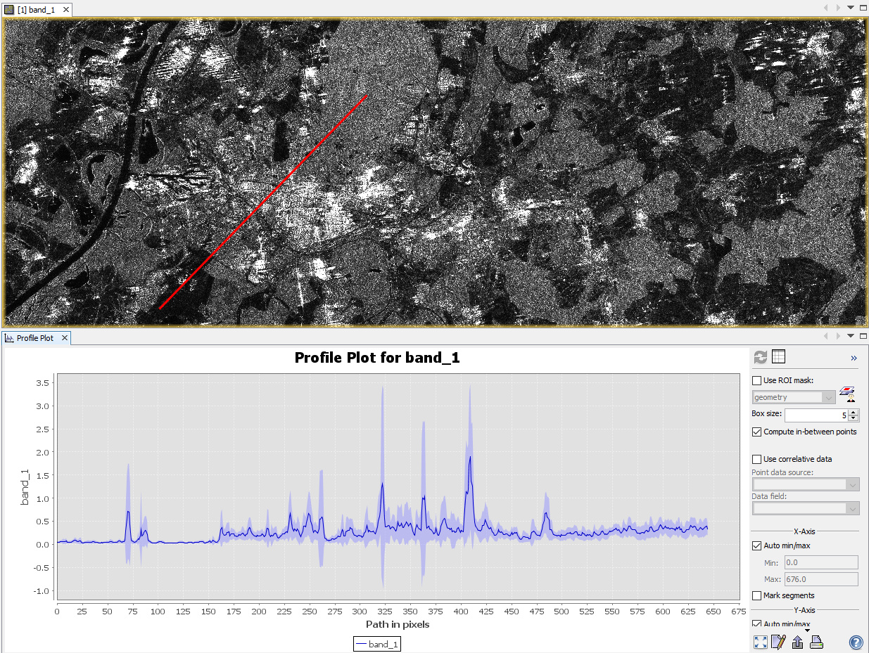
I can’t seem to perform any polarimetric analyses it keeps showing error box saying its not a polarimetric product
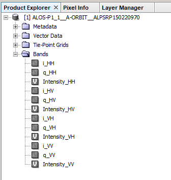
are i and q bands still in your product?
yes. i and q are still in my product.
note: the only polarization in this image is HH.
you can only perform polarimetric analyses on fully polarized data, which means that it contains HH, HV, VH and VV polarization.
If you have such data, don’t select any source bands during the processing, otherwise the tools are only applied at the selected bands.
I would not suggest multi-looking before the polarimetric matrix generation or decomposition.
Thank you so much.
But I am not getting any fully polarized images for my area. That means I cannot perform Polarimetric classification on my area?
unfortunately, yes.
Dear @ABraun,
Excuse me if I ask a question on this block. Are the “Hi-Res Terrain Corrected” products calibrated? I mean, the digital number values of original HH and HV polarizations were converted into the normalized gamma-naught radar backscattering coefficients?. I am using ALOS images to map deforestation and I have downloaded the product Hi-Res Terrain Corrected from Alaska Satellite Facility. I would beg you to help me.
Thanks,
yes, they are calibrated to Gamma0
Source: https://media.asf.alaska.edu/uploads/RTC/rtc_product_guide_v1.2.pdf
and: https://portal.asf.alaska.edu/sar-data/palsar/terrain-corrected-rtc/
Thank you very much for your kind help and for the links.
A hug!,