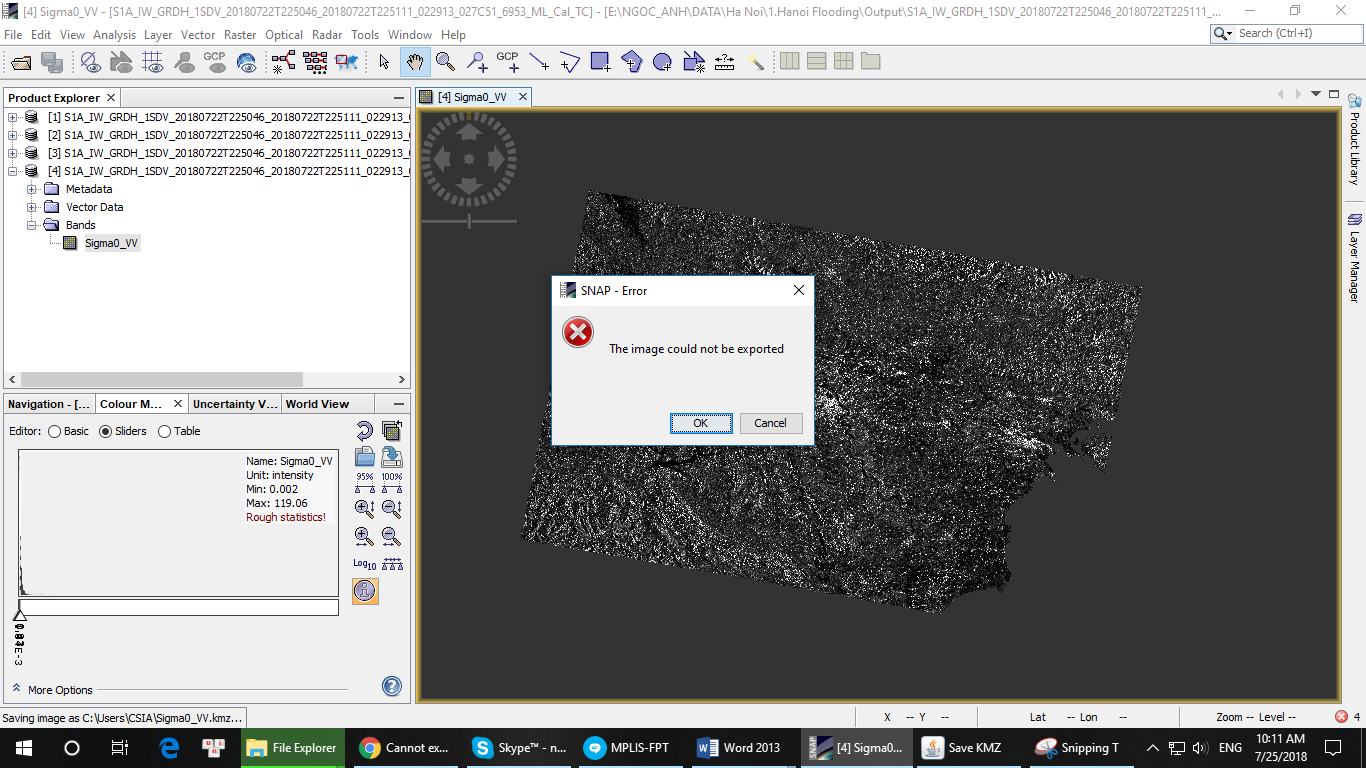
Hi everyone, I got an error when exporting data to Google Earth KMZ in SNAP when working with Sentinel 1 data. I open the image, right click on it and choose Export View as Google Earth KMZ. The error message as following picture. Please help me! Thanks.
Maybe the filesize exceeds what is technically feasible. Try if it works if you zoom in to a small area. If so, the image might be too large for a kmz at full extent.
3 Likes
Thank you very much Abraun. It is exactly as you said.

how large (colums and rows) is the exported raster band and how much RAM does your computer have?
1 Like
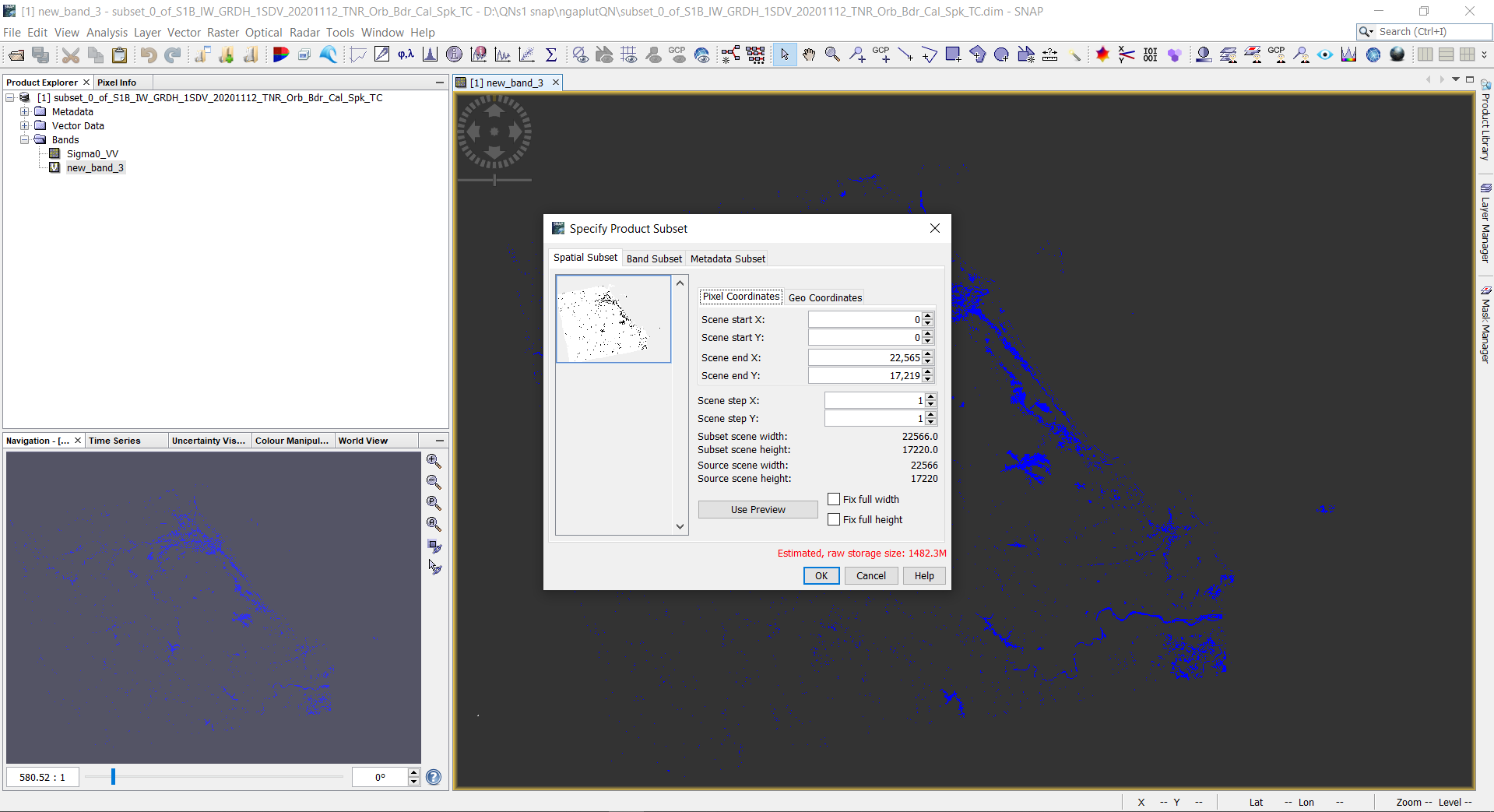
You have an Out Of Memory error and your computer only has 8 GB of RAM. Maybe you can try to use the Subset operator to make the image smaller before exporting it.
2 Likes
as an alternative, you can resample the data to a coarser spatial resolution.
Also, why is your data stored as png? This might not be the most effective format.
I don’t know why it’s png, I’m just following the instructor’s instructions.
I made it smaller, maybe not enough. I am learning how to create a shapefile in ArcGIS to cut but have not found the tutorial that I want.
then would it make sense to ask the instructor? ![]()
We can only help when we understand what you want to do and why.
1 Like
I will do. I hope when I have a little question and I can explain the problem I am having, I can still ask you. 


Very good, how did you solve it?
1 Like
I tried to cut the image as small as possible.
I tried cutting before, but I found out I made a error.
Dear ABraun,
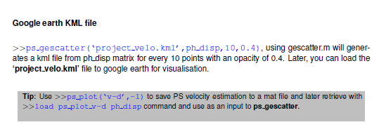
I finished the analysis through stamps. The number of the PSs was about 316000 as stamps said. But after exporting to google earth, I recognized that the number is much less so I re-export to arcgis to calculate them and the number of points was about 6000.I do not know what is the point that I missed. Help!
the kmz export defines the fraction of points which is used. If you type 10, you only get 10%
1 Like
Thanks alot!
What is the -ve value used for? I couldn’t find an explanation for that in the manual.
Plus, is it possible to plot the legend for the ps velocity on google earth ? I cannot crop the legend from the plotted map on matlab because the color scale of all the exported points to google earth drastically changes
you can see all variables used for plotting here: StaMPS/ps_plot.m at master · dbekaert/StaMPS · GitHub
I don’t think StaMPS exports a legend with the kml file automatically, sorry.