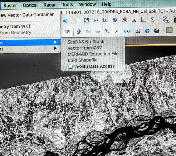
Why it is not possible sometime to import ESRI shapefile. It is not possible to select the option.
you have to select the name of the product in the Product Explorer (not a band or metadata record), before the ESRI Shapefile option is enabled in the menu.
I’m having the same problem, even when the product is selcted (Sentinal 2 imagery), yet when I go to Vector>import>, all of the options are greyed out.
Can you check if the product is geo-coded? Is it shown in the world view?
What is shown when you open Geo-Coding information dialog ![]() ?
?
It seems there is no geocoding information. Clearly I was doing something right because I thought I was downloading a TIFF file with WSG 84 coordinate data, but that information is being lost somewhere along the way.
Instead I downloaded and then presented as a GeoTIFF data product and that seemed to allow me to attach a shape file, although I’ve yet to find out how to actually see the shapefile, as it’s currently not visible.
