Hello,
I’m processing an SLC product and maintaining the full complex signal with the following pipeline:
TOPS Split
Radiometric Calibration (with complex output)
TOPS Deburst
Range Doppler Terrain Correction (output complex data)
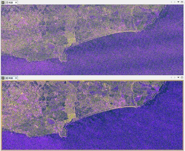
After the last ‘terrain correction’ step, I observe scalloping in an RGB image produced from the output magnitudes (top image). The scalloping doesn’t appear until this final step. If I do the ‘terrain correction’ step without ‘output complex data’, I don’t get any scalloping (bottom image). I’m not sure what’s happening. How can I get a terrain corrected complex signal with no scalloping?
Please try nearest neighbor resampling for the SAR data (not the DEM) during the terrain correction.
1 Like
