I’ve been having issues trying to import a single co-ordinate into SNAP. I understand this issue has been discussed on here before, however, unfortunately I can’t make sense of the solution.
I want to identify a single glacial lake in the Andes that I am studying so that I can subset my data to speed up processing and deformation map creation.
I understand that the data within the excel file must be correctly formatted and Raster data must already be imported into SNAP. I have read the guidelines on ‘CSV file Conventions’ under the help section but unfortunately cant make sense of them and was hoping someone may be able to show me an exact example of how my excel file should be formatted in order to correctly import a single co-ordinate.
Every time I try to import the data through the ‘Import vector data’ section the ‘Neither lat/lon nor geometry column provided’ appears and I’m unsure how else to try and format the data within my excel file.
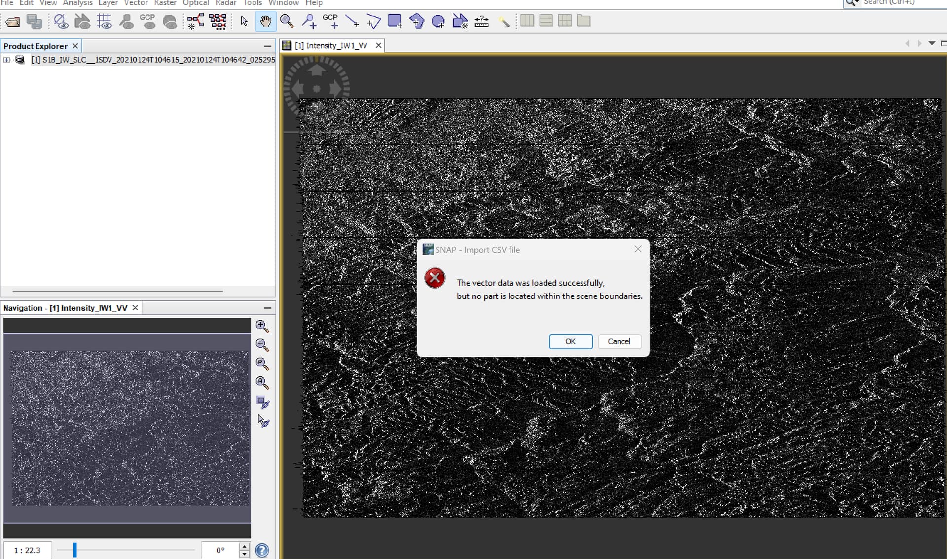
I have managed to get past my first error message. However, now when I’m trying to import the CSV data its saying ‘The vector data was loaded successfully, but no part was within the scene boundaries’, I
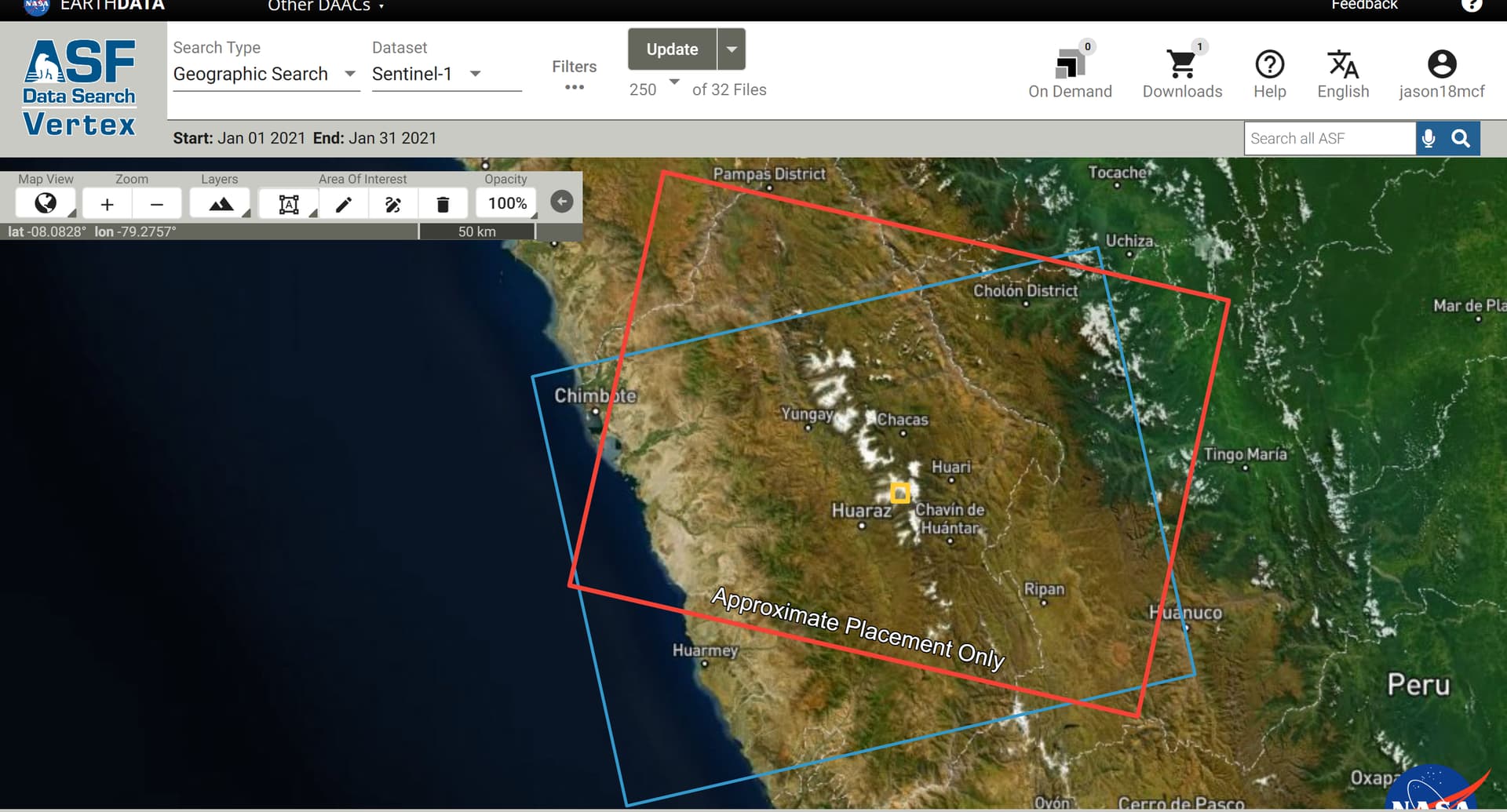
understand that this message is self explanatory but the tiles I’m using were downloaded from the ASF Data Search Vertex and cover my AOI so I’m unsure how this is happening.
My apologies, the correct co-ordinates are ‘-9.39361111, -77.37777778’.
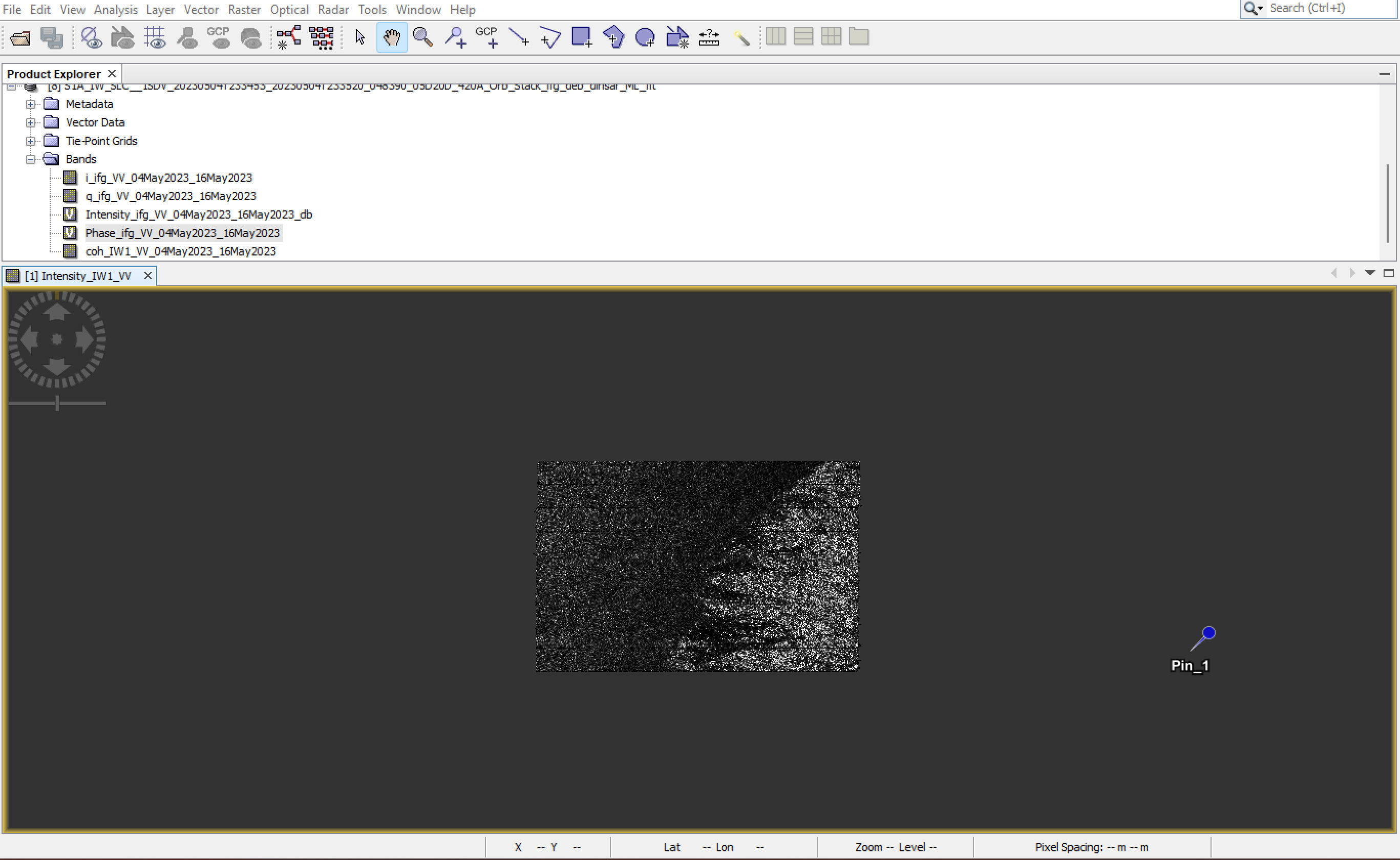
I have manages to successfully import the co-ordinates into SNAP when all I have loaded is ‘Intensity_IW1_VV’ band for one of my chosen dates. The data imports with no error but I cant seem to see a co-ordinate (point) in the display.
I am trying to make an interferogram with SLC tiles from 03-07-2023 and 15-07-2023 and once I begin the first processing steps e.g. Coregistration, Deburst etc. the CSV file which was imported before processing will no longer import and is showing the ‘vector data was loaded successfully, but no part is located within the scene boundaries’.
I’m unsure why this is occurring and not sure what to try next.
Yes that makes complete sense, but my issue is that I only have 8gb of RAM on my current device. This is why I wanted to pinpoint my area. So I could subset the tile to just my AOI before unwrapping so it could be done successfully with 8gb of RAM.
My worry at the moment is that I have a data issue. I took your advice and imported the point as a pin which worked, however, it appears to be showing up outside of my study area. I’m sure that my coordinates are correct.
Both scenes that I downloaded from the ASF data search vertex completely cover my study area and were downloaded as SLC packages. But the pin appears well outside of the scenes imported into SNAP so I’m