Hello!
I am processing data from CHRIS/PROBA-1. Using Chris-BOX in SNAP I made a noise reduction, cloud screening and atmospheric correction without any problem. Now I am trying to do a geometric correction. I downloaded telemetry data for my image and I saw that after correction there are info about lat&lon, but this image is not flipped. I was trying to do ortorectification or reprojection, but it didn’t work properly… My image is approx 3-4 km lower in the right side than the correct area. I tried to flip (in graph builder) the image and make GC after that. Same result as earlier So what I should to do? Shall I edit telemetry data? Or maybe shall I add manually some GCP? Maybe I skipped some steps?
Theoretically the algorithm does not require any user input as it is based on the geometry of acquisition. Unfortunately PROBA platform does have a pointing problem, which has not been identified yet. Therefore, at least one GCP per image is required in order to compensate for the de-pointing although the precision of the correction is not good enough. Three GCPs per image provide satisfactory results and nine GCPs per image result in excellent co-registration for the 5 images, …
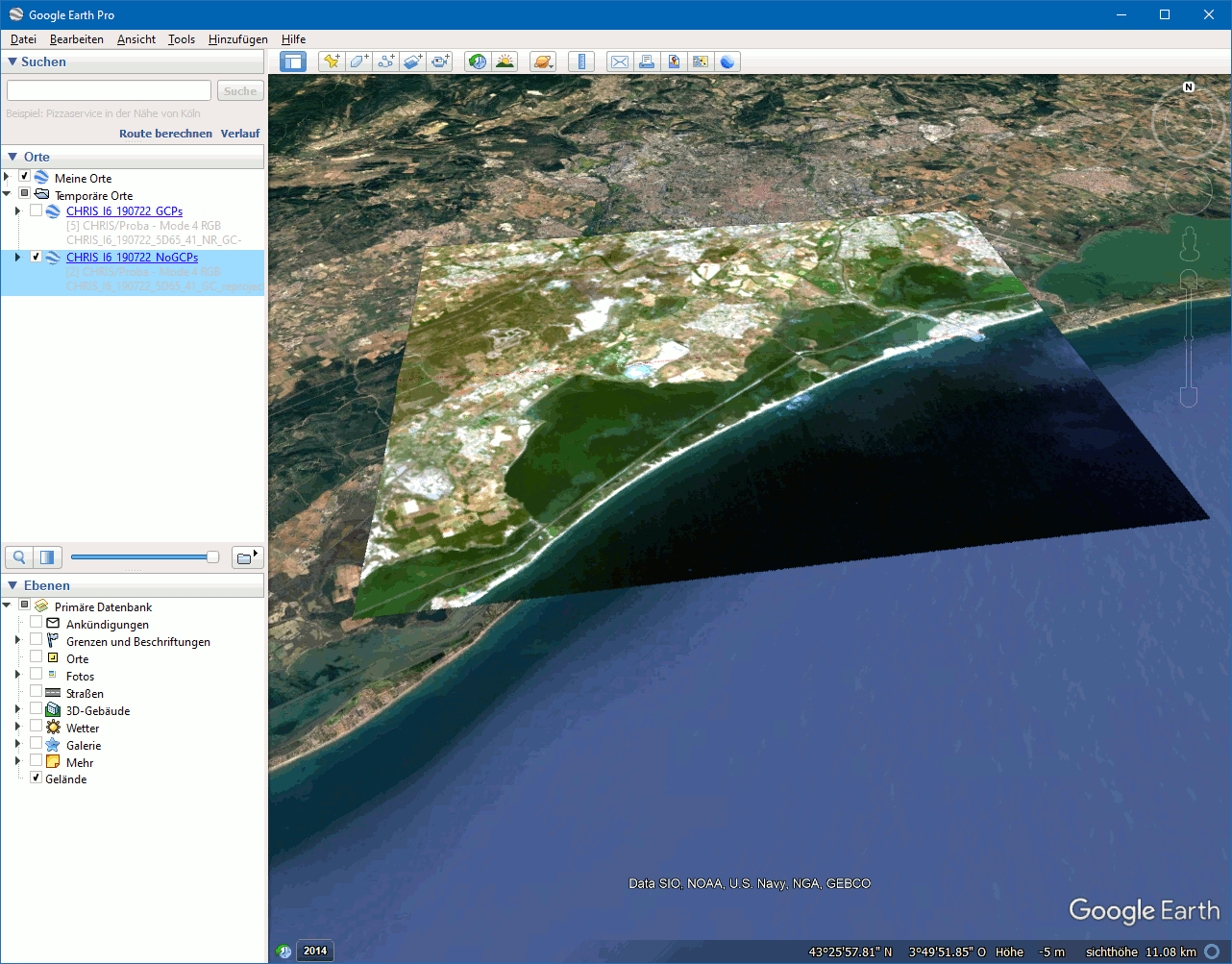
I once did a comparison with and without GCPs and exported the result to Google Earth. The gif image shows how the scene jumps.
The accuracy of the result will also depend on the accuracy of the GCPs. I would suggest that you add at least 3 GCPs well distributed over the image. If you can set more, it is even better. But not more the 9.
Hi Marpet!
Thank you for your response.
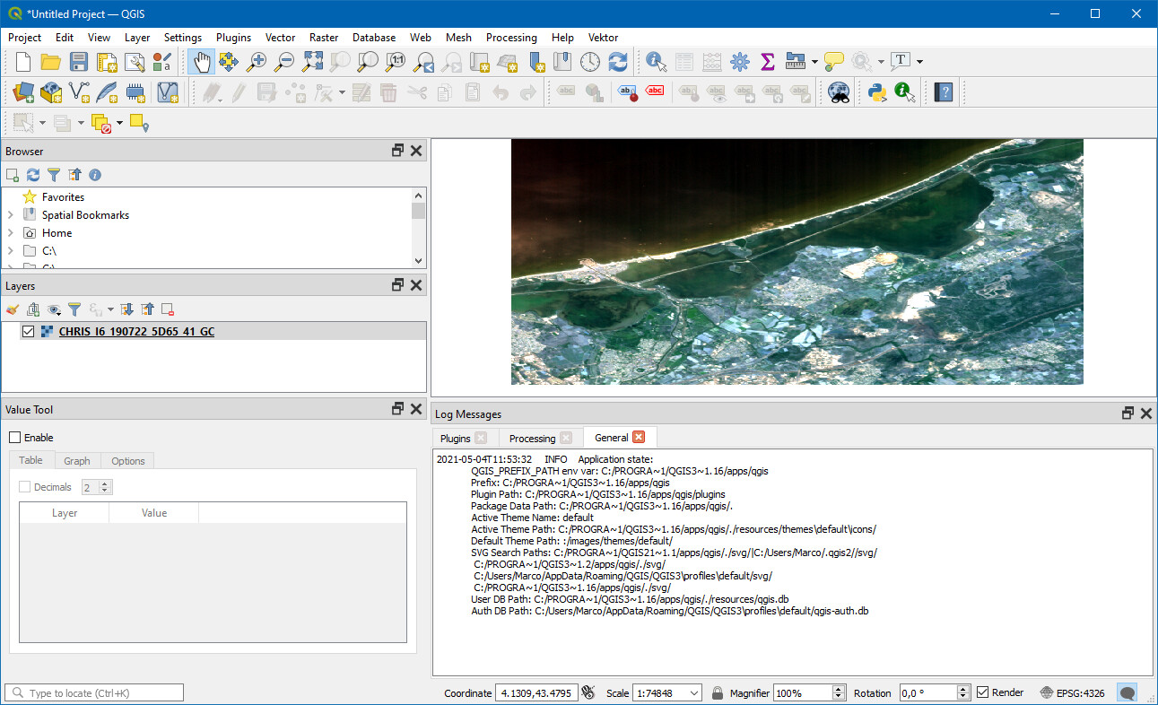
I added 5 GCP to the image after atmospheric correction, which I previously flipped. In the World View, I can see that after adding Geo-Coding, this image is already in the correct place and has all LAT & LON coordinates. But now I have a problem with exporting. After exporting to GeoTIFF or to ENVI format and opening in QGIS, I can see that it is still pixel coordinates. I tried to re-project to EPSG: 4326 and after that I already have these coordinates, but I’d rather avoid the extra steps. Is there an option to save this image after adding GCP?
Should I make a geometrical correction anyway? I tried to do it, but the effect was similar (pixel coordinates).
Was it a good idea to use the FLIP option?
Thank you in advance for your answer and sorry but I am completely inexperienced in CHRIS processing and am just trying to learn.
Yes, it is not necessary to flip the data. It will be flipped after reprojection. But if you don’t want to apply this step then it might be good to flip the data.
For me it worked to save the data as GeoTiff after GeoCorrection and load it into QGIS.
In general I would suggest to reproject to WGS84 or UTM.
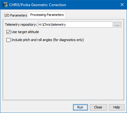
If you should apply orthorectification, I don’t know. The altitude is already considered when doing the GeoCorrection. If you perform orthorectification in a separate step then it is probably good to disable this option.
I think have to provide a disclaimer:
I’m a software developer and note a remote sensing scientist. I gained quite some knowledge over the years, but still my suggestions can be wrong.
Thank you.
I still have problems. I rotated the image, added 6 GCPs, and after geo-coding, the image turned a bit and moved in the right place. However, when I compared it with OSM, there was a difference of about 3-4 pixels (after re-projection). I also added GCP to the georeferenced image, but after geo-coding nothing is updating and the image is still where it was. The re-projection I was doing was for the WGS84 or UTM layout.
Do you have any idea what to do? I would like to analyze the image of Chris and Sentinel so I want them to be the same.
As for orthorectification, I can only do it on the georeferenced image and, as I said, it is wrongly located.
It could be that the telemetry data and the GCPs you have set do not provide a higher accuracy.
I found this paper: (PDF) Geometric and radiometric pre-processing of CHRIS/PROBA data over mountainous terrain (researchgate.net)
In this paper a table is shown which gives the RMSE for X and Y pixel for the 5 view angles.
It shows that the accuracy depends on the view angle.
RMSE is up to 2.9. So this is in line with your observation.
They have not used the chis-box. At the time the paper was written the toolbox didn’t exist yet.
So, I think I can’t help you much with this.
 So what I should to do? Shall I edit telemetry data? Or maybe shall I add manually some GCP? Maybe I skipped some steps?