You can SubSet or Collocate or use Mask(s). Native functions in the interface, callable by GPT and/or snappy. So basically you should be more than fine with these options.
For Sentinel-1 there are other options for Interferometric stacks.
Snappy is Python binding to SNAP Toolbox or rather the other way around and GPT is command line tool that comes with SNAP Toolbox basically it is the Toolbox without UI.
In the regular UI these options can be found under the “Raster” Submenu.
Hello @ABraun and @marpet
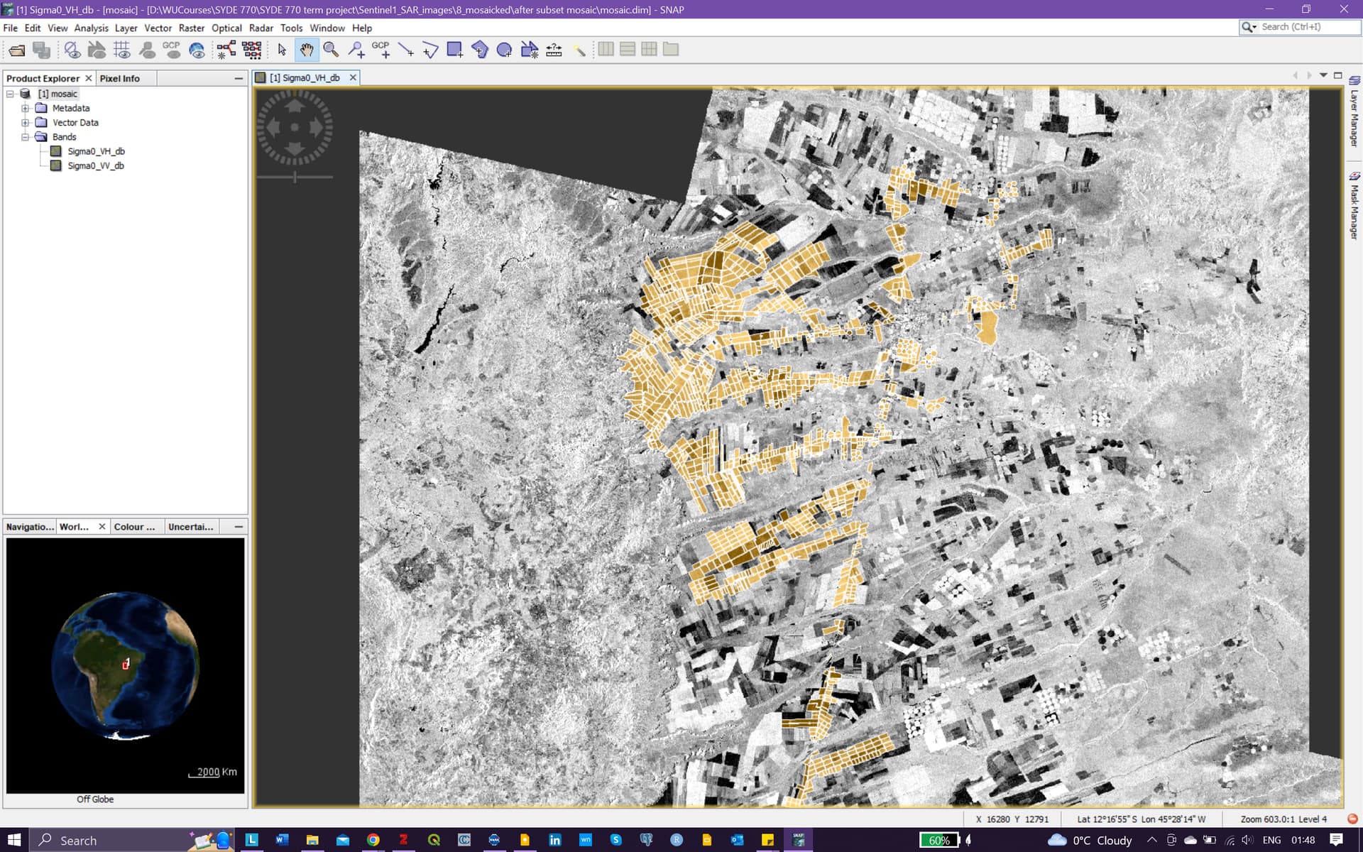
I have an issue with clipping my processed sentinel1 image. I will be using this data for crop classification and I have a polygonal shape file for the AOI.
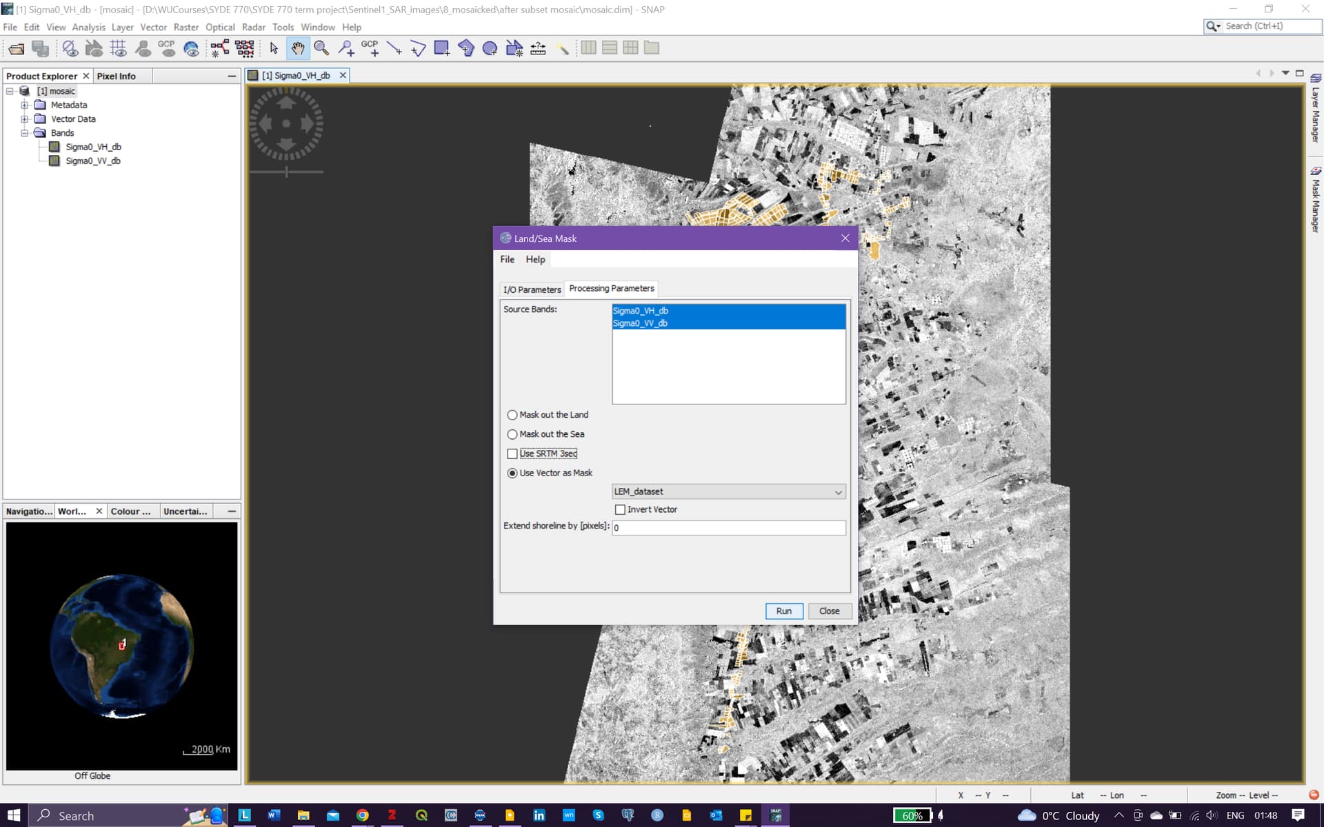
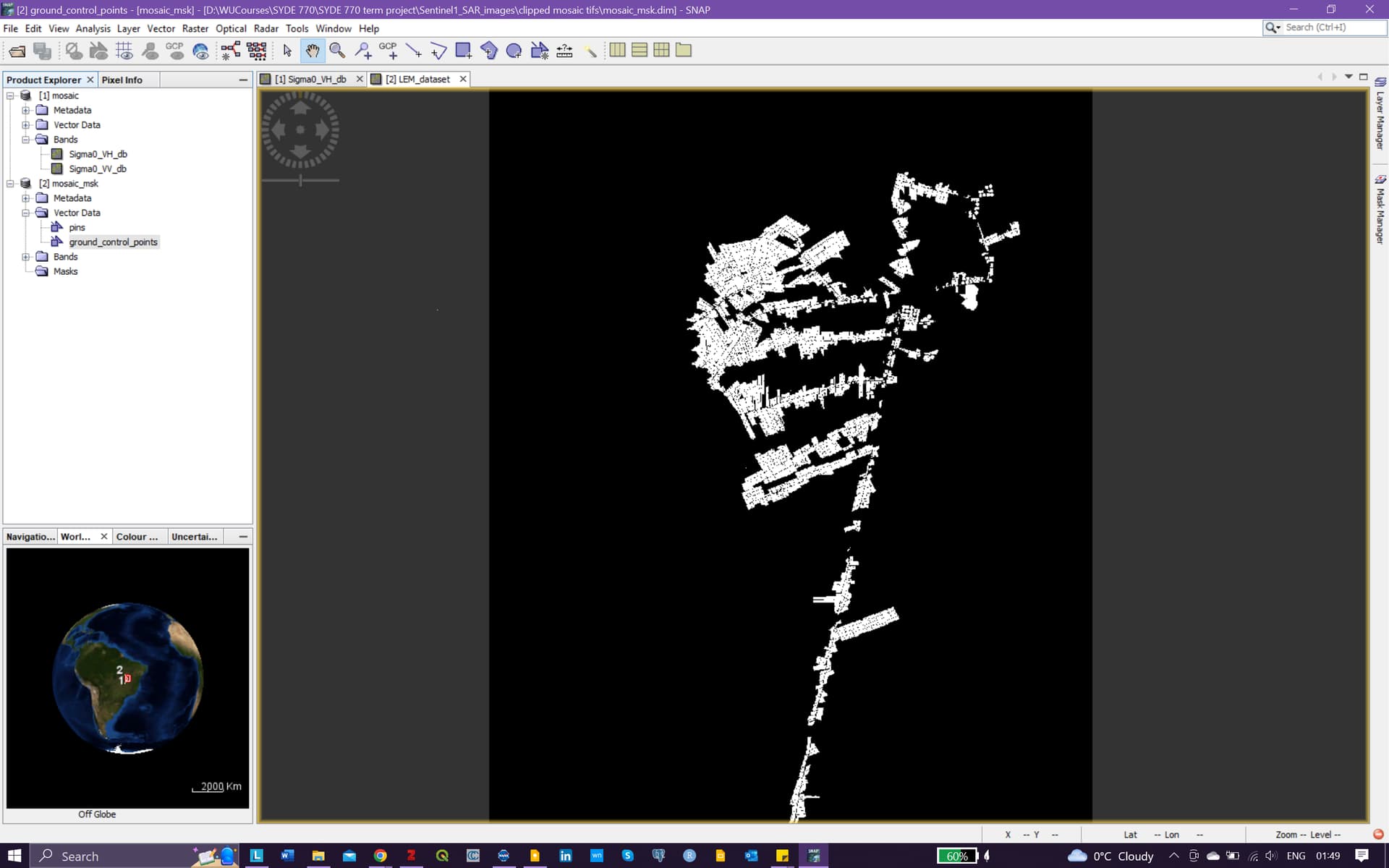
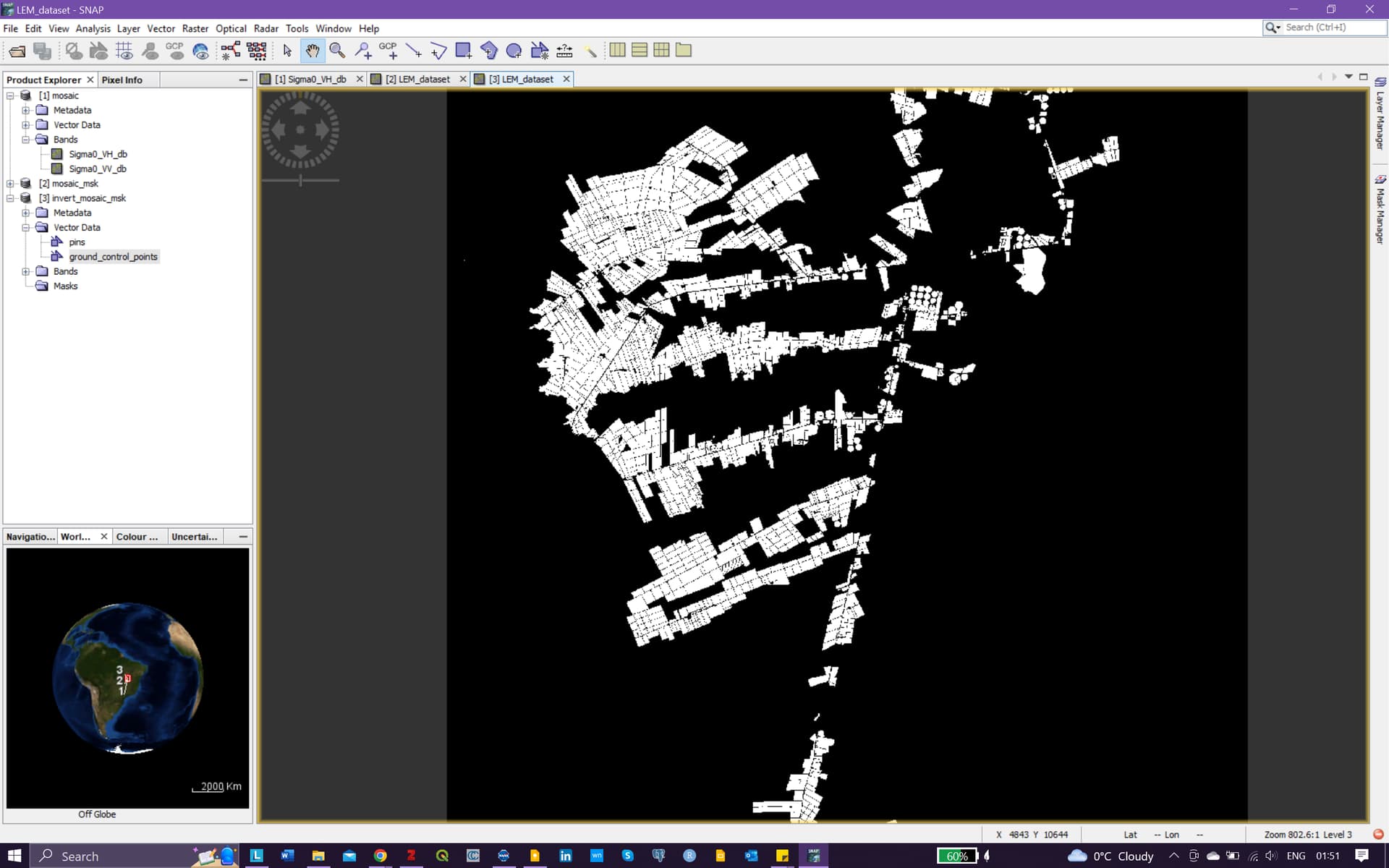
I used the land/sea mask and got a weird result. I am attaching the screenshots below, can you please look into it?
1st image shows my polygonal shape file.
2nd image shows the parameters
3rd image shows result1
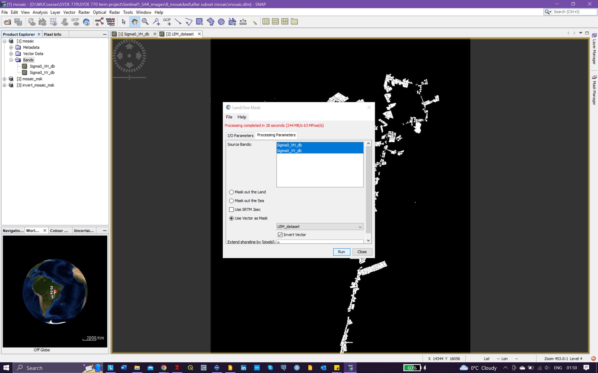
4th image, i have selected the option “invert vector” incase it changes my result
5th image shows the same result as the result1
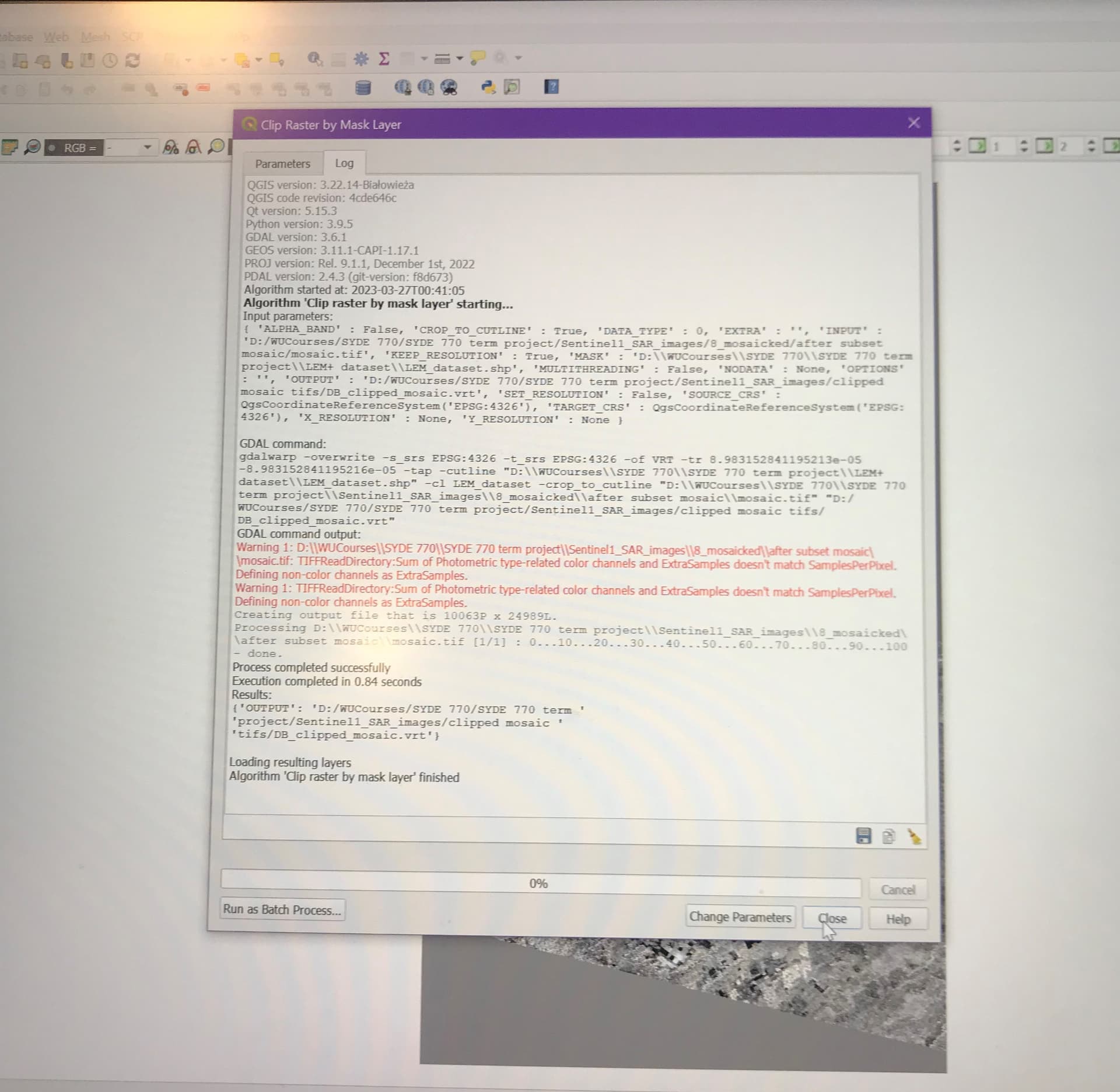
I even exported the SAR image into tiff in QGIS and the file size is 7 GB, is that normal? I am using GRD format. Also I tried clip raster by mask layer in that but it shows the following error.
Regarding the files size. Your scene is quite huge. Depending on the data type of the bands this might be.
You could try NetCDF4-CF as data format. This might compress the data better.
For such big geotiff files compression should be enabled by default too.
Maybe something went wrong.
Could you send your log file, if you still have it?
See here on [how to find the log files].(https://senbox.atlassian.net/wiki/spaces/SNAP/pages/1898053693/SNAP+FAQs#How-to-find-the-log-files?)
I do not have the log files now. But, this file which is loaded in the SNAP is in the format of BEAM-DIMAP.
I tried the inversion option incase if there is sth wrong with it.
What shall I do? Shall I export it as Netcdf4 and then import it in Netcdf4 and later apply masking on that?
If that doesn’t work either, do you know how can I load Beam-Dimap into QGIS as Geotiff? I tried it but the clipping raster by mask layer gives the above error.
Hey @marpet and @ABraun,
I have one more question.
I want to undergo crop classification and for this I am following multitemporal method for 5 months.
Now my area of interest has three SAR images, which should be mosaicked at the end and then clipped to get the final ROI.
I am facing issue with coregistration. Two of the SAR images has the same orbit path but the other third image has different orbit path.
So I followed the preprocessing steps individually for all of them since batch processing takes more than usual time on my system. I followed the following process:
Apply orbit file,
Thermal Noise Removal
Boundary noise removal
radiometric calibration
single Product Speckle filter
RD_terrain correction
linear_to_db conversion
after i performed these steps individually for every image, I want to coregister them. But I have two different orbit paths. Yet, I tried the coregistration method and it was successful but I did not get proper result. Most of the resultant slave images are not present.
In short, I want a multitemporal file for my ROI which needs three images of SAR to be merged.
How can I correct my steps? I want three polarizations in the db format (VV, VH and VH-VV) to get a multitemporal stack at the end. I even have to mosaic and then clip these multitemporal images at the end to get my ROI. I am confused a lot.
I am grateful if someone could answer me as early as possible.
You can only coregister images of the same orbit in SNAP. If the geometric correction with RD Terrain Correction worked well you could simply stack all images using the Create Stack operator or with the Collocation tool.
But my images have different orbit paths. Will create stack work for such images? I am confused about that. Also, can you explain me what “multitemporal compositing” is in Radar? I saw one of the video online and the person applied this after coregistration and this (“multitemporal compositing”) combined all the bands into single VV and VH band. Does this undergo loosing the metadata or affect the backscatter intensities?