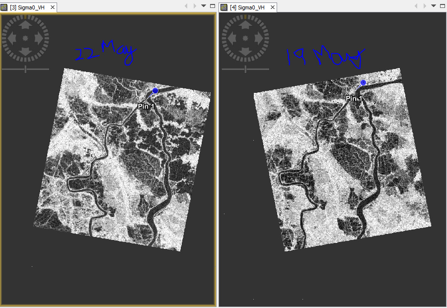
I am trying to find the flooding and the change that is caused by cyclone in the area using sentinel-1.
However, for the event of cyclone two images are available pre-disaster( Sentinal 1 A ascending)
and post-disaster 22 May (S1-B descending).
Can we compare the two images they don’t have the same orbit or ascending and descending?
What operation do I need to do on it before proceeding to next step of flood mask detection?
I want to analyze the area in between the two rivers
Images attached:
Images acquired from different directions (asc/dsc) do not always contain the same scattering mechanisms, because the signal interacts with different surfaces and their shape, orientation ect…
For flood masking, this is of minor importance because the flooded areas are mostly flat and you are searching for a strong decrease of backscatter intensity.
Are these two images before and during the flood? In such case, you can collocate the products to bring both bands into one stack and then use the mask manager to find pixels which have a strong decrease of pixels, for exmaple with this expression:
image1 +5 < image2
This returns true for all pixels which are at least 5 dB lower in image 2.