Hi,
I want to compare a self made S1 DEM with a 90m DEM from TandemX (eg. Differential maps, stadard deviation…). Are there any tools for that in SNAP (for coregistration, resampling…)?
Hi,
I want to compare a self made S1 DEM with a 90m DEM from TandemX (eg. Differential maps, stadard deviation…). Are there any tools for that in SNAP (for coregistration, resampling…)?
when you geocode your S1 DEM with the Range Doppler Terrain Correction module, simply use the TanDEM-X model as external DEM (make sure you project it into WGS84) and check “Elevation” as additional output. The final product consists of elevation_VV (this is your S1 DEM) and elevation (your TanDEM-X elevation). You can then perform a raster differencing to see how similar both rasters are.
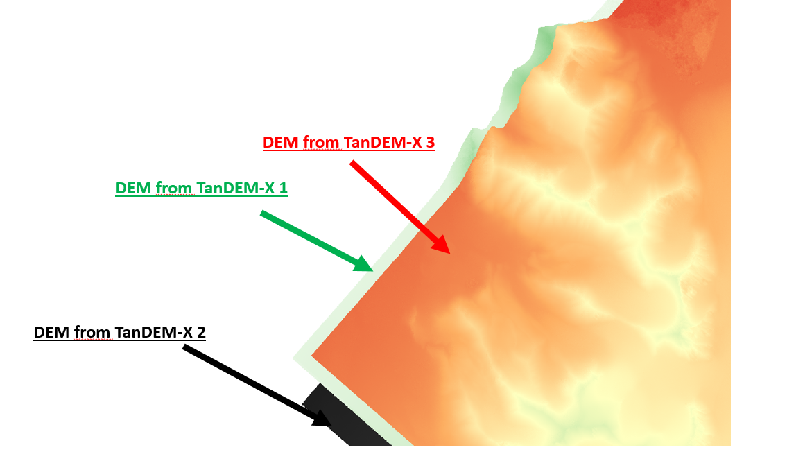
Hi
I made three different DEMs for three different years for a glacier.
This is what I did:
Info for the first subset of TanDEM-X data (1):
8823×5815
Info for the second subset ofTanDEM-X data (2):
8798×5403
Info for the third subset of TanDEM-X data (3):
8778×5807
Then I overlaid DEMs on each others but their locations are different as you can see in below images.
I do not know what should I do to have same pixels and geo location…
and why the stacking did not work for them…