Hello everybody.
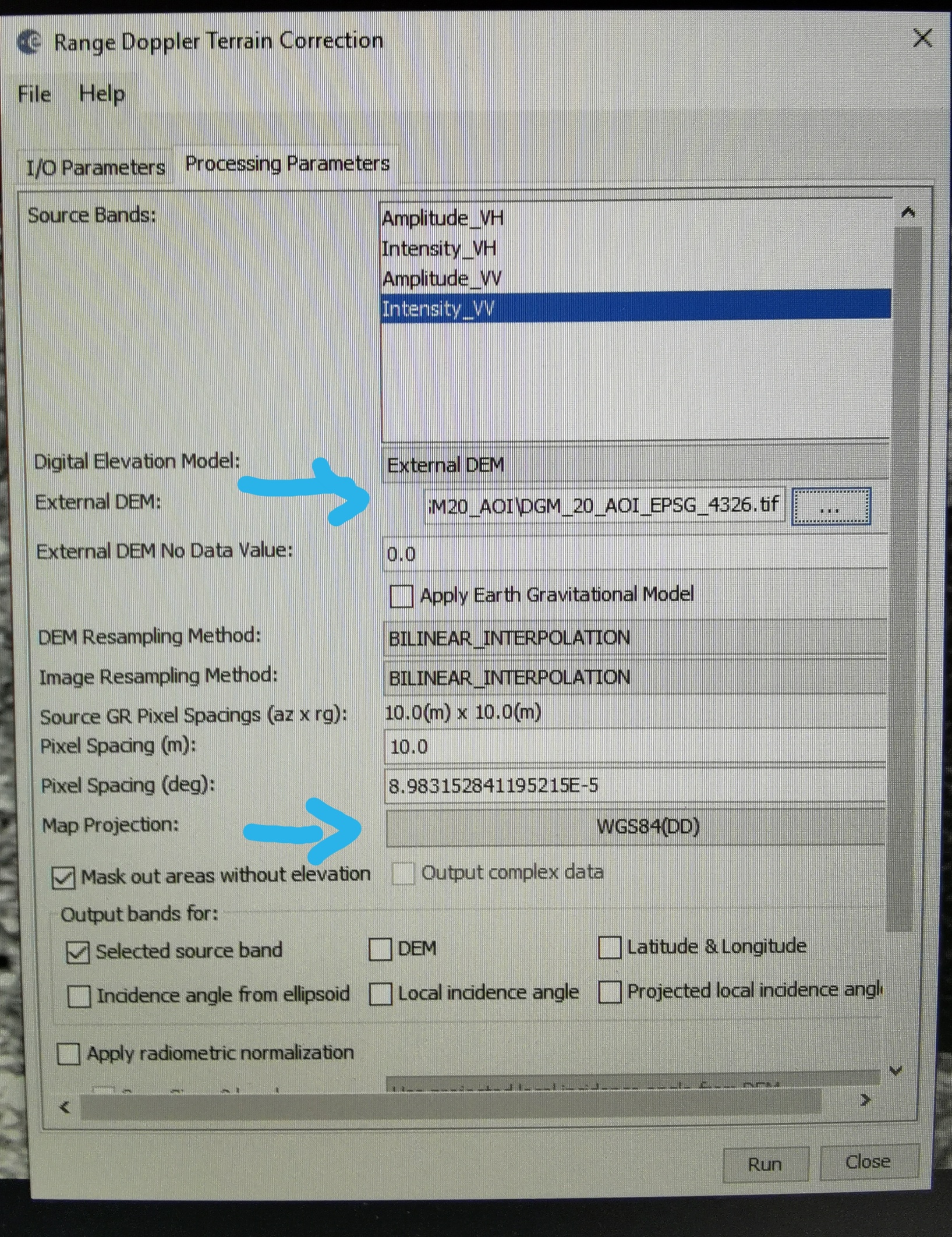
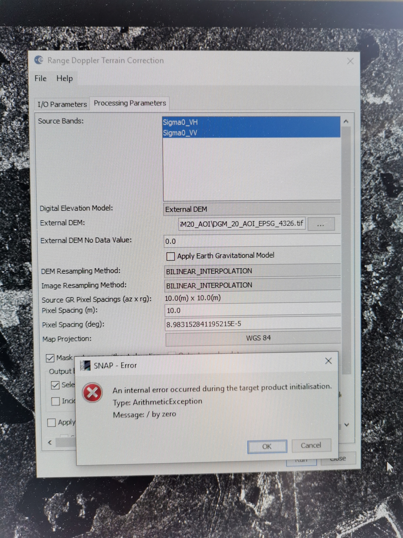
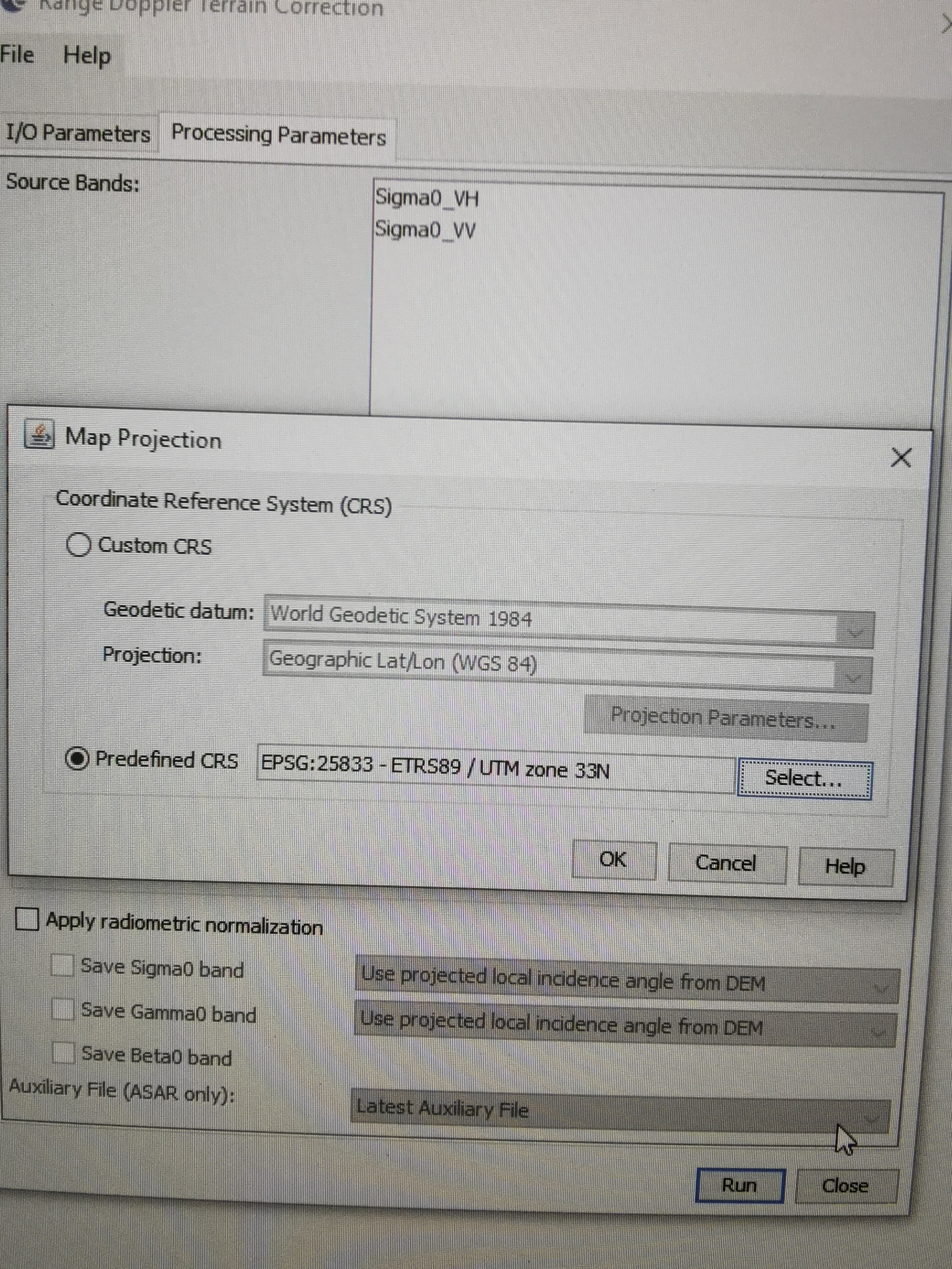
I am having problems with Range Doppler Terrain Correction. I use an external DTM, which is available in EPSG 4326. Is that correct? Can I use this or in which coordinate system does it have to be? Later I want to combine the grid with data in EPSG code 25833 in ArcMap. Which coordinate system do I have to set for Map projection in snap? When I set EPSG Code 4326, I get an error message. Which configuration would be correct here?
so there is something wrong with the WGS84 projection. Is it an option to terrain correct to UTM and then reproject (using nearest nieighbor resampling) to WGS84?