Good Morning,
I whould like to kwon if it’s possible with SNAP to convert a layer/mask (or more specifically a edge) into a set of points ?
How could I know the passage between X/Y and lat/long ? (with some tie-grid points I guess)
Is it a bijection (ie X/Y → lat/long and lat/long → X/Y) ?
My goal is to create some polygons (using WKT) in order to select some areas which does not contain many clouds.
Once I have a polygon, is it possible to define the area inside and outside this polygon in order to get the areas with and without clouds ? 
Thank you so much for your response.
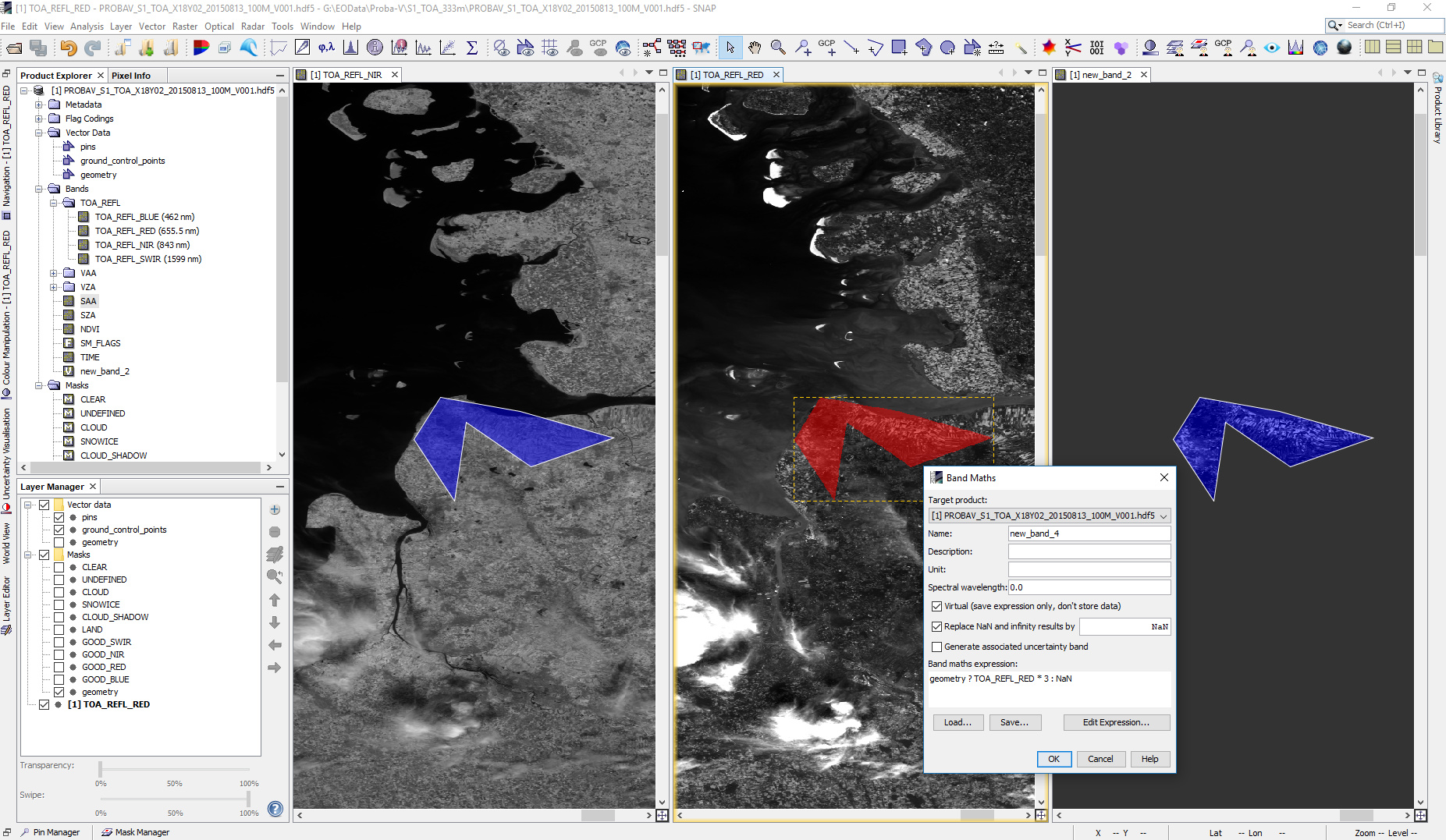
As soon as you draw the polygon a corresponding mask is created. You can use it in several processors in a mask expression or in the band maths.
The image shows the drawn geometry (left), mask (middle), result of band math (right)
Thank you so much marpet !! ^^
And if I want to select the area outside of the polygon, what command should I write in the Band Maths operator ?
Furthermore, I would like to know if I can easily convert an edge into dots in order to create some polygons which will alow me to select the area inside/outside of this polygon ?
Regards,
aross
Just invert the expression:
geometry ? NaN : TOA_REFL_RED * 5
You mean you want to do an edge detection on the data and based on the edges you want to create a mask/geometry?
I don’t really get your requirement yet.
But you can let run a filtering (see in menu: Raster \ Create Filtered band)
And based on the result you can use band math to create a new band which can be used as as mask.
Mask band expression for example
Oa12_radiance > 60
And then use this created band in another expression:
mask_band ? sin(view_zenith_angle) * Oa14_radiance : cos(view_zenith_angle) * Oa14_radiance
Maybe this helps you already
All right, thanks a lot Marco !