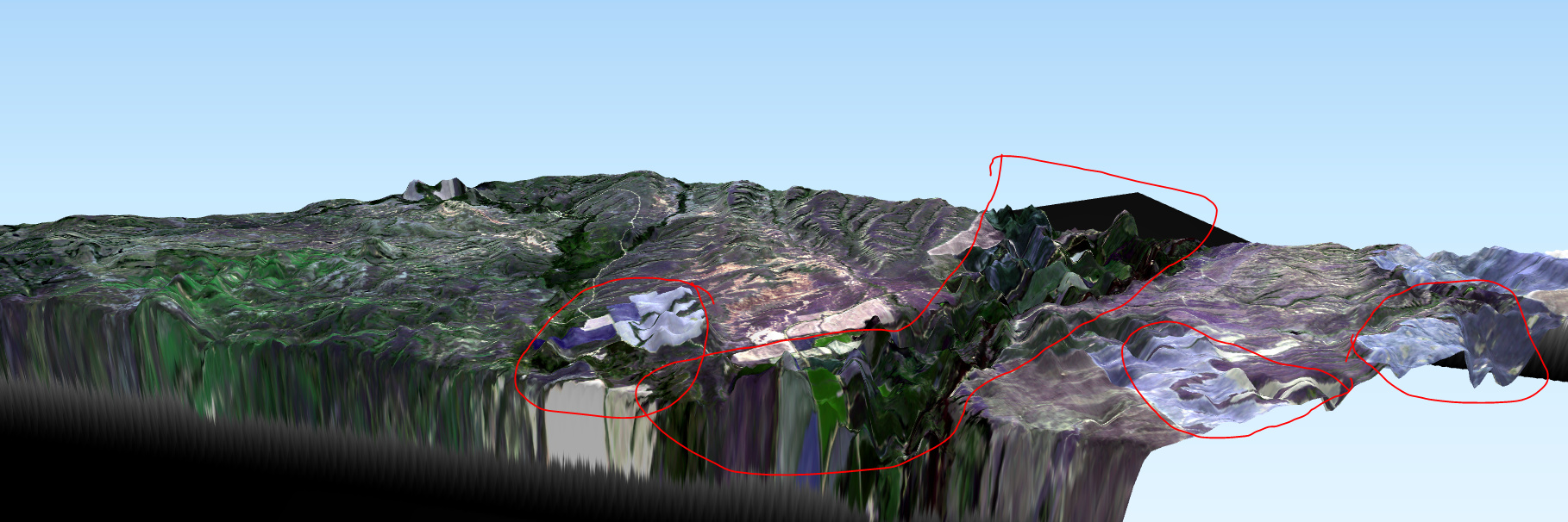
Hello, I have been attempting to create a DTM for an aoi using Sentinel SAR data. My first attempt was somewhat successful using 2 SAR images from 7-1-2018 and 7-13-2018, however, there was some loss of coherence in vegetated areas that caused some areas to have unrealistic elevations (circled in red).
Sentinel DTM
Does any one know any tricks I can try to improve my results in these locations?
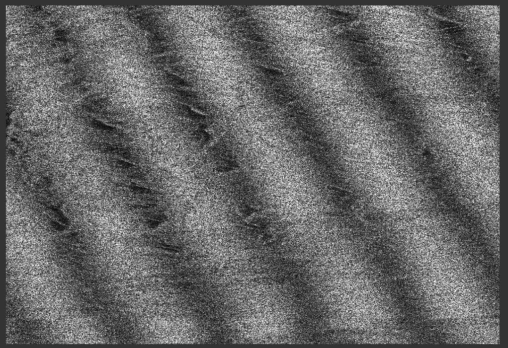
I tried finding a data set with a shorter temporal baseline and tried processing that (S1A 7-25-2018, and S1B 7-21-2018). The problem was that even though the 2 images were both ascending orbit, the S1A and S1B images have a different orientation and after creating an interferogram with the S1A and S1B data I had funny looking results.
The coherence image below has some weird trend, I guess from the different orientation of the acquisitions… I know some people are using S1A and S1B data together, does anyone know how to do this?
One last question I have, is it possible to increase the accuracy of the product (reduce the errors in vegetated areas) by using multiple images somehow? From my reading it seems like this is how traditional InSAR DEMs are created but I haven’t found a very informative workflow on how to increase the accuracy by including a timeseries of imagery.
Thanks in advance,
MR