I have processed several Sentinel 1A level 1 GRD products in the s1tbx (subset, radiometric calibration, range-doppler terrain correction, conversion to db and band maths) and I wish to coregistrate the outputs (sigma0_vh, sigma0_vv and sigma0_vh/vv) using the automatic coregistration tool with one of the output as master and the rest as slaves. The procedure failed each time, indicating ‘no product reader for band null’.
Could someone explain why that fails and what would be an alternative way to do this (I’m new at SAR image processing)?
I’m not sure I could answer this without seeing the products being coregistered. Does it say which operator is giving the error? It might be band name related.
Actually when I tried to coregistrate products before conversion to dB, the problem was gone.
In any case the coregistration continued failing and I obtained for many registrated slave an ‘empty’ image (full of 0s). Apparently, not enough GCPs were found for several slave images (minimum 3), even for a number of GCPs equal to 11 and a GCP tolerance up to 1 (which is too high anyway).
Also, is it normal for the running time to be really long even with the smallest window size ?
Since the images are already in the same geometry (they are from the same track, right?) you should be able to co-register them simply with Create Stack under co-registration/stack tools. Restituted or precise orbits should be used
As mentioned before if the products are from the same track it should work fine with the SAR- Coregistration tool or Create stack.
However if the products are even at the same position only the master area (track) will be used as a governing mechanism, which can neglect some of your data, mostly because of their position outside the bounding box of the master products.
I am using for this matter the collocation from the raster menu, it collocates only two products at a time but it yields more solid output (not better).
If you have a wished area you can even create a dummy raster (for instance in QGIS, where you convert vector layer into raster and save the result to geotiff). Opening the dummy raster in SNAP toolbox and using this location (file) as master for collocating your processed data. Repeat and you will have all your processed data in one file (use the updated master raster again and again).
Hint.: Using GPT and writing a small loop program outside SNAP could speed it up.
I have tried Create Stack as proposed and it seems to be working fine and indeed SAR co-registration does not for images of track different from the master.
Suprd, where can I find this collocation tool in the s1tbx? Is it different from what Create Stack does (“collocating two spatially overlapping products”)?
It is a raster operator, so probably you might be ending losing some metadata. But I do not thing the Create Stack works much differently from this as it is working on the master-slave pixel basis.
Depends how much data you want to process and more.
I cannot vouch for the collocation-tool as it has been developed in the optical-side of SNAP. It may very well work perfectly but more testing is probably required.
Coregistering GRDs from different tracks, even ascending and descending, should work fine with the SAR-specific coregistration tool. I have applied this to hundreds of images without any problems (as long as there is enough overlap, of course).
When setting this up for the first time, one thing I initially overlooked was the “Initial offset method” parameter in CreateStack. Have you set it to “Product Geolocation” instead of “Orbit”?
Edit: It is probably worth mentioning that the images were calibrated to gamma0 and geometrically corrected with Range-Doppler Terrain Correction before proceeding to coregistration.
Indeed I have left the ‘Initial offset method’ to ‘Orbit’. Could it be the reason why slave images with a different track than the master end up being shifted after co-registration?
When I collocate my images using only the Create Stack operator, I didn’t get that shift even with the ‘Initial offset method’ set to ‘Orbit’.
I will try again with the different setting and see what it gives. Thanks !
Hello, i would to know about corregistration more …Could tell me How the master image and and the slaves are chosen …
I want to make time series and i have to corregistrate 33 images . ( Sentinel 1 B - GDR)
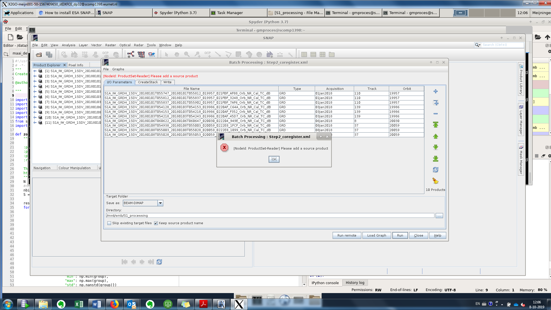
Dear all, i have 10 images of Sentinel-1 already processed an dtrain corrected and now when I try to stack them I get this error message: Please add a source product, anyone has any idea?
in case all your S1 processed data are geocoded or Range Doppler Terrain correction to the same coordinate reference, then you could select geolocation.
Concerning your screenshot, move between tab and see if the error message disappears!