Hello, I want to improve the results of Sentinel-2 imagery-based solar farm detection using Sentinel-1 data. I’ve read that Sentinel-1 data can help with classification, however, as a geoinformation student at my university, we’ve never used radar data. Two papers that I found used S1 data for cases that were similar to mine:
- Detecting Photovoltaic Installations in Diverse Landscapes Using Open Multi-Source Remote Sensing Data (Remote Sensing | Free Full-Text | Detecting Photovoltaic Installations in Diverse Landscapes Using Open Multi-Source Remote Sensing Data)
a description of the S1 data processing in that case:
GEE offers calibrated, ortho-corrected Sentinel1 imagery with a spatial resolution of 10 m. This imagery was pre-processed by thermal noise removal, radiometric calibration, and terrain correction, as implemented by the Sentinel-1 toolbox.
- Solar park detection from publicly available satellite imagery (https://www.tandfonline.com/doi/full/10.1080/15481603.2022.2036056)
a description of the S1 data processing in that case:
This product has been calibrated and ortho-corrected, at a resolution of 10 m
My current workflow is as follows:
- Apply the orbit file.
- Thermal Noise Removals
- Border Noise Removal
- Radiometric Calibration
- Speckle Filtering
- Terrain Correction
- Conversion to dB
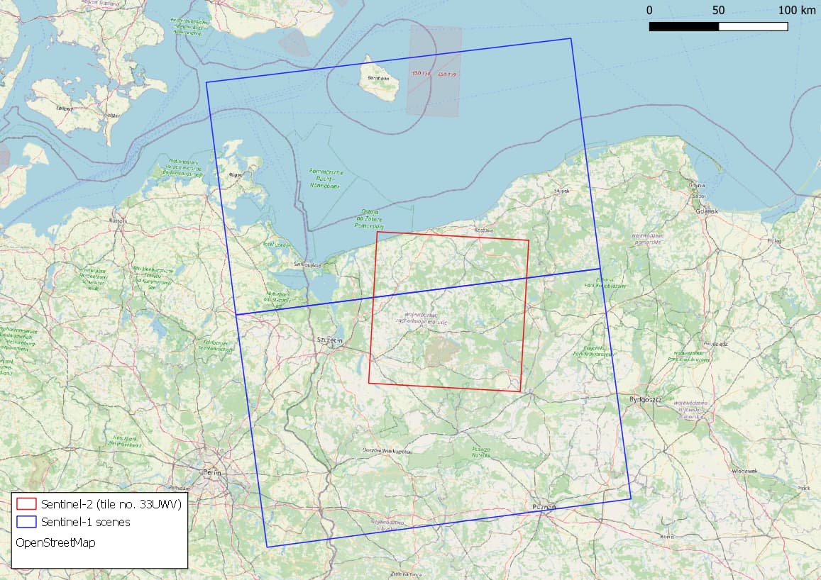
However, as the attached map shows, Sentinel-1 scenes are not always covered by Sentinel-2 tiles. I need to create a mosaic of two S1 scenes (usually taken on the same day) and then subset it into an area of a selected S2 tile. Which tools should I use? What is the correct order in this case?