Hello everyone!
I’m very new at this topic and I’m interested if it’s possible to create displacement map from ICEYE SLC data in SNAP?
As far as I know there’s no InSAR-suitable ICEYE data available yet.
What do you mean?
Sorry if my question is really stupid
Iceye is still working to position their constellation to the point where the orbits are usable for InSAR. The current sample SLC pairs will likely not give you good results.
2 Likes
Thanx a lot!
Dear colleagues,
please notice one more option for SAR data for interferometric processing - https://www.iceye.com/downloads/datasets
I haven’t test them personally, but it was declared that SNAP7 can process them.
Enjoy!
thank you for the note. I couldn’t find the interferometric pair on this page.
It could be found here- https://www.iceye.com/lp/spotlight-slc-grd-set1 filling the form for requesting data.
unfortunately, the pairs consist of one SLC and one GRD of the same date - so no chance to test its InSAR capabilities.
May be it is time to ask the company to provide several data sets to research community. 
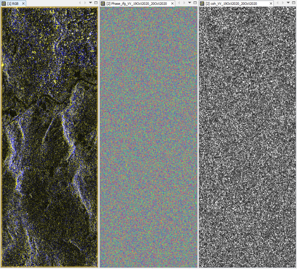
I’ve tried several times using different iceye slc data, but the coherence was terrible and the phase image was unreasonable.
could you please show an example?
I had a similar case, but then found out that the perpendicular baseline was too large, even if the images covered the exact same footprint.
coregistration was successful, but interferogram and coherence were awful
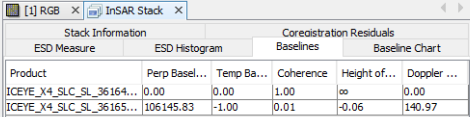
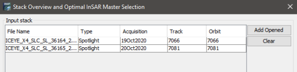
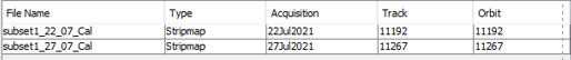
When I checked the InSAR Stack tool I found out that both images are not taken from the same track (relative orbit)
Currently, I did not find any information on the repeat cycle of ICEYE.
Edit: Obviously, the images cover the same footprint, but from different tracks/angles.
1 Like
May be we should ask the company how to deal with this.
Also the baseline is really too, too large.
May be for DEM creation it should work as the temporal baseline is 1 day, but not
for displacements detection.
Other reason I could see for the bad results is the size of the satellite - the smaller the satellite the difficult to keep it in narrow orbital tube.
Is there a document that describes their orbital tube / ground-track setup? It a rapidly evolving constellation so I’d expect these to change every now and then(?)
these are available:
1 Like
Hi ABraun,
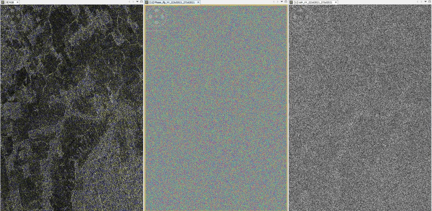
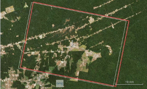
I am new in InSAR technique and I am trying to generate a interferogram from an forest area with Iceye data. I would like to mapping deforestation. First of all, I applied radiometric calibration to data. I got the same result as yours (see image attached). This corregistration I got using DEM-Assisted Corregistration.
.
This was the summary from InSAR Stack. I did not understand what a perp baseline negative means.
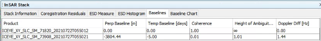
The images are not from the same orbit and track, but in world view, they are in the same footprints.
I really appreciate if you could guide my somehow.
Thanks in advance!
Baseline of 3.8km at X-band is a lot longer than the so-called critical baseline in InSAR. This means that the two images will be uncorrelated, and interferometry is impossible (interferogram contains only noise with coherence close to zero).
1 Like
Thank you so much for reply mengdahl