Thank you @ABraun and everyone else on this forum who helped me 18 months ago so I am now knowledgeable and empowered through ESA Copernicus Sentinel 2 SNAP 7.0.4 processed images. Below is the public comment I just submitted to the California Water Commission using Sentinel images captured just hours ago. It is an eerie dark red dawn here in Concord CA USA and ash has settled on the cars parked outside. This is when we need Sentinel’s great eyes and all her Multi Spectral Instrument capabilities fully functional and calibrated. Thank you. Leland
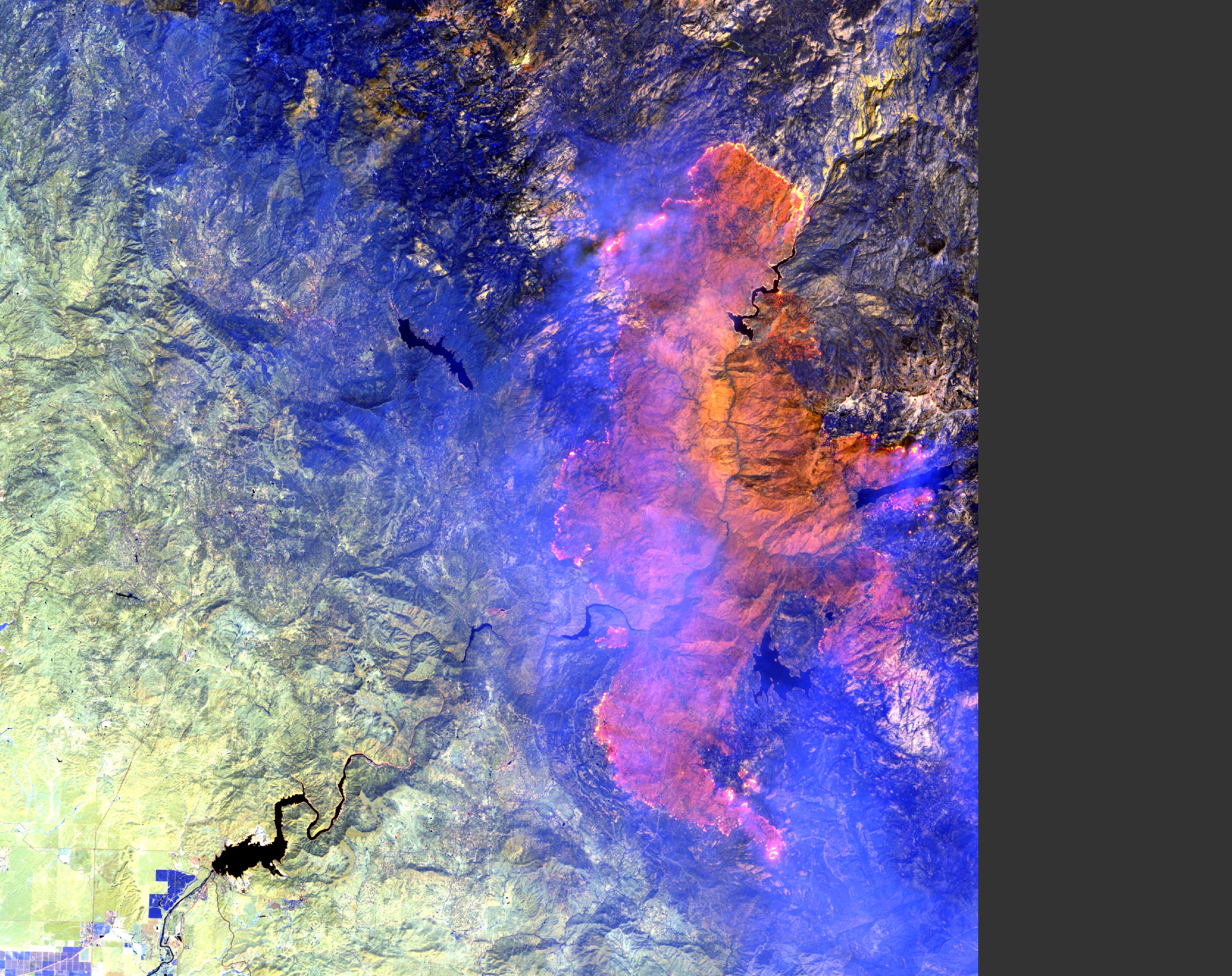
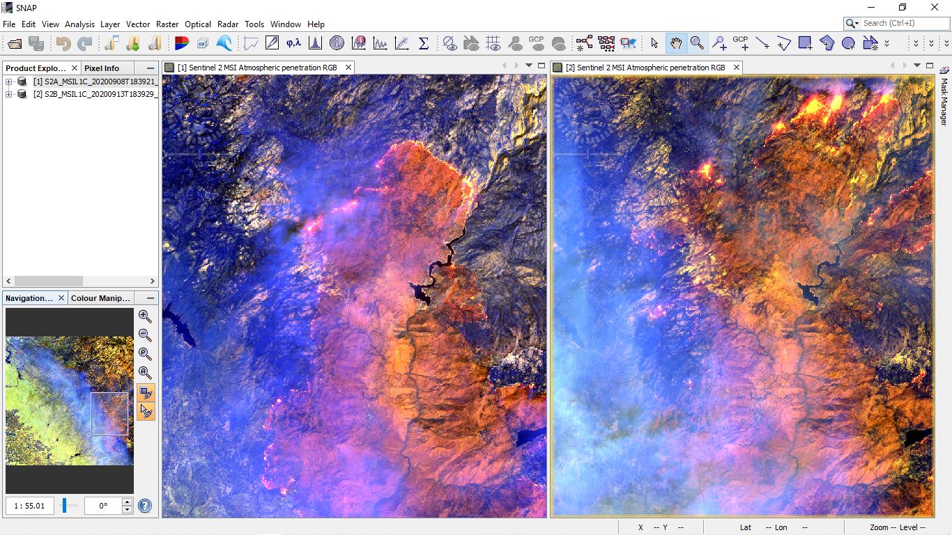
Copernicus Sentinel 2A “Creek fire” images captured 8 Sept 2020 18:39:21 Zulu - Stop processing invoices
Dear Commissioners, Staff and the Public,
This is my 35th letter to the California Water Commission (CWC). Please accept the attached European Space Agency (ESA) Copernicus Sentinel 2A “Creek fire” (East of Fresno California USA) satellite images captured 8 Sept 2020 18:39:21 Zulu for the 21 Oct 2020 CWC meeting under the public comment agenda item.
I penetrated the smoke layer obscuring the visible spectrum by using the default atmospheric penetration mapping of colors and wavelengths in SNAP 7.0.4.
Color Band nano-meters
Red B12 2190
Green B11 1610
Blue B8A 865
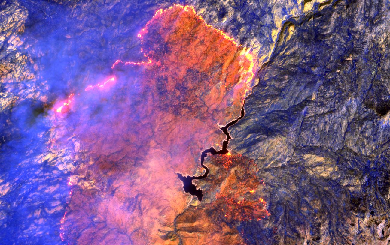
It can take 10 years for a watershed to recover from fire and the “Creek fire” is in the heart of the San Joaquin River watershed as you can see in the attached close-up of Mammoth Pool Reservoir. This fire will decimate water quality downstream and kill salmon swimming to spawn in the San Joaquin and Mokelumne River, a tributary to the San Joaquin.
Please immediately stop processing invoices for all Water Storage Investment Program (WSIP) projects on the San Joaquin River until you, Staff and the Public understand all of the environmental and ecological impacts and the impacts have been publicly vetted.
Thank you,
Leland Frayseth
Concerned taxpayer and citizen