Thank you @ABraun your satellite captured another great image of the “Creek fire” 13 Sept 2020. I sent the update below to the California policy wonks. I bought a new Windows 10 10th generation i7 laptop and SNAP is the first app I installed. Leland
Update 1
Dear Collegues,
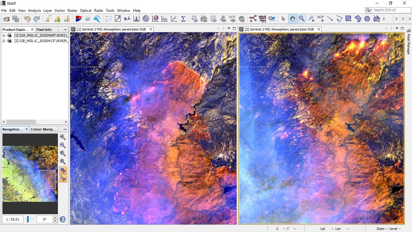
Reference the image below, the right window Copernicus Sentinel 2A “Creek fire” image captured 13 Sept 2020 18:39:29 Zulu, 8 Sept 2020 left window.
I penetrated the smoke layer obscuring the visible spectrum by using the default atmospheric penetration mapping of colors and wavelengths in SNAP 7.0.4.
Color Band nano-meters
Red B12 2190
Green B11 1610
Blue B8A 865
It appears back fires and fire breaks established on 8 Sept in north east came unbuttoned. Imagine if you had a multi-year Tempeance Flat construction project underway in this part of our state. The CWC, WSIP staff and WSIP applicants seriously need to dial wild fires and preventative controled burns into their planning, consturction, schedule, cost estimates and contingency plans.
Leland