Dear All
Please help me.
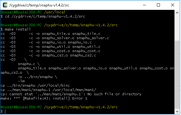
Here I will post some steps that I faced during the installation.
I follow the files Installation_SNAPHU_ENGLISH_ABraun.pdf
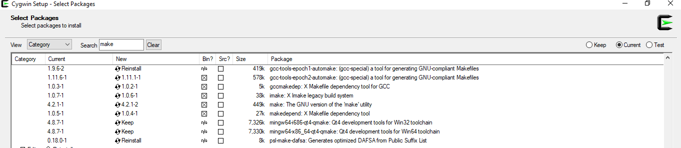
then when installing, the Cygwin version was different than the instruction.
Next, I will post all pictures where differ.
Versions do not matter, any other versions of cygwin and gcc-core and make will work.
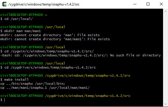
As for the make step: Navigate to the directory where you downloaded and extracted snaphu. It may be C:\temp\snaphu-v1.4.2 only in my example. You will have to adjust that to the paths on your machine.
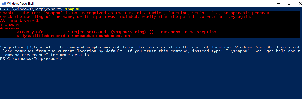
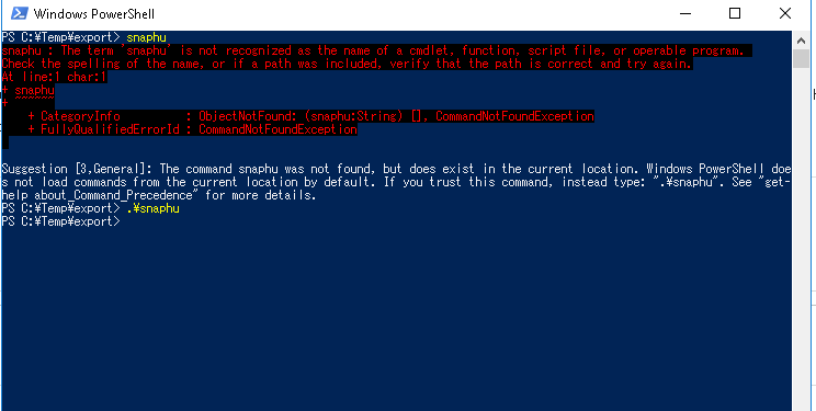
From your third screenshot I see that snaphu.exe was somehow compiled anyway: For running snaphu from the Windows Power Shell: Just follow the message: type “.\snaphu” instead of simply “snaphu”
Hello,
I am very thank full for your suggestion.
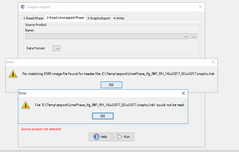
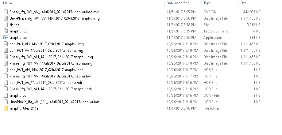
I tries it in Cygwin. I become success to get unwphase ------.img and .hdr,
Then I tried to snaphu import by SNAP tool box.
there different kind of error message has been displayed.
I hope you understand my steps.
Hopping your comments.
Hello,
I am very thank full to you for your support and becoming optimistic.
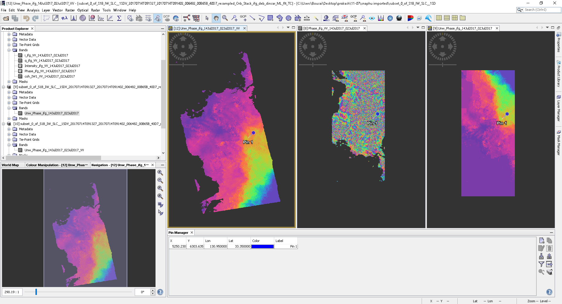
I have successfully completed Snaphu import and open in SNAP.
Now my target is to measure the displacement and create the DEM of these area.
Here is the my result.
It’s hard to see from your screenshots what these pictures are. Did you already apply terrain correction?
Normally, you make an interferogram, remove topographic phase, unwap your phase, convert it to displacement and then geocode it. Last step is to level it to a zero point with no elevation with the band maths.
These are my steps.
select two SLC images and open in SNAP.
creat Subset
Coregistration
Interferogram generation
Topsar Debrust
Topographic Phase Removal
Multilooking
Goldstein Phase Filtering
then the number (8)
snaphu export
snaphu import(no 9)
and create no 12 by Range Doppler Terrain Correction ( picture also there), ( no.10 also same but I try to add the unwarp phase band and others together in single file.)
After this,
I try to run Phase to height, but in this, a new file is created but there is no band.
I hope you got my mistakes.
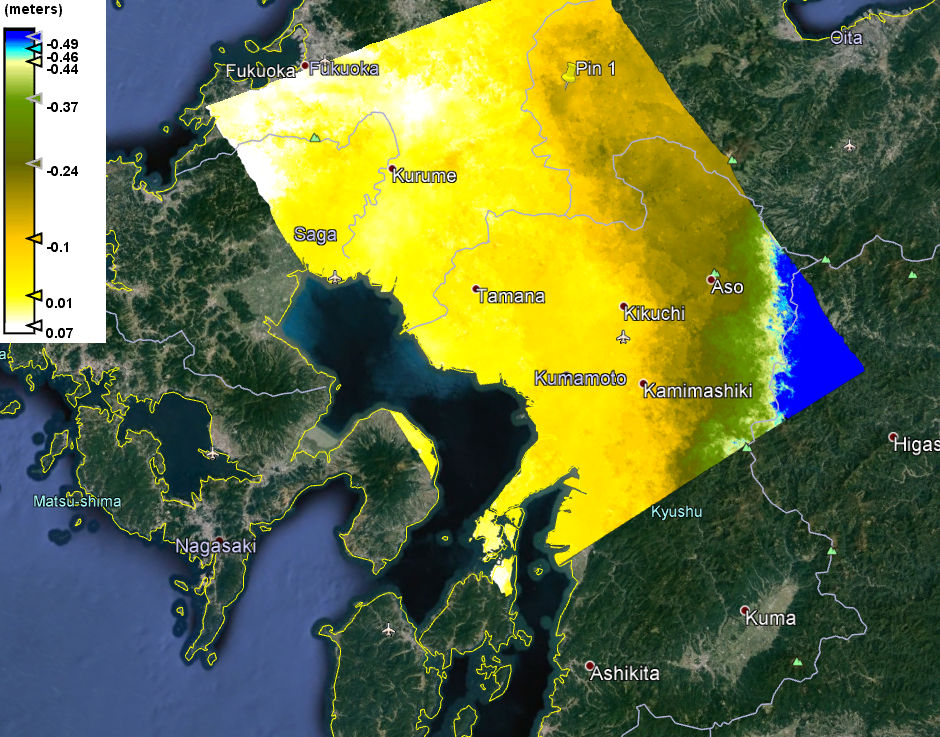
After that,
i tried to make phase displacement and got it like this.
for displacement you use topographic phase removal (before unwrapping) and phase to displacement, for DEM you just use phase to elevation (before terrain correction)
The image you show looks okay, but the coregistration caused a ramp in your image which might not be the true displacement.
Dear Sir
Thank you very much for your support.
I hope, I understand it. I will follow the steps for DEM generation as you posted in another section.
I will go through coregistration process again and will discuss later.
Dear ABraun Sir,
I was studying about the generation of DEM and coregistration process.
My Plan is to create an accurate displacement map, and change in height, and DEM with the counter map.
Would you please suggest me some hints, how can I perform the well.
In future, I want to learn to make the time series Displacement graph and the map of the particular place in mountainous terrain.
Actually, I am doing repetitive works for getting good coregistration.
Meanwhile, I got another problem too, for making subset and coregistration.
I try to make the subset of IW2 by split it and debrust it and coregistration, it said I cannot do in a single swath.
I try again like split and apply orbit files and coregistration, it also not possible.
So, I want to know how to create the subset for IW2 and IW3 area, which can be further processed in SNAP.