Say, you either have a full S2 dataset which you opened as regular S2 product in SNAP, or you have a subset from said product which you saved in BEAM-DIMAP format. How would you be able to delete all geocoding from that image or subset? I intentionally want to have the projections and transformations removed from the dataset. All coordinates would fall back to pixel coordinates.
I need this for students to practice co-registration!
Thanks
Delete it. Afterwards there should be no geo-coding anymore.
Another option would be to export single bands to an image format like TIFF. And then import the images again. But then you have to deal with multiple products. These could be merged into a single one by using BandMaths.
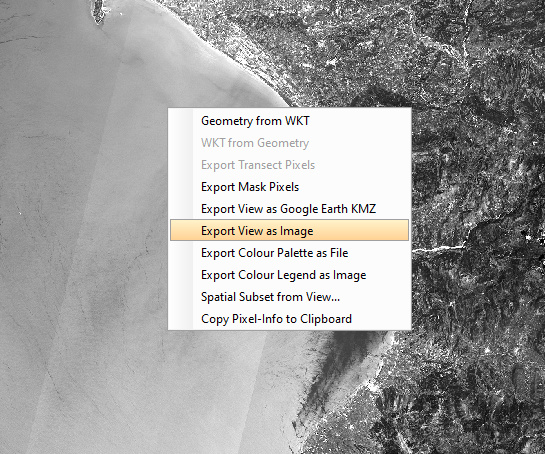
To export such an image, open a band view and open the context menu .
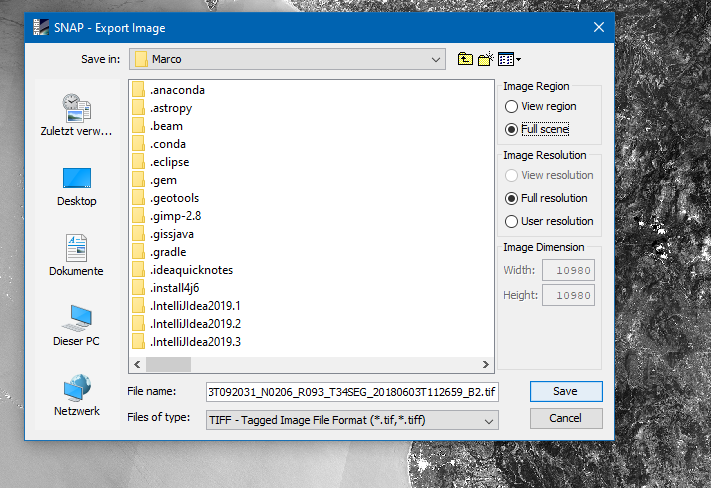
Select “Export vVew as Image”. In the upcoming dialog ensure that ‘Full Scene’ and ‘Full Resolution’ are selected.
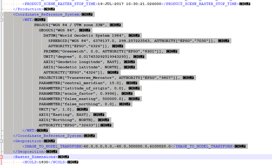
thank you for your helpful answer! In fact, I found the parts where geo-coding is dealt with in the .dim file and deleted it already. Still, there were X and Y coordinates that correspond to UTM, since the upper left corner is specified in the “IMAGE_TO_MODEL_TRANSFORM value” in the <Spectral_Band_Info> of each band. When I deleted this information, the image was turned upside down. I decided to overwrite actual X and Y with 0, 0. Now X counts backwards into negative ranges, but the students will have to deal with that.
I am stuck, however, at co-registrating the image after deleting the geocoding. I was hoping for something similar to Erdas, where you have a master and a slave image and find GCP in both of them to link them together. Do you happen to know, where I can find a manual or tutorial on that?
excuse me,I exported my sentinel-2 data as GeoTIFF,so it lost geocodig.now,i want to use it in snap with other sentinel2 data ,but the error message is that “the data must be geo-coded”.I want to know how can i add geocoding to the GeoTIFF data.can you give me some advices?