Dear all,
I produce DEM by using TanDEM-X products
. I read some steps in STEP forum and even follow this image
I am following the steps in the video to make phase unwarpping
the result was very bad
Can anyone guide me to the wrong places?
Dear all,
I produce DEM by using TanDEM-X products
so you mean that there is a vertical offset between your measurements (GNSS) and the InSAR DEM?
This can have many reasons - where is your study area located? Please check here if the offset matches the goid height in your area of EGM96: https://en.wikipedia.org/wiki/EGM96
What module did you use to convert the unwrapped phase? Phase to height or phase to elevation? If the latter, which reference DEM did you use?
If it is a linear shift you can manually correct it. I often do this because the absolute heights of InSAR products are not very good. If you want to share the table above I can check if it is possible.
Dear @ABraun Thank you for your interest
yes the vertical offset between your measurements (GNSS) and the InSAR DEM is high.
the study area locate On the Iraqi-Iranian border
case study.kml (1.8 KB)
The GNSS observations were on the EGM 2008.Do you mean that I am converting measurements of GNSS to EGM96. I used phase to elevation srtm3sec
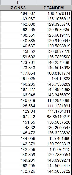
The difference is not uniform in all measurements. If you want help me you can share the tableee.xls (24.5 KB)
So you decided to help me. Can I share all the sub-steps with the pictures?
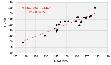
thank you for sharing. I checked your data and we can observe a quite linear shift between GNSS and TanDEM-X values. I’m not sure if it comes from the EGM96 or not, but if you apply this equation to your TanDEM-X data the shift will be minimized and the raster values will represent the actual elevations. It’s basically just a linear regression to adjust the modeled data to your measured ones. The differences range between 8.7 and 33.4, but when you apply this equation, you will achieve the best conversion possible - at least based on a two dimensional model.
0.07085 * InSAR + 24.7
Dear @ABraun
thank you very much to help me .the equation is very important in processing of data .Now I need to know the reasons for this difference.
1-Is the problem in the processing process?
2-Is the problem with the reference system?
3-Is the problem the potential of the program?
4-Is the problem from assistant DEM?
All these questions are required of me to answer them if the supervisor asks me
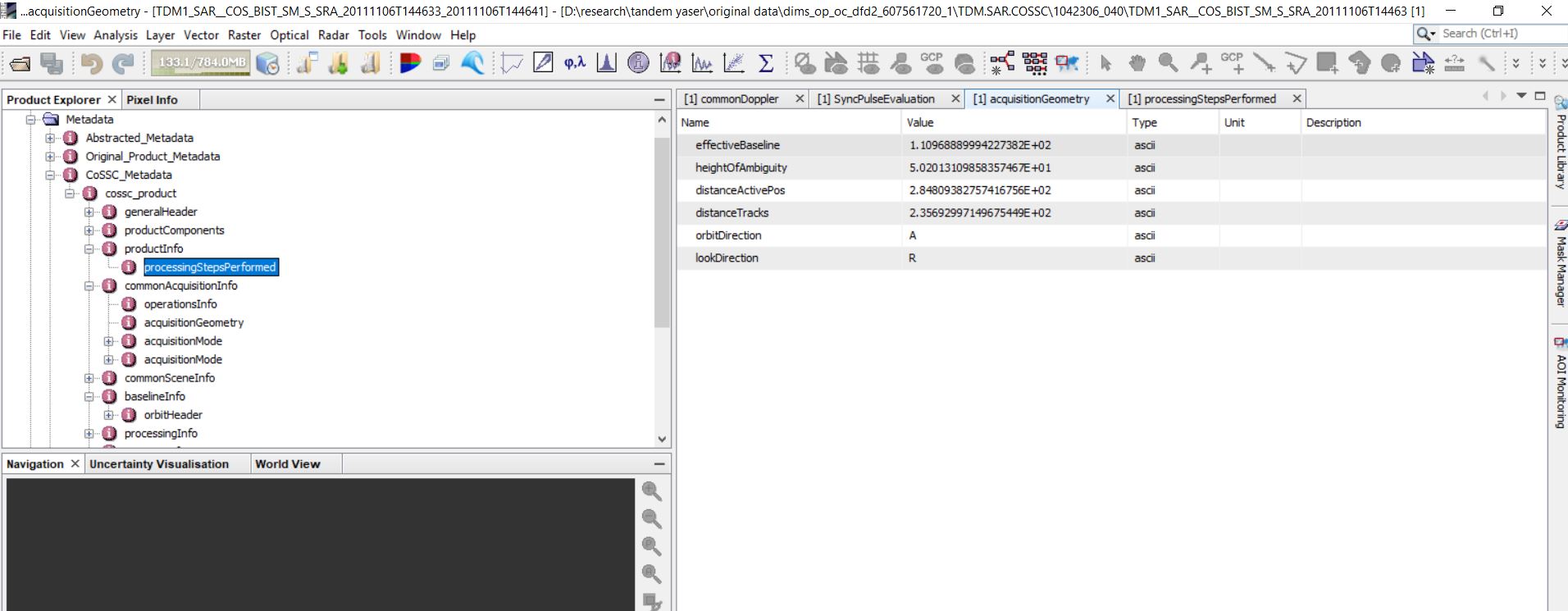
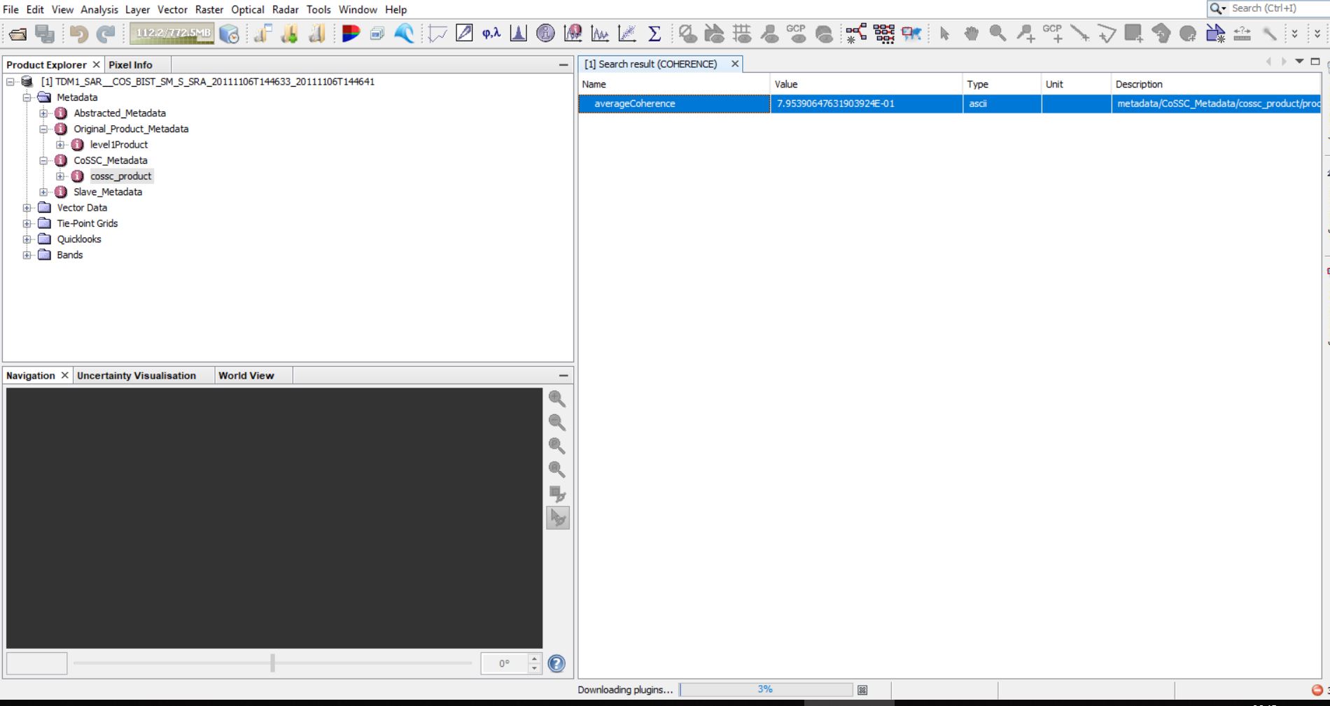
Please help me know the bugs step by step.At first you will view the processing process and wait for your comments…step.pdf (2.7 MB)
Sorry, I can’t tell where exactly is the source of the error, I only can provide a work around to solve it.
As it is your thesis it is your task to discuss potential error sources.
This might help: https://eo-college.org/resources/insar_errors/
Your processing looks alright. Now apply the equation to your elevation raster.
If it’s not TanDEM-X data (single-pass interferometry), atmospheric artefacts could be a factor.
Hi ABraun
1 . When matching the results with a high-resolution dem (.5 m) there is an offset between the two images. Please guide to the correction method
there is no universal solution to this. Have you checked if the coregistration was successful?
What is the perpendicular baseline of your image pair?
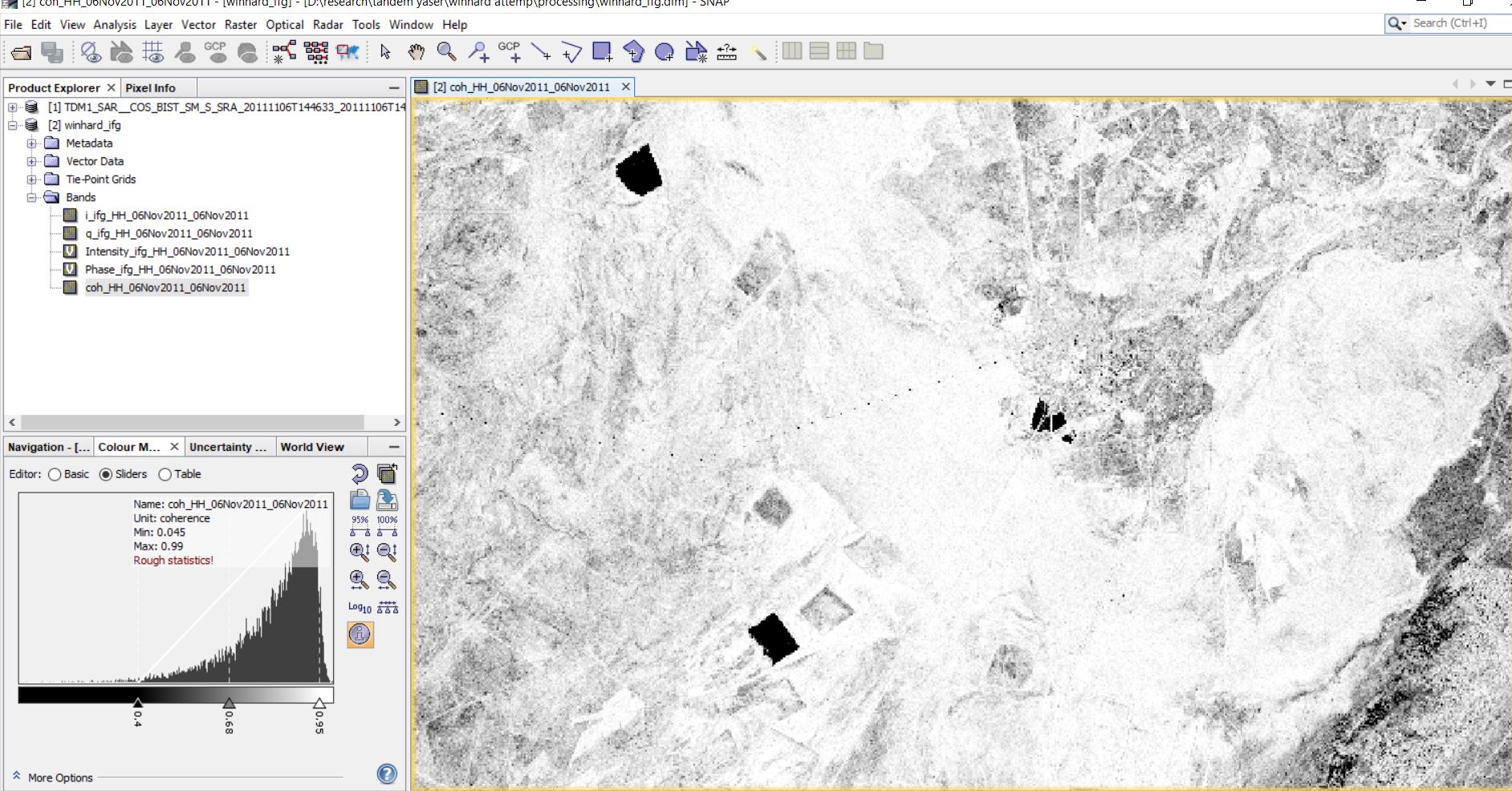
Can you please show the coherence between both images and the interferogram?
Any unwrapping errors or areas of low coherence?
All these contribute to differences better/worse elevation information.
How does the interferogram look? Initial and unwrapped.