Hello,
i try to detect the change in Elevation after a landslide occured.
I have done following steps with a pair of Sentinal 1 A SLC IW Subswaths. One Scan before and the other Scan after the Landslide Occurs.
1.S1 TOPS coregistration
2. Deburst
3. Interferogram Formation (subtract flat erath phase; Subtract topographic phase)
4. Goldstein Phase Filtering
5.Snaphu Export
6. Unwrapping
7. Snaphu Import
8. Phase to Displacement
9. Range doppler Terrain Correction
10. Export as KMZ and load in Google Earth
That are the results
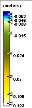
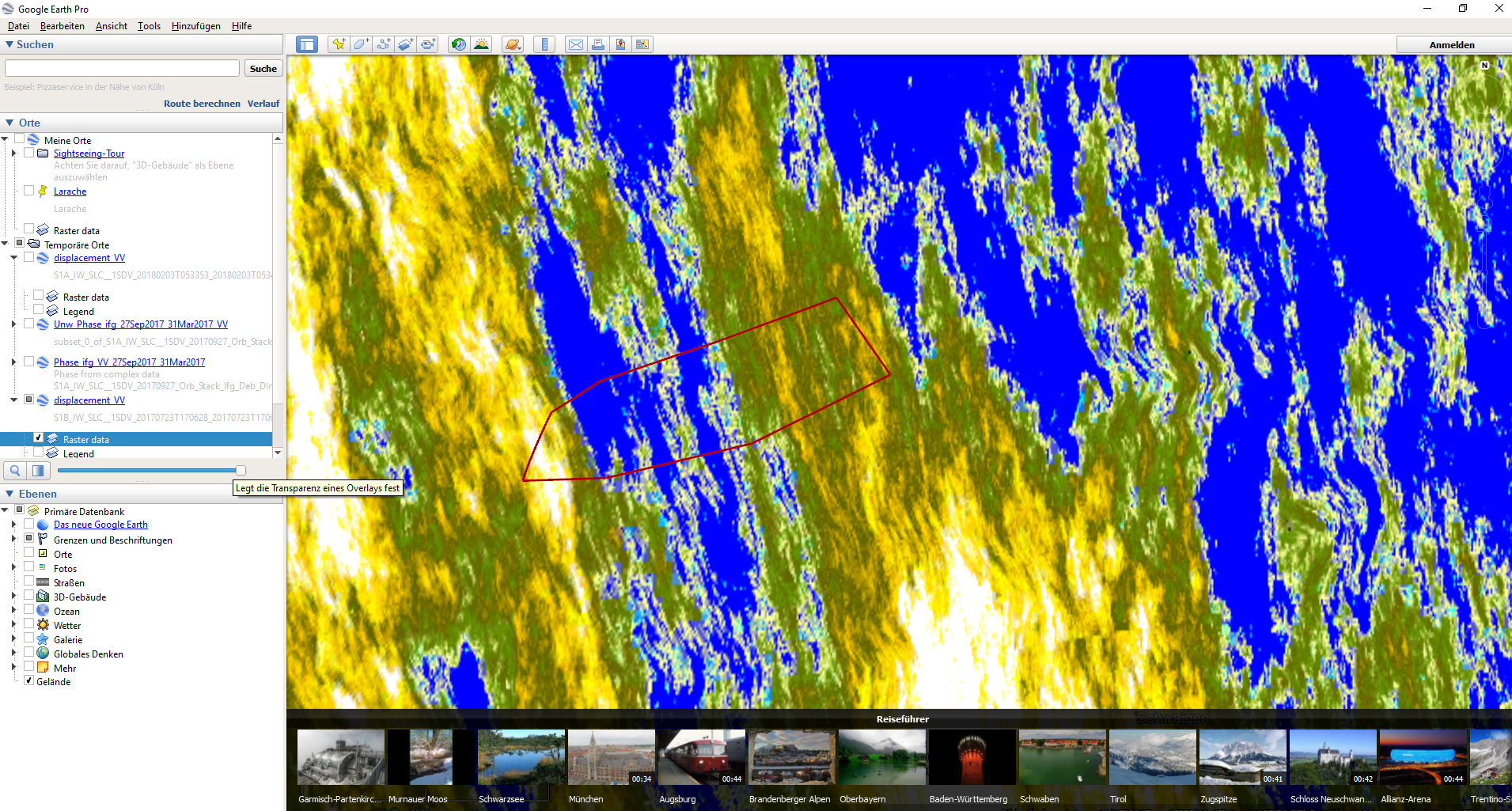
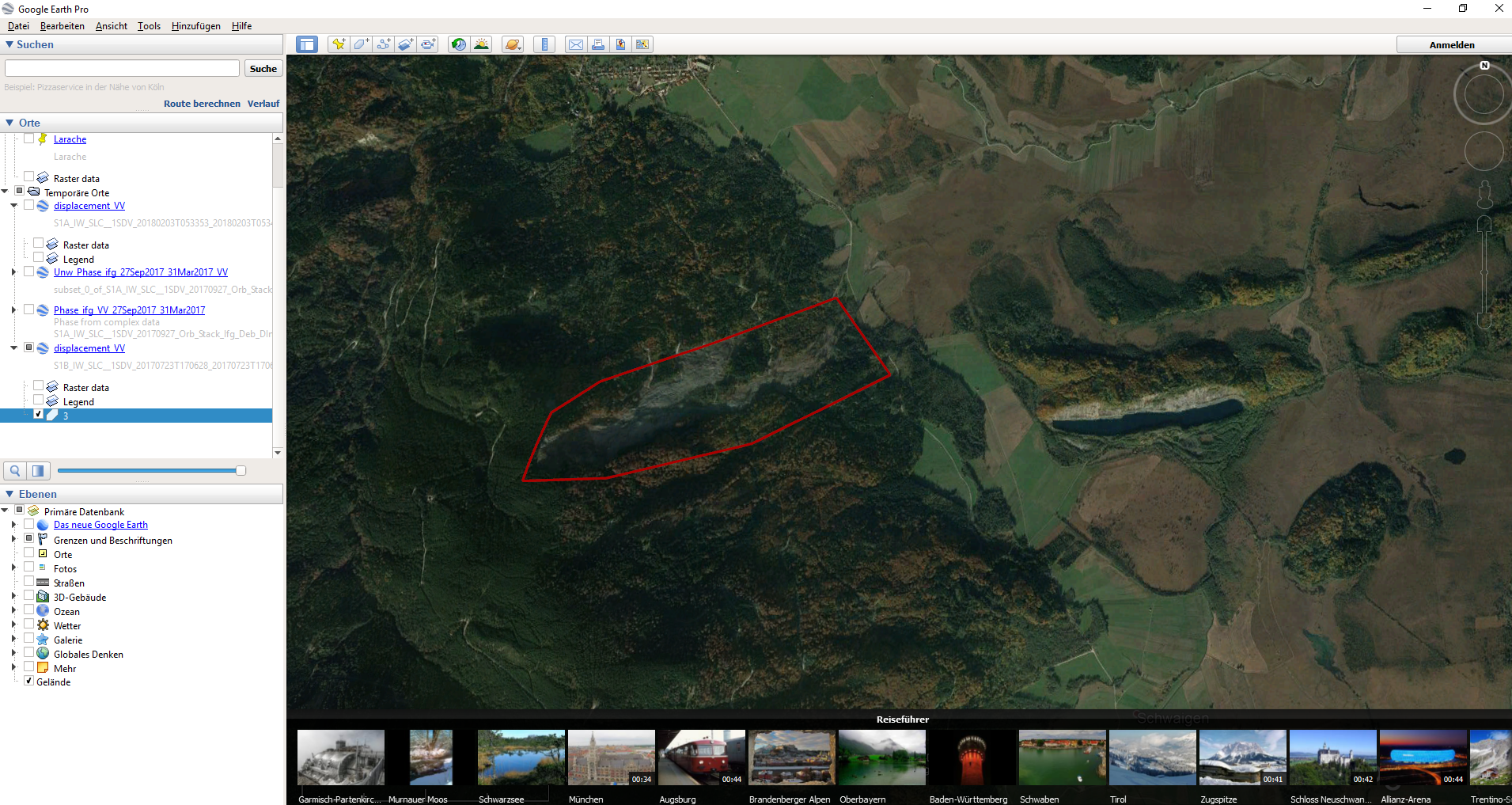
The showing Displacement doesent match with landslide Area. In General i think i have done mistakes. Maybe you can help me?
By the way is there any possibility to change the colorscale?