I didn’t find this literature, would you please to provide it to us here in STEP FORUM, if that possible,
Hi,
This source, actually, comes from the following book
InSAR Imaging of Aleutian Volcanoes. Monitoring a Volcanic Arc from Space
published by Springer
Thanks for your response, the book unfortunately is not free,
unfortunately it is not. It is a good book. I borrowed it from the library
I found it, as E-COPY from here,
thta’s good but it provides you only with some pages of the whole book though.
hi johngan
how we can find local incidence angle?
Greetings
Myself Mani.
In the end of all this conversation, did you find the answer? Can you please tell me the difference between the velocity and the time series plot, please.
I am using StaMPS and Matlab for the first time.
I used StaMPS and in the matlab i plotted ps_plot(‘v’) and i got a velocity map. Then i plotted time series using ps_plot(‘v-do’, ‘ts’) and i got time series plot. Now my kind request is can you please tell me why these two things have different scale and what is the purpose of velocity plot and time series plot and are they both different?
Please kindly answer me and give me some reference literature so that i can learn about this in detail.
Hi all,
Can you please tell me which formula shall I use to get the vertical displacement from LOS displacement?
Is it - Vertical_displacement = LOS_displacement * cos(rad(Incidence_angle)) ?
Or is it - Vertical_displacement = LOS_displacement / cos(rad(Incidence_angle))?
Thank you for help!
Ninad
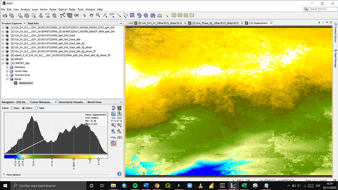
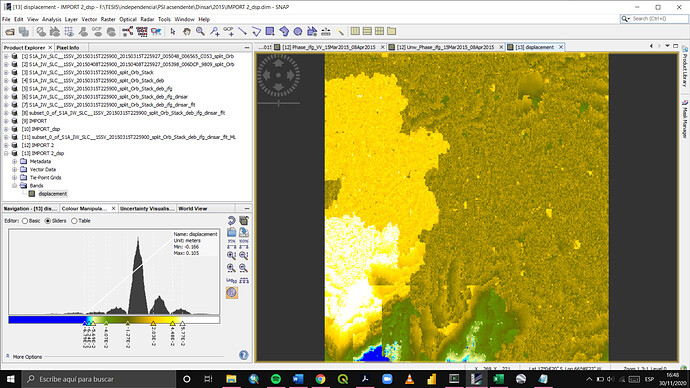
could you please upload screenshots of the two plots to demonstrate how they are of different scale?
It’s free here:
@johngan ,@ABraun I have a question here.
When calculating vertical displacement or three-dimensional displacement from LOS, which angle of incidence should be selected?
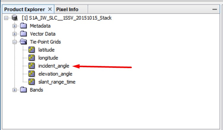
There are three types when deriving the angle of incidence in the data, including:
①Incidence angle from ellipsoid
②local incidence angle
③projected local incidence angle
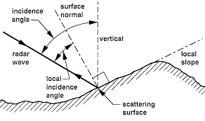
If the incidence angle here is the angle between the radar beam and the normal to the scattering surface.
Then according to the picture below, what I should export is the local incidence angle, I don’t know if it is correct.
Thank you Johngan…
But why?..I must say, I had many and great problems with the normal steps from interferograms, I asked for the help of “@ABraun” and the problem was not solved, You can check here: Problem with the final steps of interferometry I was totally frustrated. But someone suggested me make the correction after the goldstein filtering, just for try, and since then all my interferograms have logic, I can detect landslide, flows and deformation correctly I’ve make hundreds of interferograms since that moment, and now all my afirmations from interferometry have sense …So can you explain me please. Why the last step must be the geometric correction? is the only way? or is a very good suggestion?
Terrain direction itself does not automatically solve problems, but my guess is that the resampling which is part of the terrain correction smoothes some of the noise within the interferograms.
If this is the case with your data, I would rather recommend to apply multi looking on the interferogram which has the same effect, but does not project the data into a coordinate system.
I agree with @johngan that this should be done after calculating the displacement.
Can you please show how the results change with terrain correction applied earlier in the workflow? Bases on the from the other topic, my guess is still that for some image pairs decorrelation is too high and unwrapping will introduce random patterns which are no longer trrelated to the deformation at all.
Thanks @ABraun . Do you mean resampling the second step? the interferogram formation?.
After interferogram formation, apply Radar > SAR Utilities > Multi looking for a test (eventually also a Goldstein filter) and see if the unwrapping produces better results.
Hello. I might have a question about the accuracy of the Los velocity deformation and the actual PS displacement of the time series when the process is done by StaMPS. I am wondering which is the low limit untill I can considerer the displacement a reasonable value. In one article of Colesanti is written down the following:
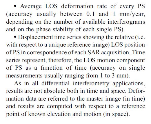
So I want to find out whats my PS results accuracy.
I am working with Cosmo-Skymed StripMap Himage data, and the results of my LOS velocity displacement are very low( 0.5mm), even though my movements go from positive to negative with great values ( around 20 mm). This big difference make me thought if I actually can use this results, becouse somewhere i read that the method cant measure movement lower than 2mm/year…
