We are applying IdePix on L1C_SYN products that combine OLCI and SLSTR L1B inputs (using L1C SYN tool v2.5). For pixel status mapping, previously we used Idepix 7.0.5 in SNAP 7.0.3. Some time ago we switched to Idepix 8.0.1 in SNAP8.0.0.
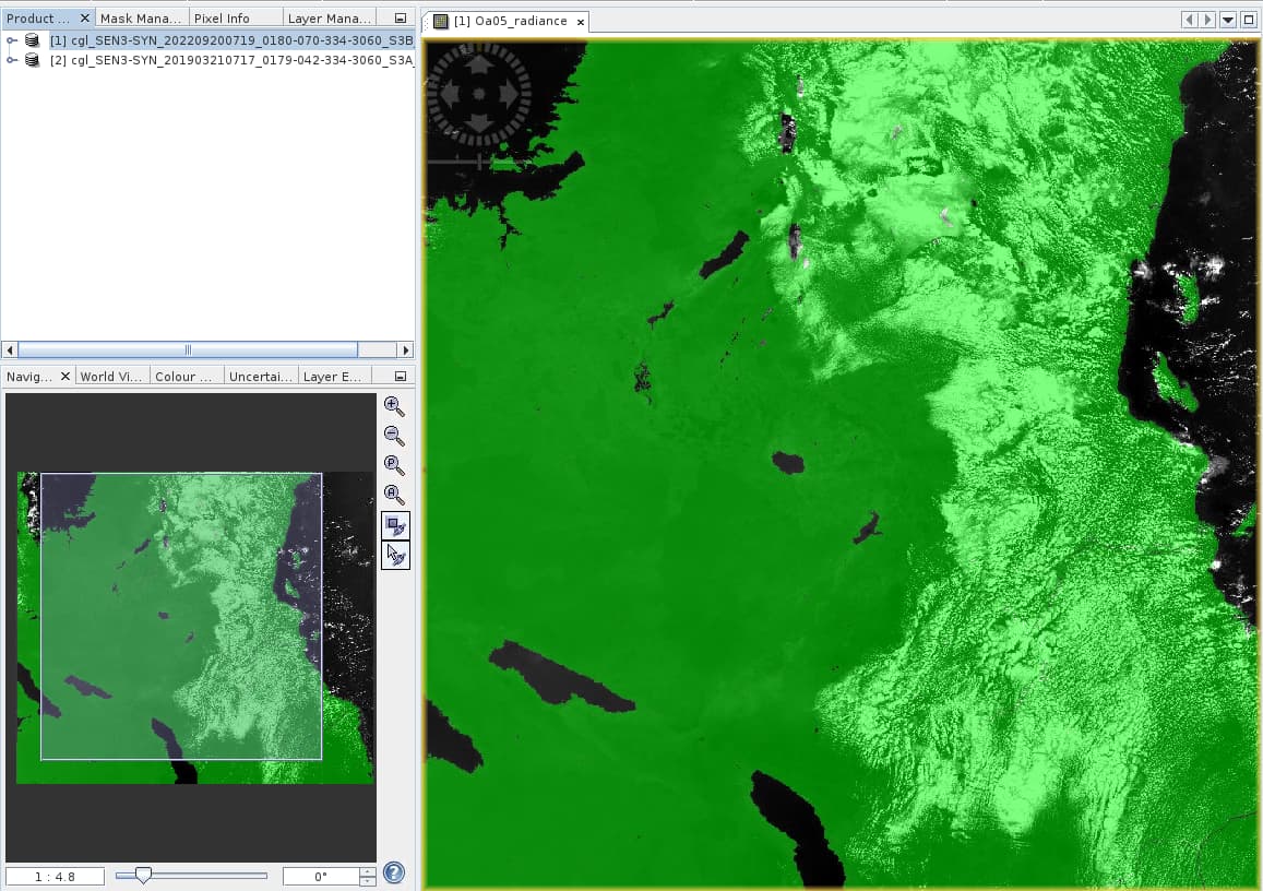
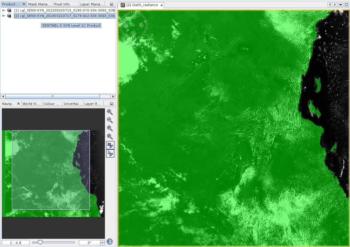
Now we have noticed that after updating Idepix, the pixel_classif_flags.IDEPIX_LAND is different. Below I show examples over East Africa (Lake Victoria and the Great Rift Valley), with in green where IDEPIX_LAND == True. (Images are from different dates, but the point is clear.)
In Idepix 7.0.5, all oceans and inland waters get status IDEPIX_LAND = False.
I think the problem here is that you are comparing the special CGLOPS IdePix v7.0.5 and the general for SNAP 8.
The special adaptation for CGLOPS have not been migrated into the general development branch of Idepix.
But we are currently investigating how we can harmonize both or better distinguish between both.
Hello @marpet,
Thank you for your swift response!
I am not sure to understand what the ‘special CGLOPS IdePix’ version includes and how it differs from the general IdePix. Could you explain?
Best regards,
Carolien
The differences are about the flagging for inland water, coastal areas, and cloud over water.
That’s what I remember from the top of my head. There might be some minor adaptations more.
I remember we also had some discussions on wrong direction of cloud shadow projection. Might it be the case that this correction is not taken into account in Idepix v8?