Hi there,
There is strange bands coming out from my DinSAR process:
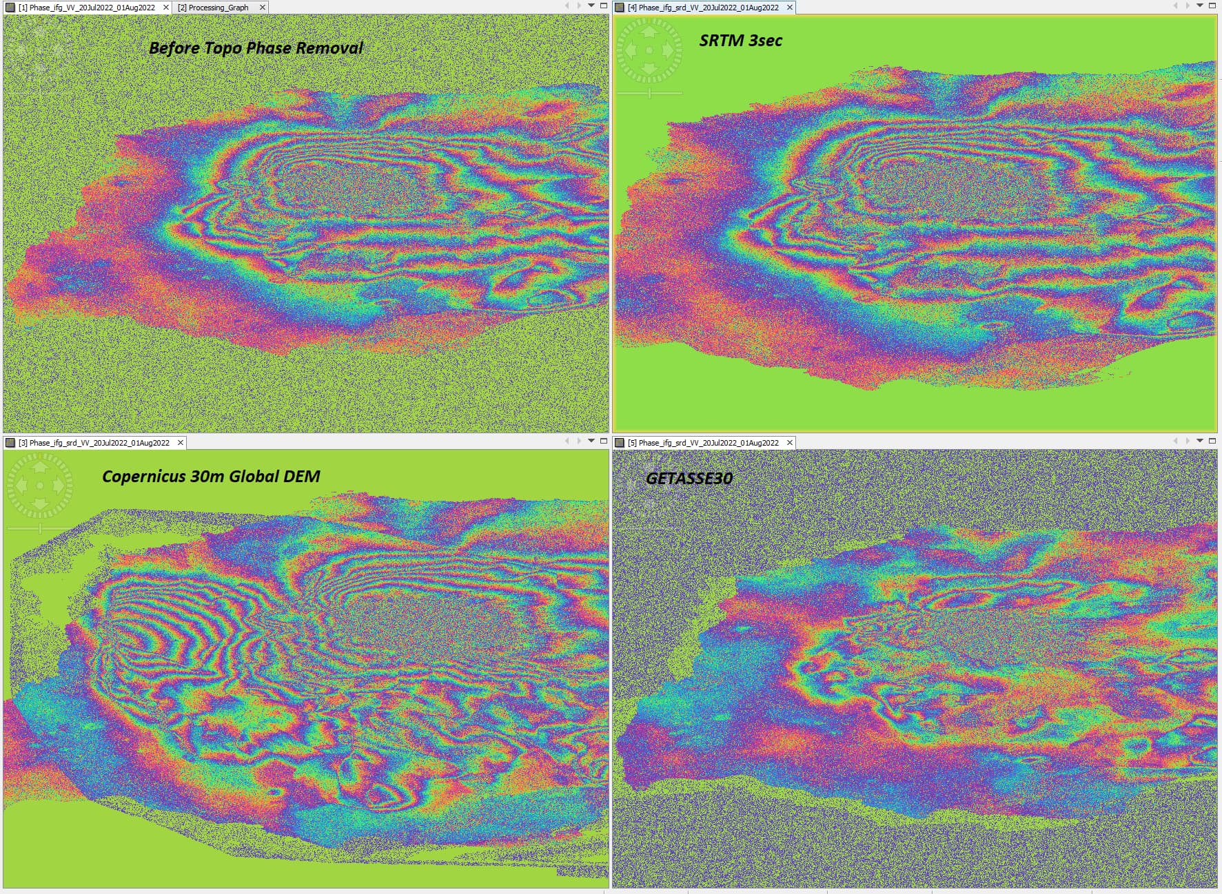
Those bands seems coherent but looks like a modulo 2pi between each… it doesn’t seems correlated with IW and/or subswath…
Datas are S1 IW SLC mode.
Any idea about how comes ?
Thanks!
Ari
ps: Coherence is good
Okay those bands are coming from the “Topographic Phase Removal” operator
Till now my issue is only reported in Iceland Area, I would be curious if anyone is facing something similar applying differential inSAR.
I tried this step with different DEM:
- Obivously SRTM is not covering this area, so the operator did not change the result from inSAR to DinSAR with SRTM3sec DEM.
- Copernicus 30m DEM => weird pattern (Copernicus 90m gives same result)
- Getasse30 => appropriate, but does not mask out at sea level wiith “Range-Doppler Terrain Correction”…
Best,
Ari
1 Like