I recently found out that the bandwidth and the central wavelength of Sentinel-2A and Sentinel-2B processors are different (MSI Instrument – Sentinel-2 MSI Technical Guide – Sentinel Online - Sentinel Online)
I used two images one for each satellite in my study on Vegetation decline and Urban area expansion and I used the NDVI and NDBI index. I performed these calculations on the SNAP platform.
My question is does this mismatch in bandwidth drastically impact the NDVI 0r NDBI calculations? If Yes to what extent? If No, why not. In any case is there any literature that could support it? (Sorry for being novice I would need to support the claim in my thesis !)
Thanks in advance for the help.
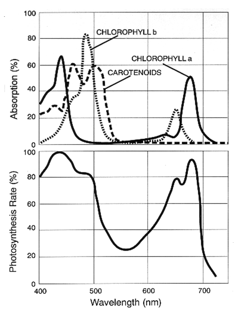
The difference in wavelength is not big enough that it changes the NDVI drastically.
The Normalized difference vegetation index - Wikipedia article can already help you here.
If you look at the graphs in this image you see that a change of few nano meters do not change much.
