hi all, me again…
for those who follow, i have crossed all hurdles and got stuck here…
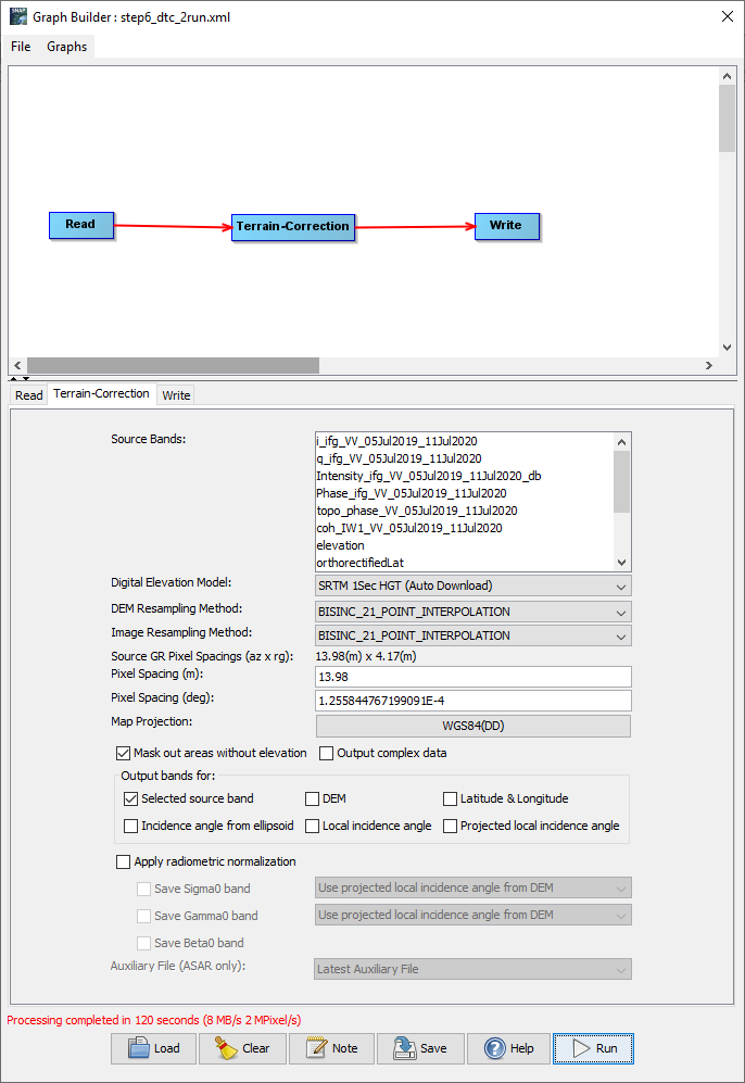
i have run the following: split, orbit, backgeocoding, esd, interferogram, deburst, topo phase removal , goldstain filter, snaphu (in and out), and the additional outputs recommended somewhere (phase to height , dem and displacement). now its time for terrain correction (TC) - and i cant make it work.
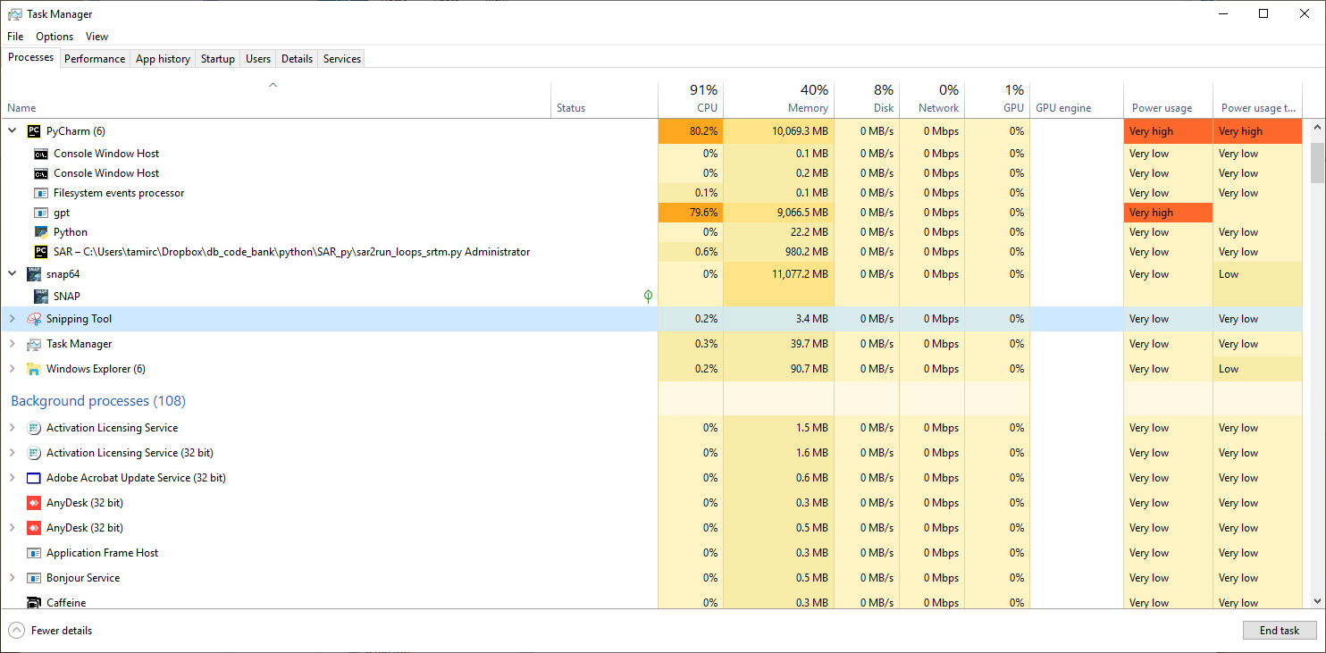
im running all this on a win10 computer with 128g ram and 12 cores. i am using python to edit xml graphs and running them via gpt … my snap is 8.0.0 (i regressed after the upgrade was not working - see Topographic Phase Removal Error)
so
i have run successfully the TC process on my input file from the menu (about 2min)
i have also run it successfully using graph (about 2.5 min)
but now , i have tried to run it via gpt (essentially i used python to edit and change the input and output file and create a new xml graph). the xml files look similar but when i run it - it hangs for a long long time (hrs, overnight until i braked it…). i cant see an obvious reason since it works fine as a grap in snap but fails in the gpt. i suspected it had something to do with the indents of the xml and did some trials but no solution so far…
the most annoying thing is that the edited xml (the one edited by python) works just fine if i run it in snap graph interface but not in gpt… it just hangs for hrs and hrs until i break the process… i don’t think its the gpt engin seeing that i have just run 15 previous steps just fine…
very weird…
did anyone had similar problem? any idea how to tackle this?
below i will paste the edited and saved graph (the one that runs in snap) and the graph window…
============================================================
1.0 Read D:\tamir\SAR\output_dir\20190705-20200711srtm1abcbc3abc4abc5IW1_3-3.dim Terrain-Correction SRTM 1Sec HGT 0.0 true BISINC_21_POINT_INTERPOLATION BISINC_21_POINT_INTERPOLATION 13.98 1.255844767199091E-4 GEOGCS["WGS84(DD)", DATUM["WGS84", SPHEROID["WGS84", 6378137.0, 298.257223563]], PRIMEM["Greenwich", 0.0], UNIT["degree", 0.017453292519943295], AXIS["Geodetic longitude", EAST], AXIS["Geodetic latitude", NORTH]] false 0.0 0.0 true false false false false false true false false false false false Use projected local incidence angle from DEM Use projected local incidence angle from DEM Latest Auxiliary File Write D:\tamir\SAR\output_dir\20190705-20200711srtm1abcbc3abc4abc56IW1_3-3.dim BEAM-DIMAPstep6_dtc_2run.xml (3.2 KB)