Hi,
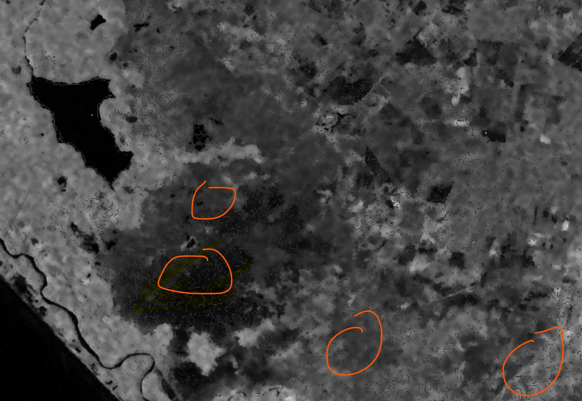
I’m terrain-correcting a High-resolution Stripmap TerraSAR-X image using the LiDAR DTM (1 resolution Digital Terrain Model) available for that area. The problem I’m observing is that there are many pixels around the terrain-corrected image that contain NaN values (and I need to eventually make a subset to get the information needed only).
This same problem doesn’t appear when I terrain-correct the same image using the auto-download option with the SRTM DEM 1-arc-second (30m resolution).
Below is the portion of the graph I’m using to do the terrain-correction, and the terrain-corrected image with the extra space. Is the difference in the resolution between the SAR image and the LiDAR DTM responsible for the extra-empty-space?
<node id="Terrain-Correction">
<operator>Terrain-Correction</operator>
<sources>
<sourceProduct refid="Calibration"/>
</sources>
<parameters class="com.bc.ceres.binding.dom.XppDomElement">
<sourceBands>Sigma0_HH</sourceBands>
<demName>External DEM</demName>
<externalDEMFile>C:\Data\LiDAR\dtm-wgs84.tif</externalDEMFile>
<externalDEMNoDataValue>-9.999</externalDEMNoDataValue>
<externalDEMApplyEGM>true</externalDEMApplyEGM>
<demResamplingMethod>BILINEAR_INTERPOLATION</demResamplingMethod>
<imgResamplingMethod>BILINEAR_INTERPOLATION</imgResamplingMethod>
<pixelSpacingInMeter>2.2</pixelSpacingInMeter>
<pixelSpacingInDegree>1.9762936250629475E-5</pixelSpacingInDegree>
<mapProjection>GEOGCS["WGS84(DD)", 
DATUM["WGS84", 
SPHEROID["WGS84", 6378137.0, 298.257223563]], 
PRIMEM["Greenwich", 0.0], 
UNIT["degree", 0.017453292519943295], 
AXIS["Geodetic longitude", EAST], 
AXIS["Geodetic latitude", NORTH]]</mapProjection>
<alignToStandardGrid>false</alignToStandardGrid>
<standardGridOriginX>0.0</standardGridOriginX>
<standardGridOriginY>0.0</standardGridOriginY>
<nodataValueAtSea>true</nodataValueAtSea>
<saveDEM>false</saveDEM>
<saveLatLon>false</saveLatLon>
<saveIncidenceAngleFromEllipsoid>false</saveIncidenceAngleFromEllipsoid>
<saveLocalIncidenceAngle>false</saveLocalIncidenceAngle>
<saveProjectedLocalIncidenceAngle>false</saveProjectedLocalIncidenceAngle>
<saveSelectedSourceBand>true</saveSelectedSourceBand>
<outputComplex>false</outputComplex>
<applyRadiometricNormalization>false</applyRadiometricNormalization>
<saveSigmaNought>false</saveSigmaNought>
<saveGammaNought>false</saveGammaNought>
<saveBetaNought>false</saveBetaNought>
<incidenceAngleForSigma0>Use projected local incidence angle from DEM</incidenceAngleForSigma0>
<incidenceAngleForGamma0>Use projected local incidence angle from DEM</incidenceAngleForGamma0>
<auxFile>Latest Auxiliary File</auxFile>
<externalAuxFile/>
</parameters>
</node>