a new product reader is available in SNAP for EnMAP data from DLR.
It is able to read the L1A, L1B and L2 data in GeoTiff format.
The reader works already quite well but is still in a preview phase.
Feedback is of course welcome.
For installation, make sure that you have community plugins enabled in the SNAP Plugin Manager.
What will you use EnMAP for?
For us (Brockmann Consult) EnMAP and the reader plugin will be helpful in our EnSAD project for enhanced categorisation of phytoplankton.
Thanks for the EnMAP GeoTIFF reader, it worked nicely for me – except for…
the viewing geometry. It appears that the along_off_nadir and related angles are given in the GeoTIFF at the corner points of the swath section. For projected data these do not co-incide with the corner points of the data matrix. However, the reader seems to think so.
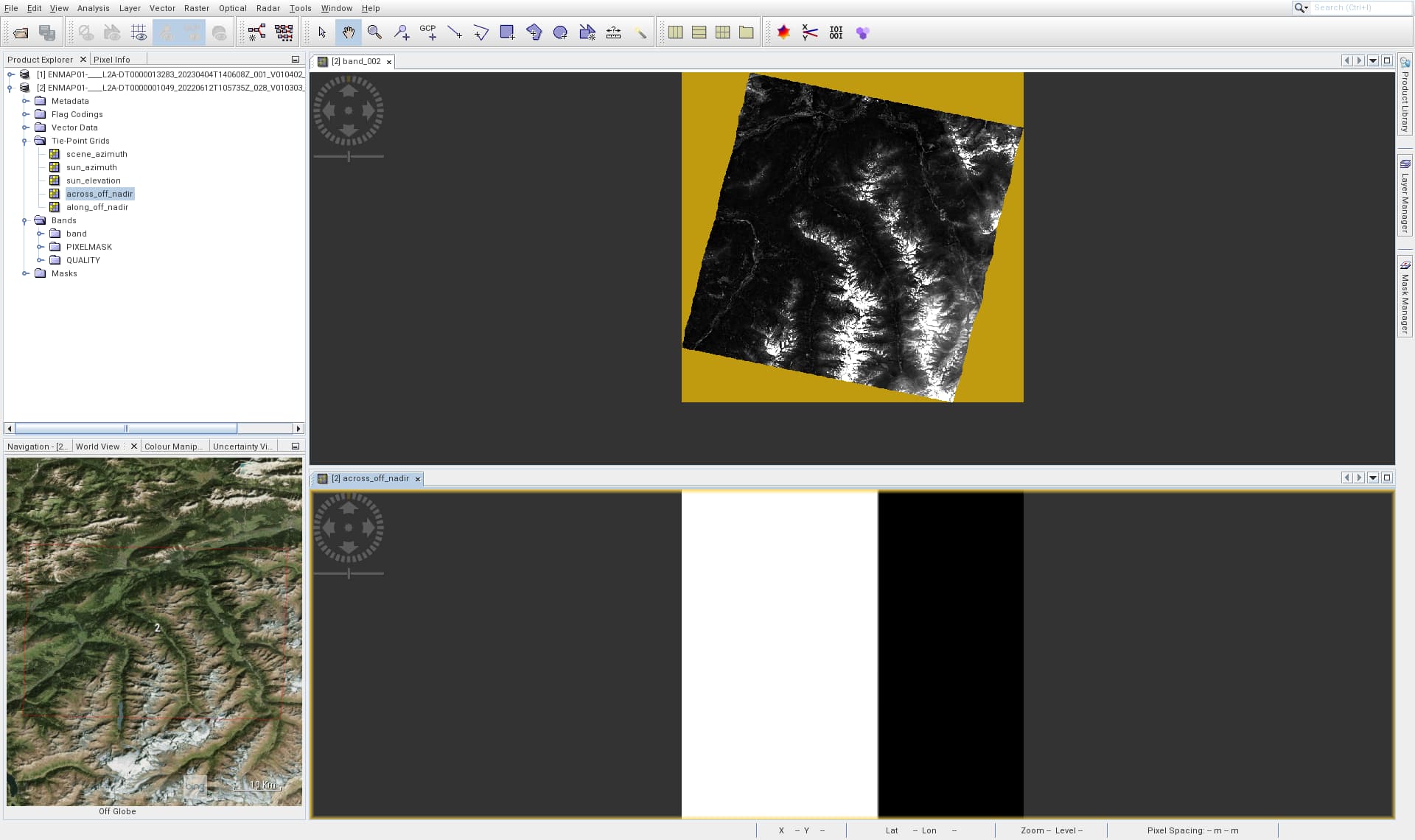
Demonstration:
Take for instance https://www.enmap.org/data/example_data/Tyrol_Austria_L2A.tar.gz
Unpack and open in SNAP. Visualise one of the bands to see the swath section. Visualise across_off_nadir from Tie-Point Grids. Change the contrast of this plot in order to see the variation in meridional direction. I had expected to see equal across_off_nadir angles in a line parallel to the swath edges, not the data matrix edges.
Your observation is correct, but this is not the fault of SNAP.
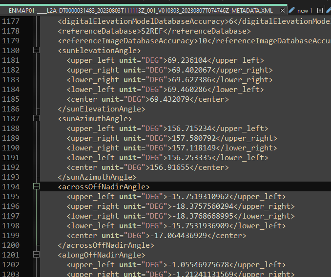
Only 5 points are defined for the tie-points, like the across_off_nadir. The four corner points and the centre.
This shows the section for acrossOffNadirAngle in the metadata XML file.
Thanks for the quick reaction. Let me disagree:
I think those points (upper_left etc.) refer to the corner and center points of the data take, but not of the reprojected image. Check the section boundingPolygon to find their coordinates.