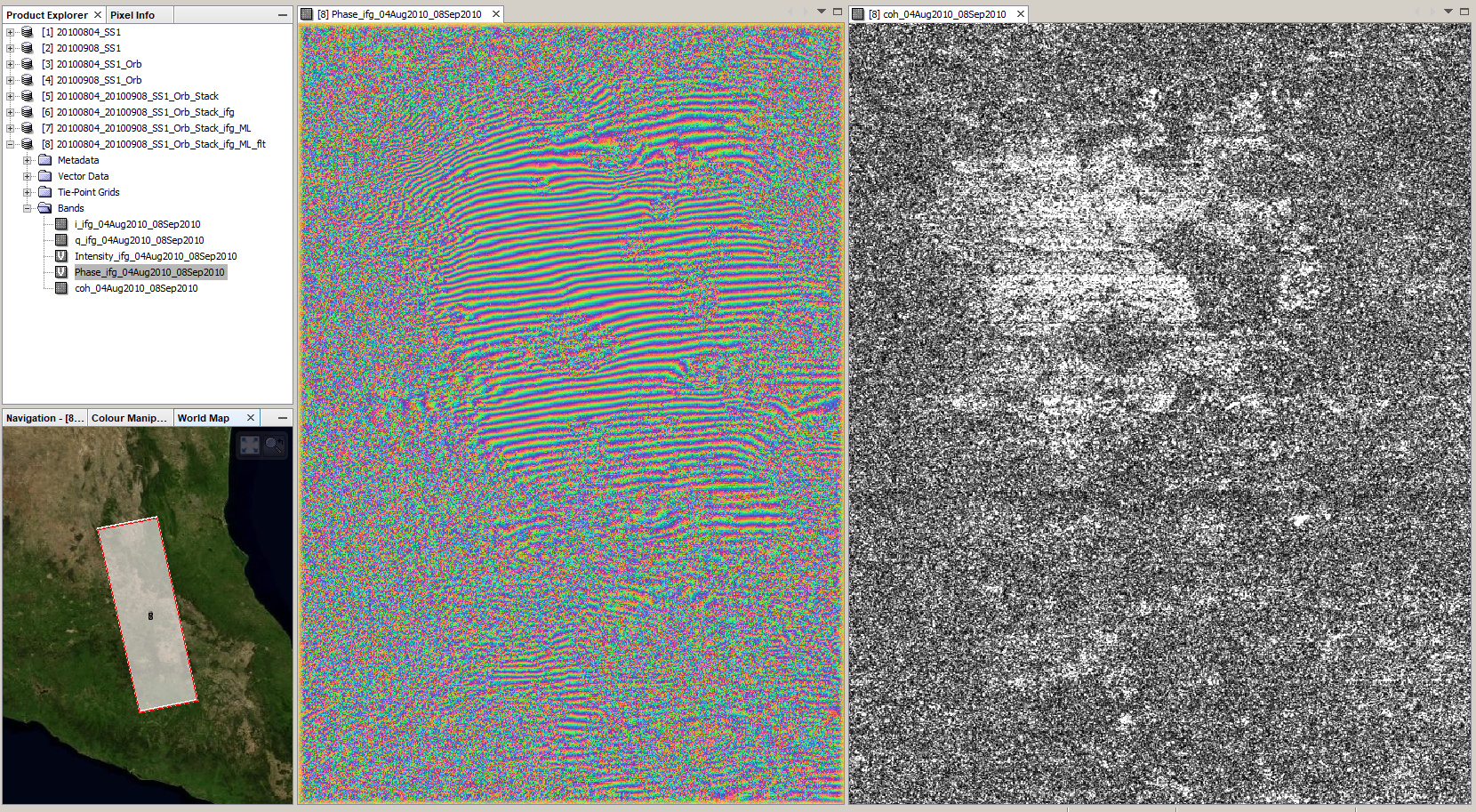
I am now testing this pair over Mexico City
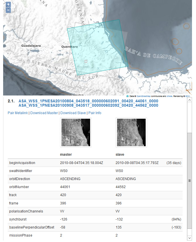
193 meters baseline and 94% burst overlap
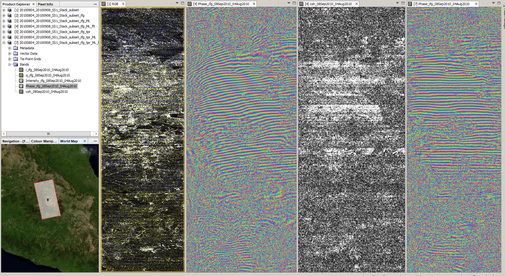
At least some fringes in the interferogram:
stack /multi-looked and filtered interferogram / coherence / topographic phase removed, multi-looked, filtered interferogram
ApplyOrbit done? Those fringes …you know what I mean
How had you coregistered them?
Which workflow had you follow?
Curious…
As vertical-aligned fringes could be ellipsoid, but not horizontal…
import > deburst > orbit > subset > coregister > ifg (tried different variables of orbit and earth interpolation)
How had you done the coregistration?
Thanks for your help
the simple coregistration module, left all parameters as standard.
Interesting… because I cannot apply the stack step based on Orbit initial offset…
Could you?
yes, the one under Menu > Radar > Coregistration > Coregistration
Have you checked visually that there’s not a larger than usual shift between the images?
I did use that one… 
This is in fact complicated as the ASA WSS was not synchronised, but I got one pair with 82% overlap
Hi everyone
I tried to make an interferogram map for an earthquake by Envisat ASAR WSS images
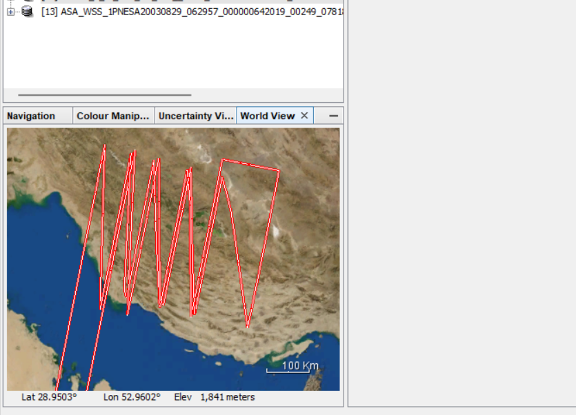
but when I tried to import the file the images shown like attached image in World View
I download this image in several times and all of them were the same.
what should I do? does it correct or no?
I noticed something similar, the World View window doesn’t really display the correct outlines, but the data should still be alright.
thanks for your reply
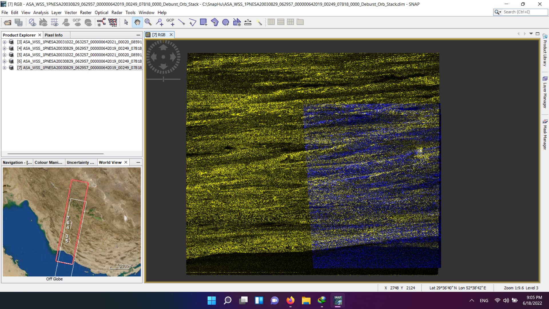
I continued by workflow chart to create interferogram:
deburst —> apply orbit (delft precise)----> coregistration (output map is become like below, I’m not sure if it’s correct or not)-----> interferogram formation (an error occured)
the coregistration completed, but not correct. More areas should be white.
Please try DEM based coregistration.
for that map I used this operator tools: Radar–> coregistration–> coregistration
then I test another way: Radar–> Coregistration–> Dem Assisted coregistration (didn’t complete by "GC overhead limit"error)
how can I use DEM based coregistration?
please see the FAQs on this error message.