Dear SNAP-Team,
I want to report an issue with the GCP-Tool in SNAP.
In my Remote Sensing class I am teaching Reprojection using the GCP tool together with the Reprojection wizard.
The problem is as follows:
-
My students have to reproject a satellite scene (Landsat 7) without Geo-Coding to a Landsat 7 scene with Geo-Coding
-
My students have to place GCPs in the scene with the geocoding and at exact the same location in the scene without the geocoding
-
Now they copy the Lon and Lat Information from one GCP-Manager to the other (Is there a better way how to assign the Lat and Lon to the scene without the Geo-Coding? For example automized via the Label? It is such a pain to copy the Lat and Lon by hand)
-
Now the Problem: When Attaching / Detaching GCP Geo-Coding, the X and Y values change when clicking on the table -WHY?
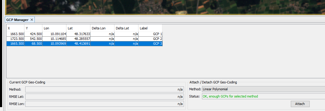
Here the GCP after attaching GCP Geo-Coding without a click on the table:
And Here after clicking on the GCP 1 and GCP 3 in the table afterwards. X and Y coordinates change to something totally different and don’t make any sense. This is confusing my students a lot!
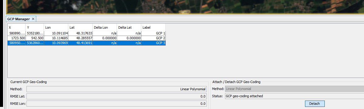
I hope this problem can be fixed, because my students have to use the X and Y coordinates to calculate the RMSE of their Geo Coding afterwards and several students had problems with the unintuitive change of values.
Best regards,
Geo