I am processing S1-A/B data covering the Ross Sea area in Antarctica. My processing graph is simple (see attached graph file) - the workflow is as follows:
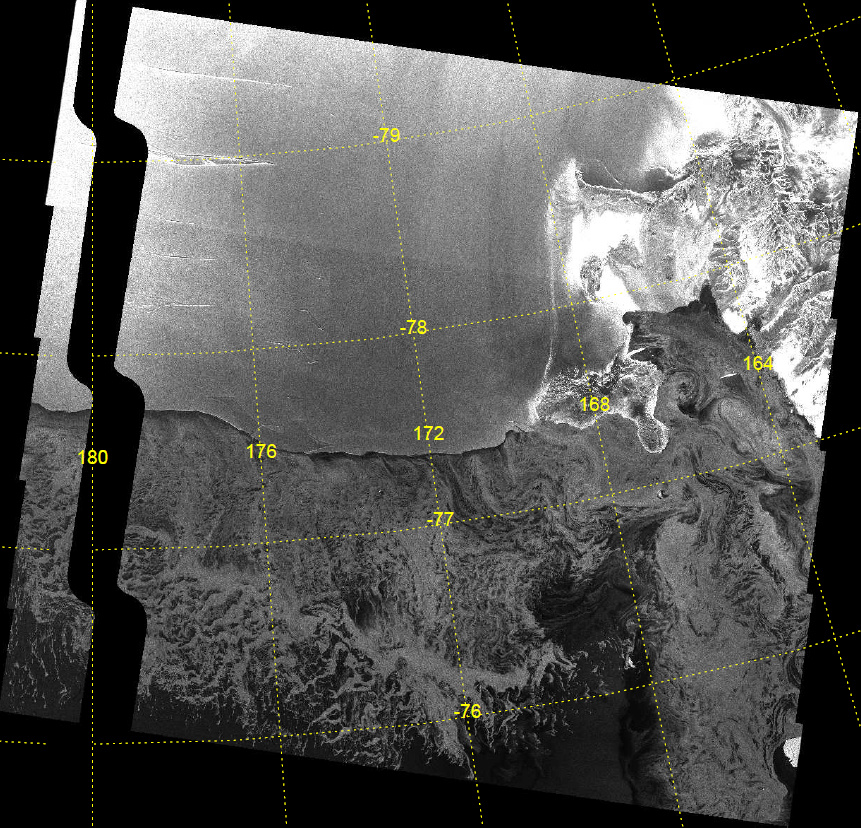
I am using a standard polar stereographic projection. The resulting images have an obvious fault along the 180deg longitude line - a ribbon of missing (zero) data. For example
The raw S1 data does not have this fault. So it appears to be the terrain-correction process that is introducing the error. I have tested this in snap versions 7.0 and 8.0.
Any help in resolving this problem would be gratefully appreciated.
Which DEM is used for the terrain correction? Maybe the gap is introduced by its resampling (you could try nearest neighbor)?
Is the “mask areas without elevation” option unchecked?
You have to wait for the next release. Or if your SNAP is built from source, you can update your source code and build SNAP again. The fix should be there.
Unfortunately, it seems the bug over the Ross Sea appeared again in SNAP Version 9.0.6.
I am processing Sentinel-1A/B data over the Ross ice shelf but the Terrain Correction with the Copernicus DEM 30 m to polar stereographic projection (EPSG 3031) fails with the error: java.lang.ArrayIndexOutOfBoundsExceptionFailed to read the data: level=0, region=[x=0, y=512, width=512, height=512]. due to java.io.IOException: closed. In contrast, it does work when projecting to Geographic Lat/Lon WGS84.
I tested on single and dual polarized data on Windows (16 GB RAM) and Linux (125 GB RAM):
S1B_EW_GRDM_1SSH_20170516T110027_20170516T110132_005622_009D90_52A4.zip
S1A_EW_GRDM_1SDH_20230927T112618_20230927T112722_050512_061574_A08A.zip
For simplicity, I only used Read → Apply Orbit File → Terrain-Correction → Write TC.xml (4.4 KB)
Any help to solve this problem is highly appreciated.