There is an error in Terrain Correction step with PAZ ScanSAR SSC with multiple strips.
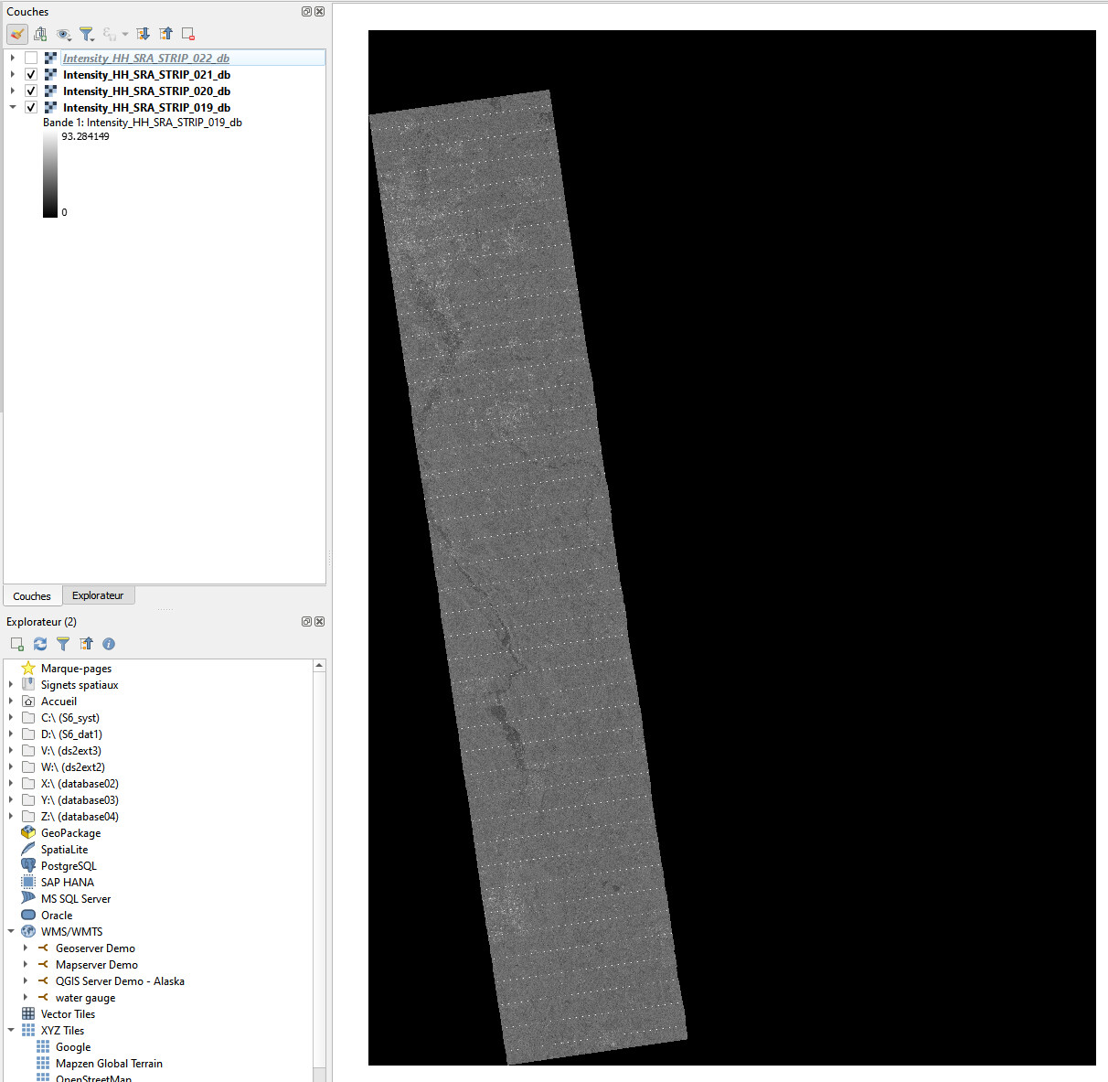
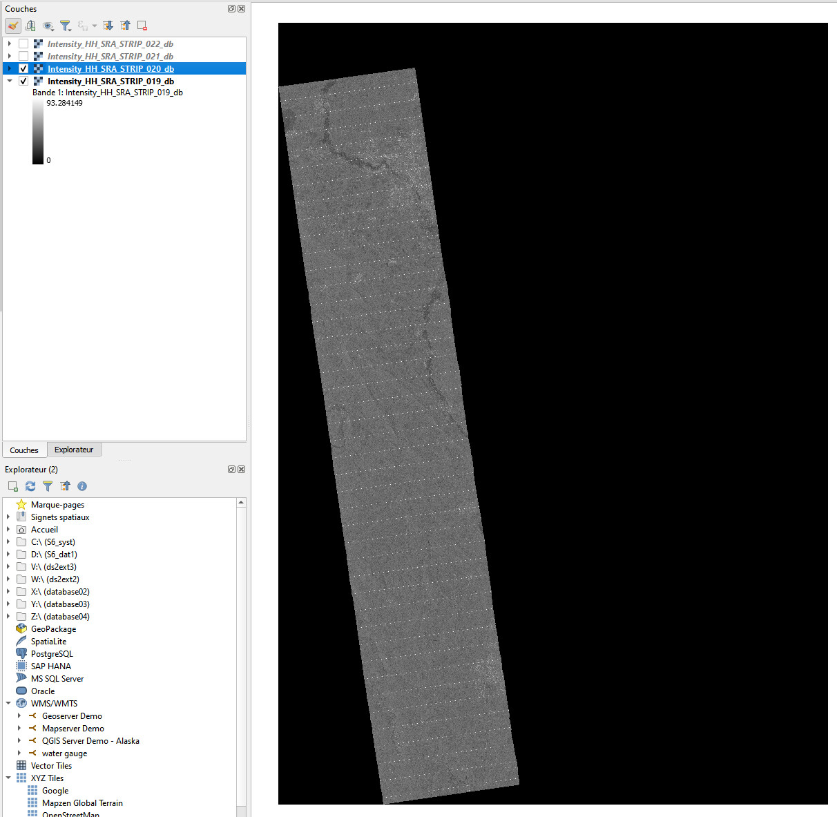
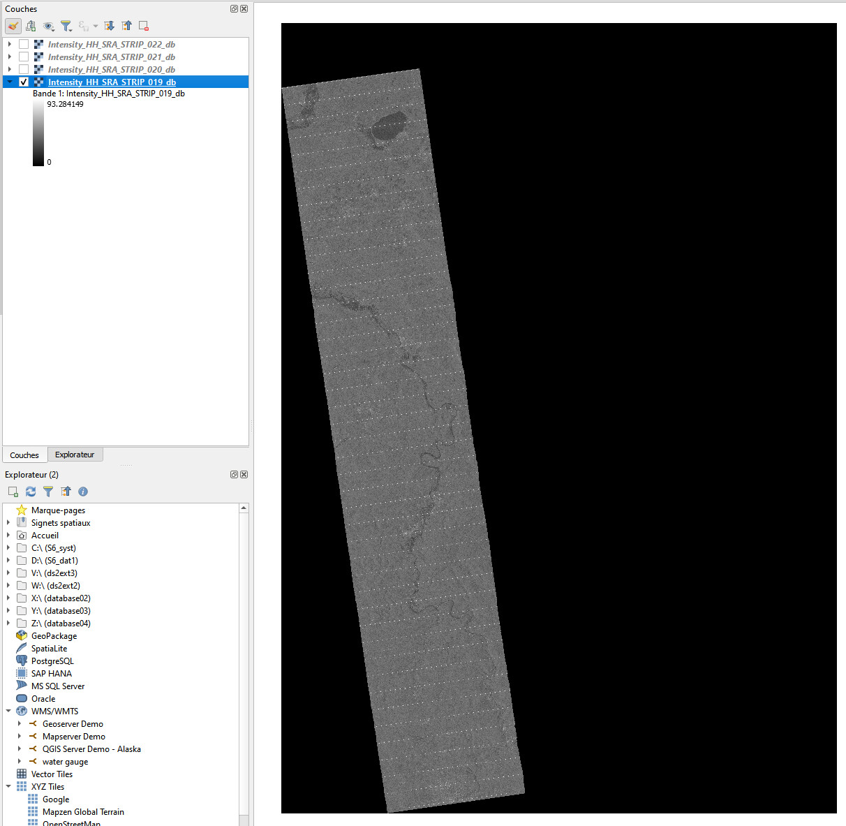
SNAP is able to orthorectify each strips, but in different .img files (with BEAM-DIMAP driver).
The only possible solution I can think about now is to manually merge the .img files post-orthorectification using a GIS software that supports raster data, ensuring the georeferencing aligns.
Yes this is what I want to do
However, as the strips are not correctly georeferenced (they are all overlapping, as if only the first strip georef was applied to all), this cannot be done (the ortho is false)…
Hmmm. Then have you tried using a different tool within SNAP, or perhaps a script, for batch processing? This might enable you to apply a uniform georeferencing across all strips.
Also, I’d suggest to check the metadata of each strip to ensure there’s no inconsistency leading to this overlap? Sometimes, a slight discrepancy in metadata can result in significant alignment issues.
There are the same (or related) issues with multi-swath CSG (see here).
This is a SNAP bug for sure.
With ENVI, this products has been successfully orthorectified.
We have looked into the issue. Unfortunately SNAP currently does not support burst data for PAZ and we will develop new operators in future to fully support the PAZ product.
In the meantime, if you could log this issue (maybe during the computation ?). This would help greatly users to know there will be issues with the computation