EU DEM v1.1 in interferogram creation

Dear colleagues,
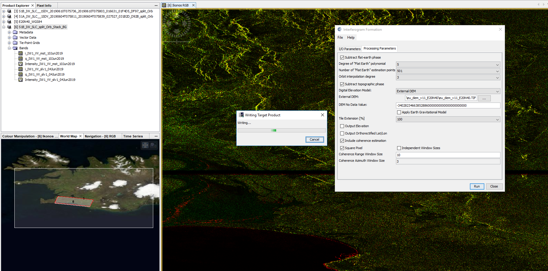
I would like to ask if someone had success with using EU DEM as provided by CLMS
link - https://land.copernicus.eu/imagery-in-situ/eu-dem. I downloaded a tile and transformed it
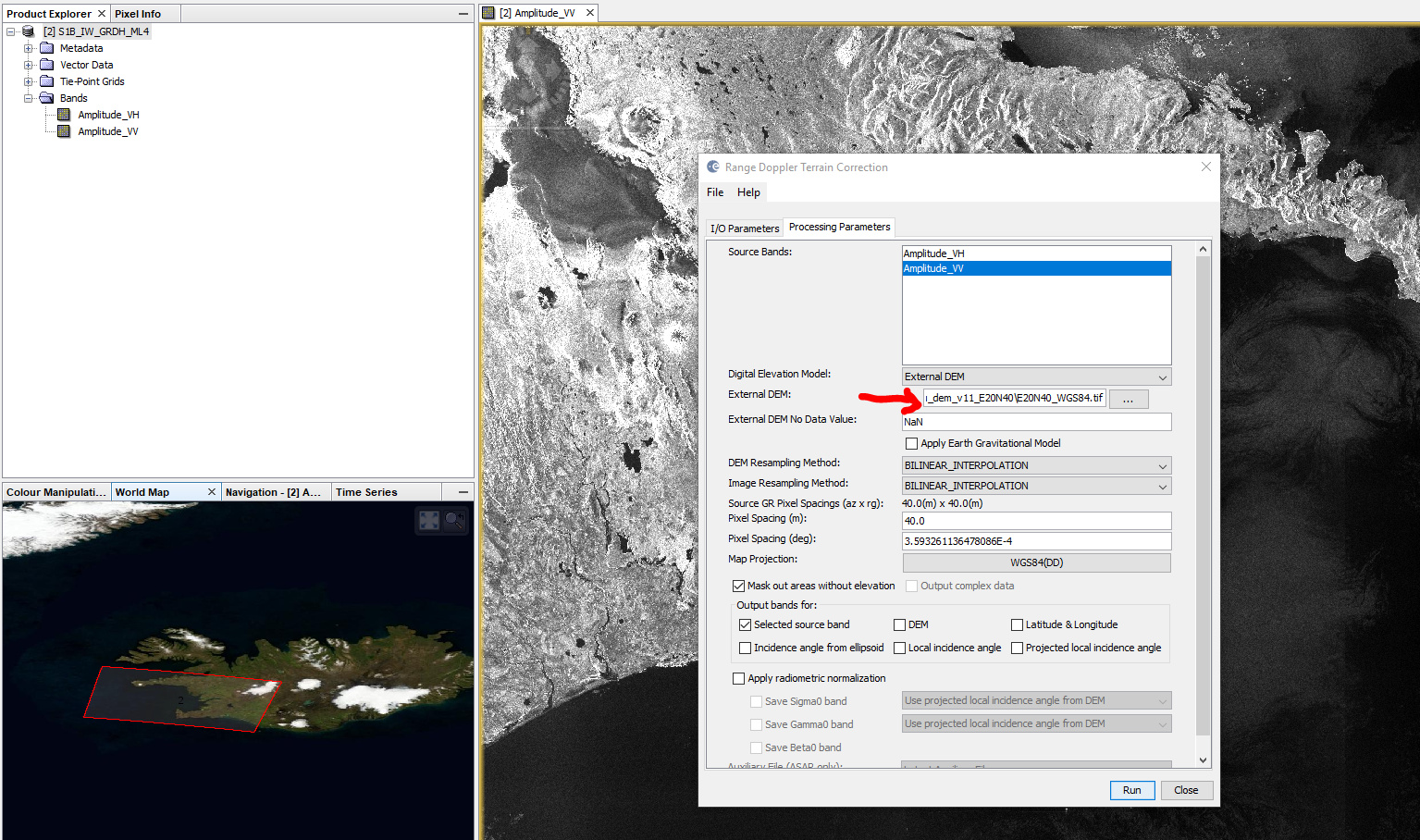
into WGS84, but when I tried it into SNAP as external DEM it resulted in several error messages
such as “Java heap error”. I was challenged to test this since this DEM provides real ASL heights
and the sea has “no data” values.

Could you advise, please.

I can’t tell about the other error messages, but this oen is purely memory-related. As the tiles are quite large (up to 5GB), did you create a subset before using them as input in SNAP?

I downloaded a part of the DEM and projected it to WSG84. Then I used it to terrain correct a Sentinel-1 image and it worked well

Are you sure the reprojection was correct? You can open the tif in SNAP and check its geocoding with this tool grafik

@ABraun I can’t believe the error is memory related - the PC I use has 48GB RAM
Thank you for the suggestion to check with SNAP - I did it only in QGIS.
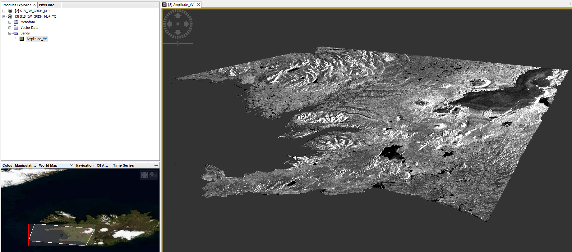
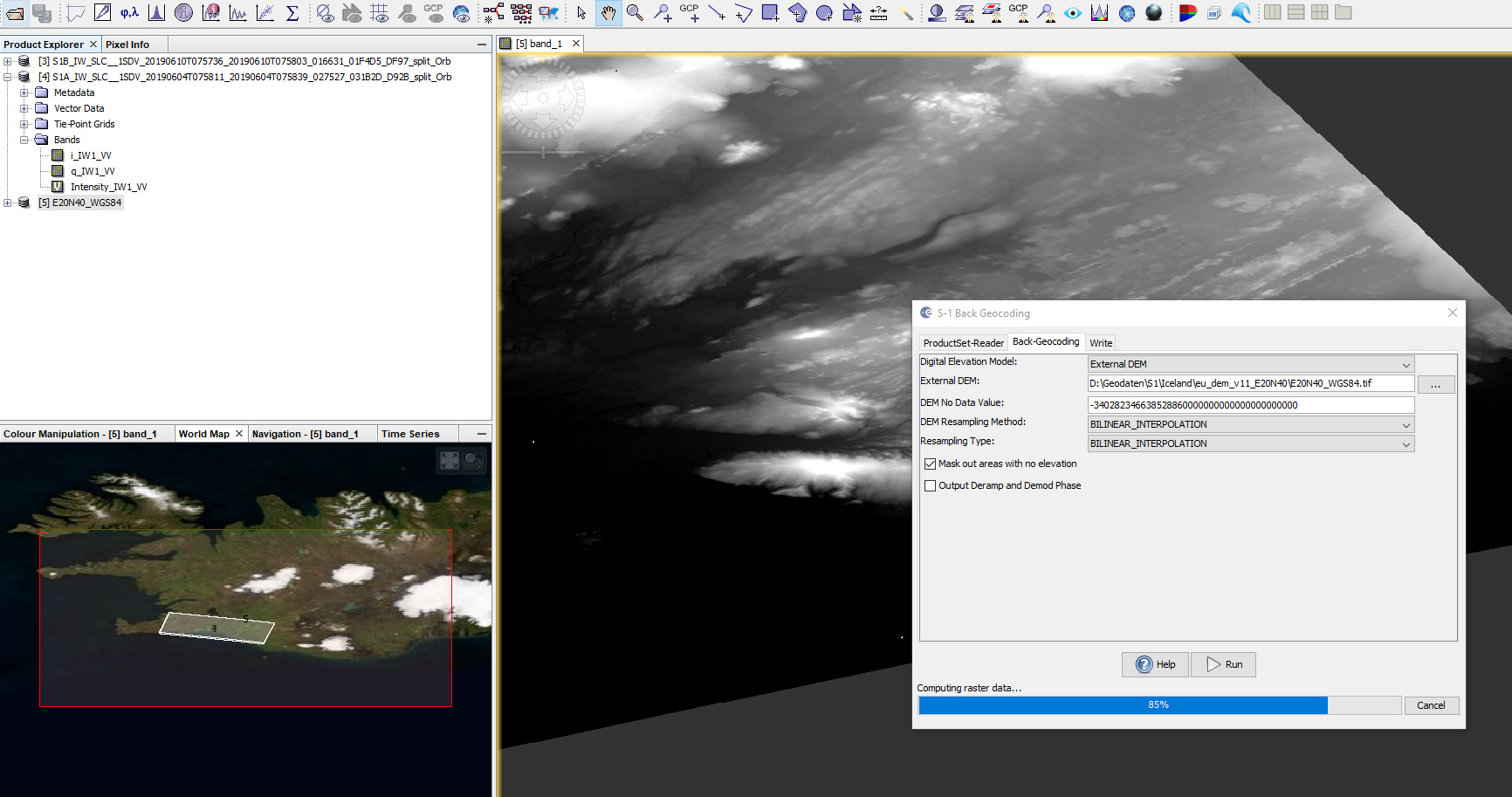
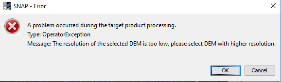
What I see you tried with GRD data while my intention is to use the DEM in interferometric processing.
But I will try it anyway.

Thank you for your support.

I have 64Go of RAM and occasionally fall into “java heap space” errors. Especially using reprojection tools.

I did not investigate how this specific part of code is written, but reprojection can sometimes be a huge RAM magnet.

1 Like

I noticed that it takes considerably longer when “re-project tie-point grids” is checked. In case of simple DEMs into WGS84 this can be neglected. Doesn’t help regarding this topic, but still wanted to share.

1 Like

@qglaude @ABraun Thank you for your remarks. I hope this will be kind of recommendation for SNAP team - to have EU DEM as option in terrain correction.

Imported DEM file into SNAP

The projection is as expected - WGS84

good to know, thanks

I now also tested InSAR capabilities of external DEMs from Copernicus

I applied

  1. Split
  2. Orbit
  3. Back Geocoding (including EU DEM v1.1) as GeoTiff projected to WGS84, see image #1)
  4. Interferogram genereation (including topographic phase removal with the same DEM, see image #2)
  5. Deburst (here I get the message below, image #3, because the resolution is too low, I resampled it to 10 meters and used the new DEM, image #4)
  6. Multi-Looking
  7. Terrain Correction (again, with the DEM, image #5 and #6)


grafik


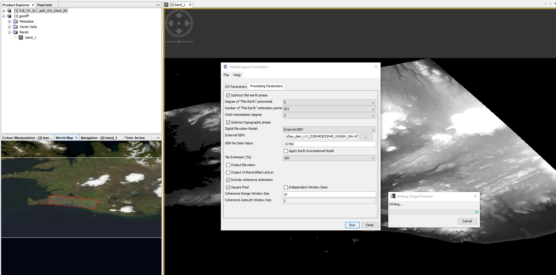
I made subset from the DEM file - about 1/4 of the on I started with - but still have “Java heap space” error.
I will try with smaller size of the DEM file.

Thank you for your commitment for resolving this issue.