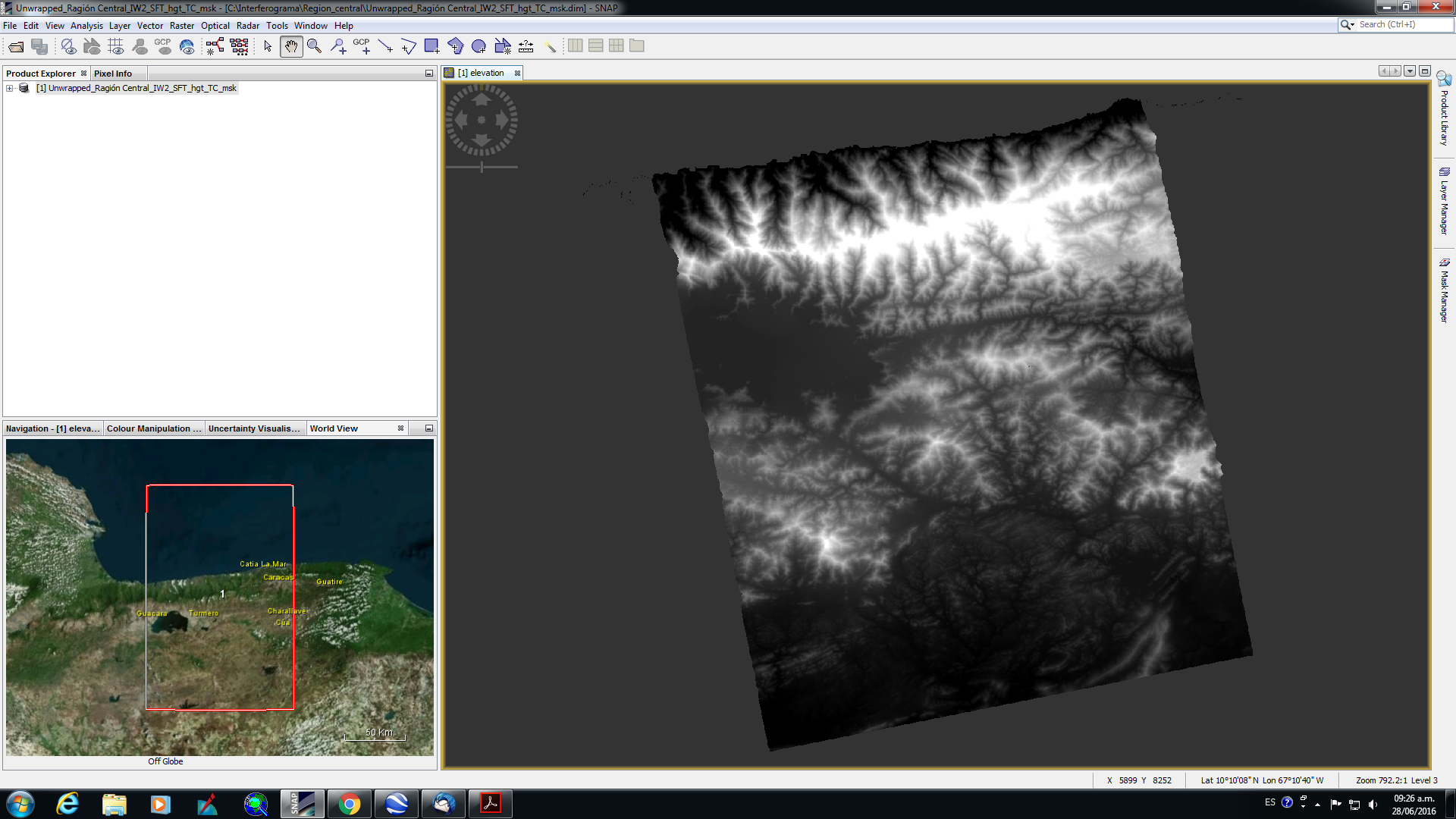
Hi all, I want to export the DEM for others formats. I did the exportation to .tiff but this don’t reads in others softwares.
The values of heigt shown are in 8 bit when I did the exportation.
Please help me with this!!!
Hi all, I want to export the DEM for others formats. I did the exportation to .tiff but this don’t reads in others softwares.
The values of heigt shown are in 8 bit when I did the exportation.
Please help me with this!!!
if the output type is different from the required you could chose
Raster > Convert Data Type > float32 and select GeoTiff as output format, no scaling, just truncate. I would assume that this works.
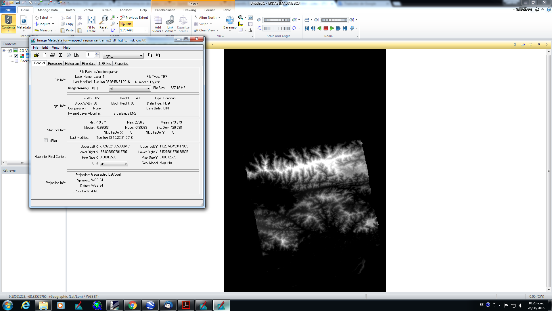
Hi ABraun thanks for your reply!!!
I did that you sayd me, but yet I have an black frame. You know as delete this???
The values of heigt shown are correct!!!
the black frame ist just ‘empty’ raster space. You would need to define this one value as NoData. As your screenshot is from ERDAS you would need to open the image metadata > Edit > Set/Clear NoData Value
Hi all
After of generated an DEM, how I can to adjust the height from relative value to absolute value with SNAP? I want to compare this with SRTM, but I need absolute values!
Thanks for advance
did you try Phase to height and/or Phase to elevation?
Hi ABraun
Yes, I did, but I want to correct the height with datas of GNSS!
do you have a few control points?
Then calculate the distance at each point to the corresponding dem, make a plane out of the distance and then use this plane to correct your elevation data.
Please, could you give me more details about I how make a plane out of the distance?
Thanks for advance ABraun
I’d use basic interpolation to derive a surface wich describes the difference between your measurements and the SAR elevations over the full area.
You can then substract this raster from your SAR values in order to correct them correspondingly.
ok ABraun, I will try this!
Thanks
the result strongly depends on the number of your control points and the interpolation method.
I’d suggest a TIN (linear interpolation).
I know, I will go try! 
Thanks again
too bad that the one at bottom left is outside. Maybe you can shift it up a few meters so you’ll have a reference point in this corner as well. Maybe the height isn’t excactly correct but it is surely better than no point.
Hi ABraun
I did an proposal for TanDEM-X Digital Elevation Models Announcement of Opportunity & Proposal Call from DLR, and this was approved.
Now I have MDE with 12 and 30 m resolution with accuracy minor 2 m in vertical for an area of 100000 km2, we will go to validate the DEM Sentinel 1 with this MDEs TanDEM for know its accuracy…
Do you have experience in this type of activities???
I applied for the TanDEM-X data as well but didn’t receive an answer yet.
I am however not familiar with DEM accuracy assessment.