Hi there,
maybe it is only a comprehension question, maybe a technical question - don’t know ![]()
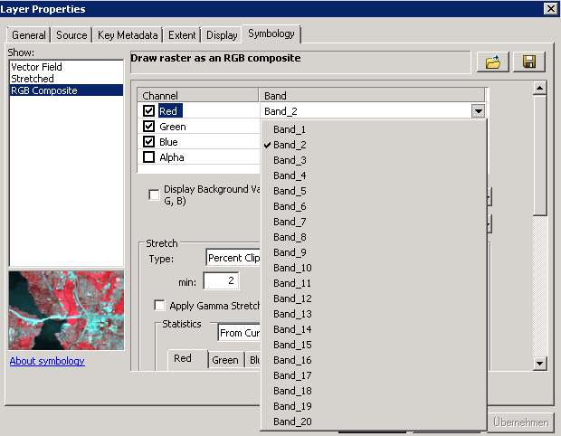
After many tries generating a Level-2A-Product I believe I did it successfully. Now I have a second product in the explorer in the snap-tool with all these single bands, again. When I export the product I get only the OPER product in the dialog to save as e.g. Geotiff. Or I can export each single band from all products. But what I want to have is an raster (e.g. tiff) with all bands. How I can realize this? Or did I have misunderstand the function and the Level-2A-Product? In my naive imagination I download the Level-1C-Product, generate a Level-2A-Procut with the Sen2Cor-PlugIn and then exported a image with all bands. Then I can use it in a GIS for further analyses. Maybe I am wrong?? Can anybody help me and explain?
Thanks in advance!!
silke
 I opened it with ArcGIS. What did I wrong?
 I have to learn more about using Satellite-data in ArcGIS.
  But do you know, why I get 20 bands for the tiff??