I am curious to know if there is a way to export NDVI maps and classified images from SNAP to overlay them on Google Earth (GE) just like we export a scene in .KMZ format to overlay it on GE.
You just need to do the same steps.
- Reproject the product to WGS84
- Open the NDVI or classified image
- and then export to KMZ
Will the classification scheme retain the Color Manipulation when one exports it to KMZ. I hope the above functionalities can also be executed via a Python script including pulling the data from the Copernicus server.
It can be done in python but there is no good API yet. It is on our roadmap to make such things better usable via API.
The images are saved as they are shown in SNAP.
Thanks for the suggestions.
Things are working seamlessly now.
I need to know how I can pull in Sentinel-2 data from Copernicus Hub with a Python script and what are libraries and command syntax one is supposed to use for performing the above operations including L-1C to L-2A conversion and KMZ generation.
regarding the python-based download, sentinelsat might be the best choice. https://pypi.org/project/sentinelsat/
2 Likes
I found this piece of code on the web. Was wondering how well this one functions wrt sentinelsat?
#Import all needed modules
import sentinelhub
import pandas as pd
import datetime
#Specify tiles, for example two in the eastern part of Austria:
tiles = [“T33UXP”,“T33UVP”]
#specify start and end date (here we use May 2017)
dateStart = “2017-05-01”
dateEnd = “2017-05-31”
#create date range
dates = pd.date_range(start=dateStart, end=dateEnd)
#loop over tiles
for tile in tiles:
print(“Downloading tile: " + tile)
#loop over dates
for date in dates:
print(str(date.date()) + " …”)
    #try if there is a product available for the selected date
    try:
        sentinelhub.download_safe_format(tile=(tile, str(date.date())), entire_product=True)
    except Exception as ex:
        template = "No image for the specified tile / date combination could be found."
        message = template.format(type(ex).__name__)
        print(message)
I can’t tell which one is better. Just try both and take the one you are more comfortable with.
I am trying to run the code given below from the following link suggested by you
from sentinelsat import SentinelAPI, read_geojson, geojson_to_wkt
api = SentinelAPI(‘user’, ‘password’)
footprint = geojson_to_wkt(read_geojson(‘search_polygon.geojson’))
products = api.query(footprint,
producttype=‘SLC’,
orbitdirection=‘ASCENDING’)
api.download_all(products)
The code gives me the following error: ImportError: No module named sentinelsat.
And the sentinelsat module seems to be already in the right place.
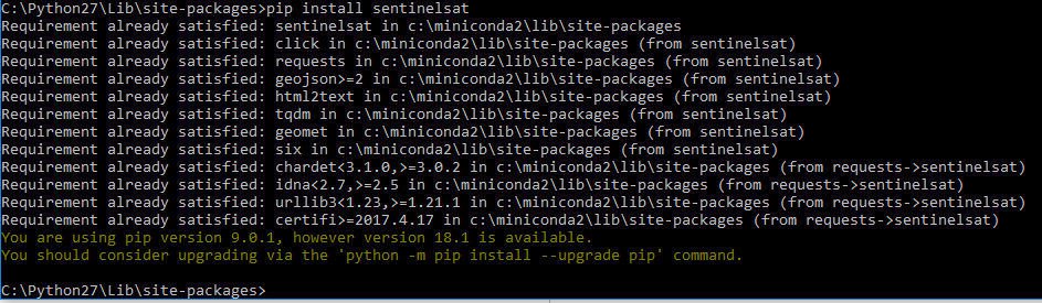
Can you please tell me what might be going wrong in executing the code.
maybe you have multiple python installations on your pc?
Try to start the one addressed by pip: c:\miniconda2\python.exe