I’m trying to export the processed images I worked on in SNAP to ArcMap as GeoTIFF or GeoTIFF/BigTIFF. When opening the new GeoTIFF product in SNAP, it looks good. When opening in ArcMap, the values are not valid. How can I export the data and maintain the pixel’s value? Is there a dedicated format for ArcMap/ ESRI?
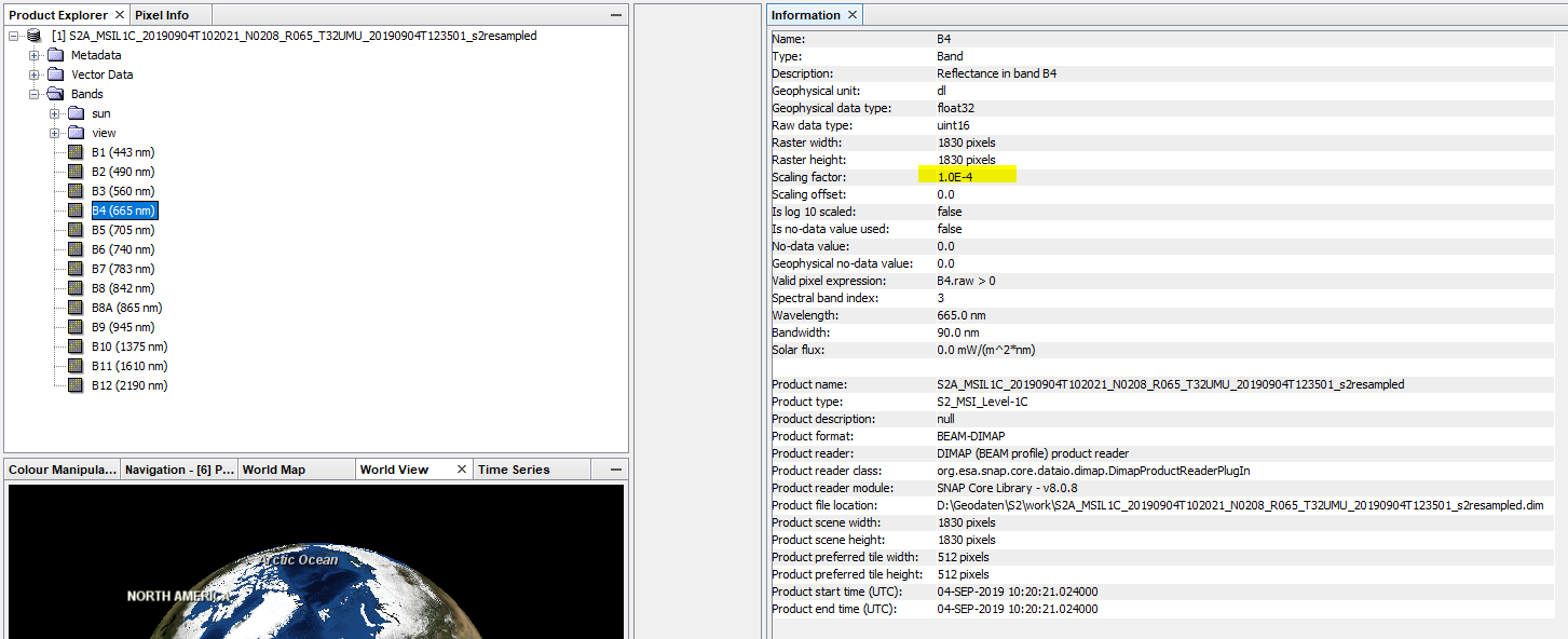
Is it because I’m working with integers?
If so, how can I change the pixels values in SNAP from int to float for all bands (except for using band math)?
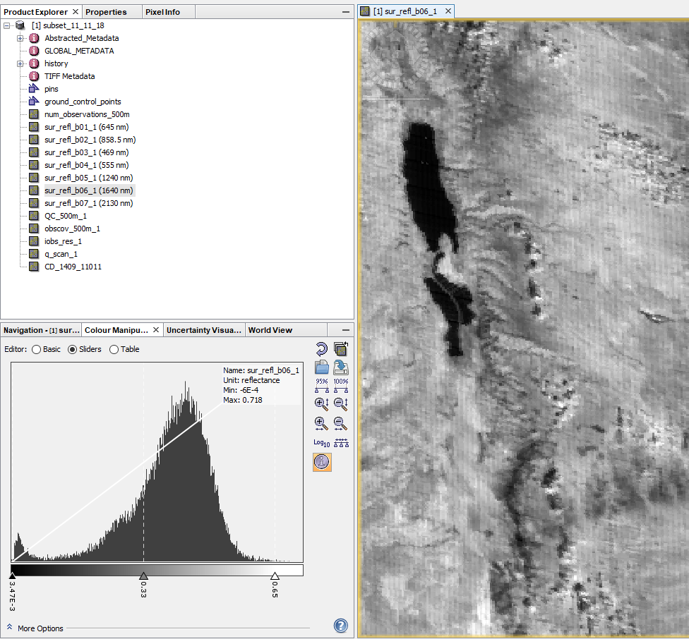
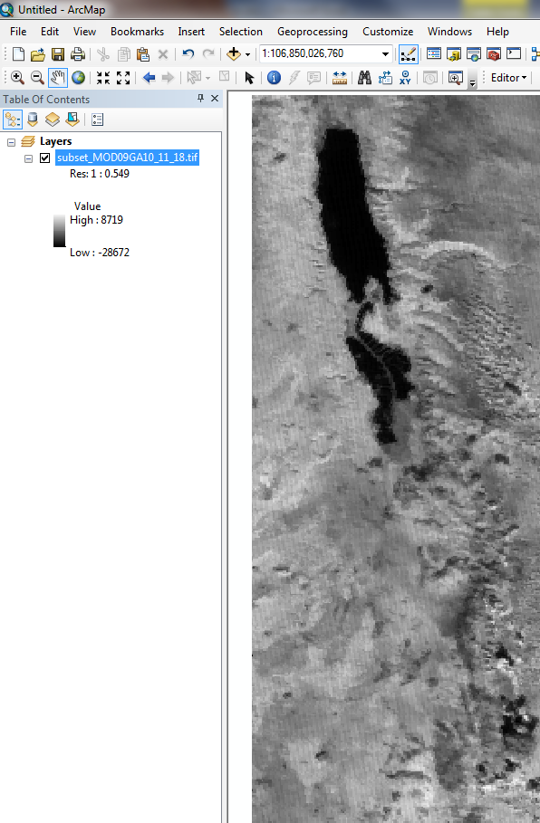
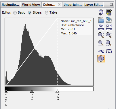
Thank you for your answer. I have looked at the tutorial, and I retried to export the raster; however, the values are still invalid. As you can see in SNAP, the values are between -0.01to 1.046 (reflectance before subsating- full image). When exporting, as shown in the tutorial (and subsating), the pixel values in ArcMap are between -28672 to 8719 (if I understand correctly, that should be between 0 to 10000 how can I have -28672?). What i’m doing wrong and how can I fix this?