Hello Forum, I am facing a strange behavior of the ‘Export View as Image’ function.
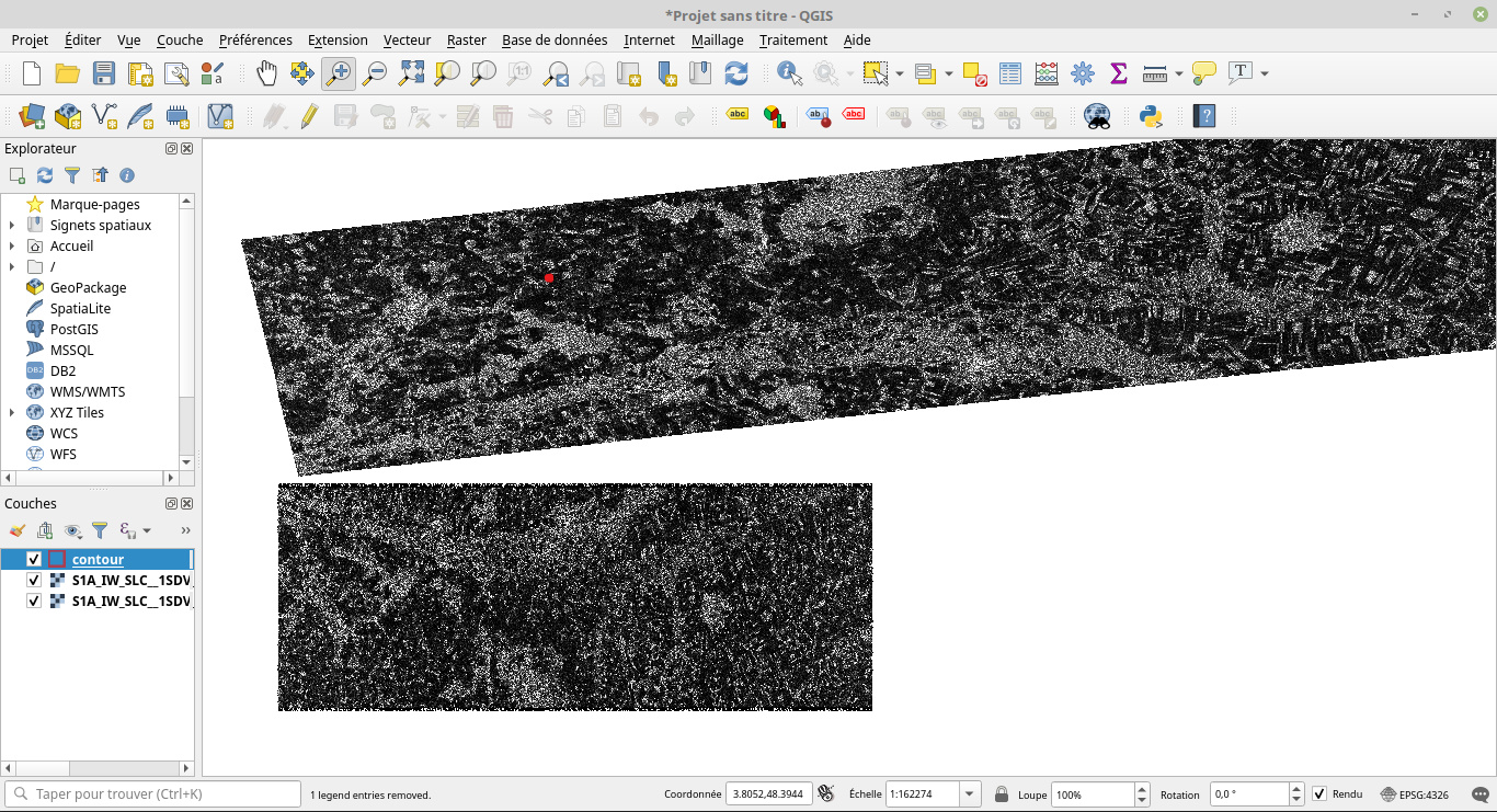
I have exported two views of the same burst in GeoTiff type: the first is obtained after ‘TOPS SPlit’ and ‘Apply Orbit File’ functions and the second one is the same after, in addition, ‘deburst’ and ‘Range Doppler Terrain Correction’ functions.
What is strange is that the second image is correctly located in QGIS while the first one is located more or less 75 km far from the correct image.
Do you have any idea to explain this ? Thank you in advance!
Capture du 2020-02-07 09-32-56|690x374
the data is geocoded during the Range Doppler Terrain Correction. That means, it is projected into a coordinate reference system. This coordinate information is not present after Split and Apply Orbit File yet, so it is put on a wrong location (also not rotated correctly).
Thank you for your answer. Happy to see that it’s normal.