I have been trying to use external DEM for topographic phase removal for my study area in Antarctica. There are some problems that I have come across, which I wish to report. Someone could also correct me if I did something wrong, please.
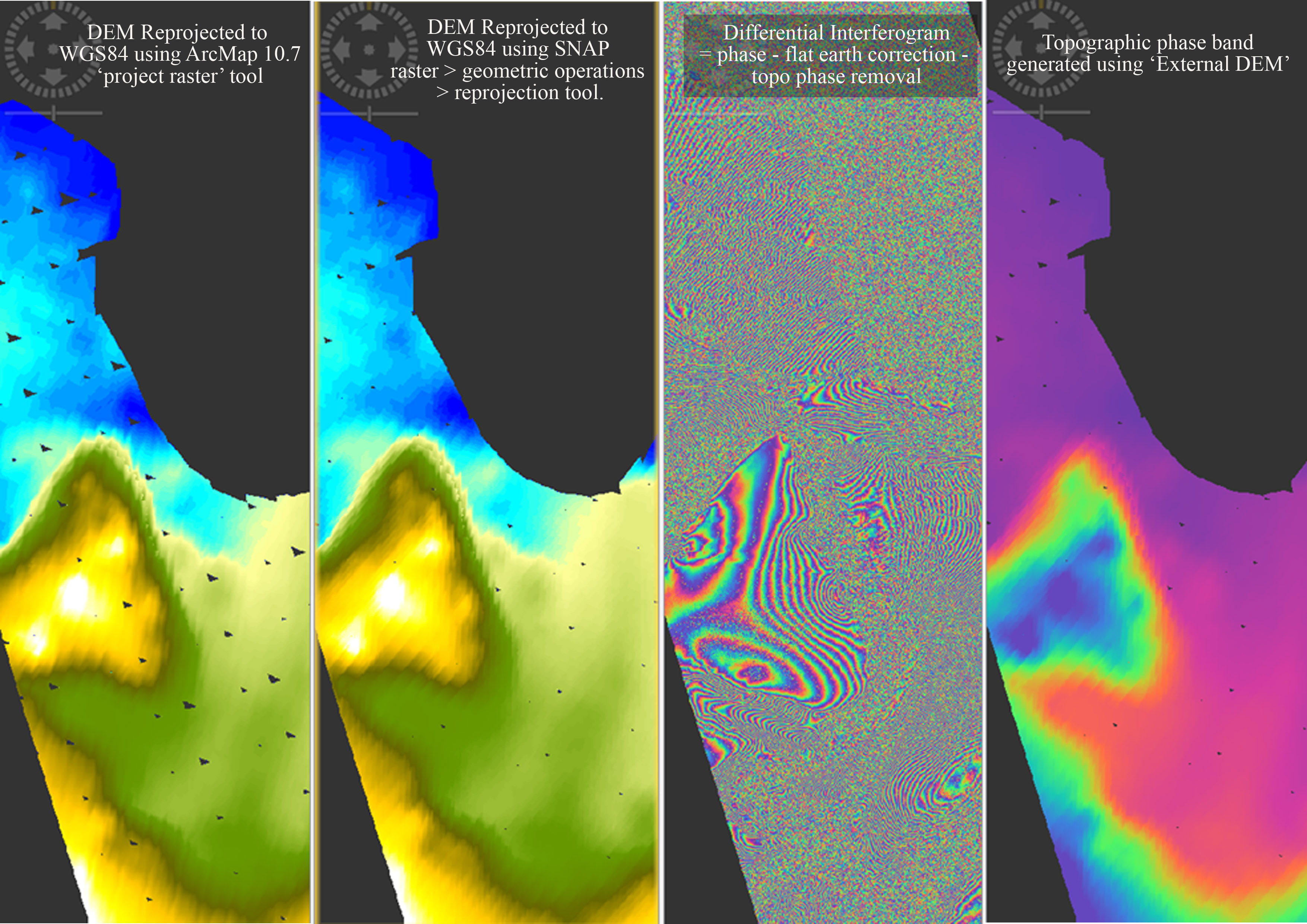
Steps followed: TOPS Split > orbital correction > ESD > backgeocoding > Interferogram generation > deburst > topographic phase removal > phase filteration > geometric terrain correction. In this process, External DEM was used only to eliminate the topographic phase. In other steps where ever DEM is required, ACE30 (AutoDownload) option was preferred. Attached image shows the outputs, which are explained as follows
1 - External DEM reprojected to WGS84 in Geographic Lat/Long coordinates using ArcMap tool - ‘project raster’. (This image is output elevation band after Topographic phase correction. Input was checked and was found to be okay).
2 - External DEM reprojected to WGS84 using SNAP’s tool: raster > geometric operations > reprojection. (This image is output elevation band after Topographic phase correction. Input was checked and was found to be okay).
PROBLEM = Visible voids / data gaps in the elevation band. The same has propagated to ‘Topographic phase’ (image 4). Further propagated to differential interferogram (although not visible in the image shown here).
External DEMs used
- REMA (200m) filled DEM for Antarctica
- Bedmap-Surface (1km) DEM for Antarctica
Both DEMs behaved in a similar way, unfortunately.
QGIS reprojection tool was also used, to end up with the same problem again. What could be the problem?