Hi there,
I preprocessed sentinel-1 images and now want to extract the incidence angle to include in a model as seperate parameter. The minimum and maximum incidence angle range from 30.06 (near) to 45.83 (far). I found online that this relation is linear in degrees from near to far.
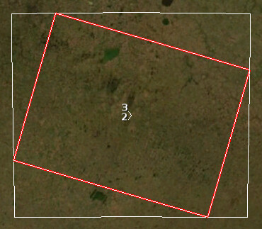
Now, the problem is that the image is already snapped with the preprocessing. I’m trying to find if something in the metadata describes the original coordinates like for example an angle. This would save a lot of time unzipping everything again and I am also not sure if preprocessing steps influenced the incidence angle (like applying DEM?).
Thanks!
For S1 products, indication of incidence angle is provided for each dataset in the annotation files, inter alia in the geolocation grid.
For instance
<geolocationGrid>
    <geolocationGridPointList count="1260">
      <geolocationGridPoint>
        <azimuthTime>2020-10-13T04:55:12.055170</azimuthTime>
        <slantRangeTime>5.340505540342646e-03</slantRangeTime>
        <line>0</line>
        <pixel>0</pixel>
        <latitude>4.367319439986660e+01</latitude>
        <longitude>1.973460801203622e+01</longitude>
        <height>8.959532699687406e+02</height>
        <incidenceAngle>3.057676597156424e+01</incidenceAngle>
        <elevationAngle>2.727472371778668e+01</elevationAngle>
      </geolocationGridPoint>
This gives a set of points as line/pixel location in the image, and latitude/longitude/height on the ground, considering a low resolution DEM used for the processing of level 1 product.
From there, it is possible to interpolate the incidence angle at any point.
Here is a comparison of incidence angle annotated over range line vs a linear variation between near and far for a GRD product. The variations of incidence angle are close to linear, but not exactly linear.
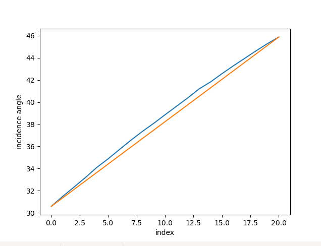
This is for the native Sentinel-1 products.
However, this does take into account the pre-processing steps applied with SNAP.
Using another DEM (finer DEM) will provide different incidence angle.
Performing an ortho rectification will as well change the shape of the image, etc
2 Likes
Thanks for your reply! For now I used the near and far incidence angle and assumed linear relation. I used the map of the original product (before snapping to new coordinate system). I think your approach would be better.
For example, if you want to know the incidence angle of a specific point, would you find the geolocationgridpoint closest to this point? And use that incidence angle?
It depends on the accuracy you require (is it just to tabulate incidence angle ranges, or get the exact incidence angle ?)
If you need to tabulate somehow, it may be sufficient to get the incidence angle of the closest grid point.
If you need to get the incidence angle for a given point you should interpolate between the geolocation grid point.
If you need an even more precise incidence angle taking into account the local variation of terrain slope, then you should either compute it considering the location of the instrument during the acquisition, and the geometry of the surface using a DEM… or have a look to orthorectification.
1 Like
Thanks this makes sense. I think a next step in a new iteration would be to interpolate between geolocation grid points. But it will be trial and error how accurate the incidence angle should be for the model.
It depends on your need of accuracy.
The variations of incidence angle in range being very smooth in range, and globally non existent in azimuth, on my side, a B-Spline interpolation is more than sufficient for my applications.
https://docs.scipy.org/doc/scipy/reference/generated/scipy.interpolate.bisplrep.html
1 Like