I am very new to InSAR, but I can tell that something is wrong with my interferogram. Here are the steps that I took with my two Sentinel-1 datasets:
Used S-1 TOPS Split to select the bursts I need.
Used the Apply Orbit File operator.
POD was only available for one image, the other image used restituted orbits)
Used S-1 Back Geocoding operator to coregister the two split products based on the orbit information
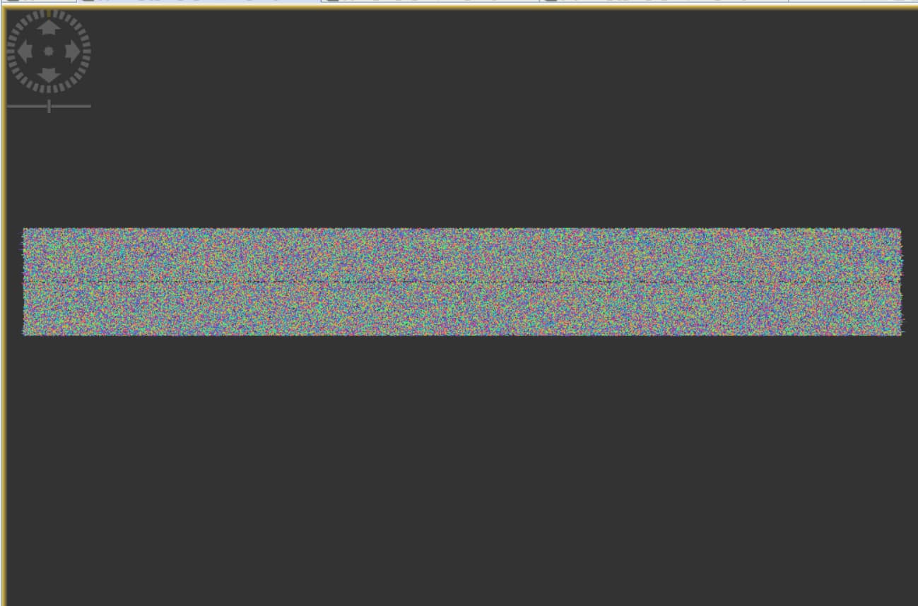
Finally, I used the Interferogram Formation operator, which gave me results that appear to have failed.
Does anyone have suggestions on what could have gone wrong/any steps I need to add to produce a more accurate interferogram with my two Sentinel-1 datasets?
This is way too long for single-pair interferometry. Please consider that any movement at the ground (e.g vegetation, water, crop growth, urban development…) leads to decorrelation of the phase. To get a clear interferogram with nice fringes you need