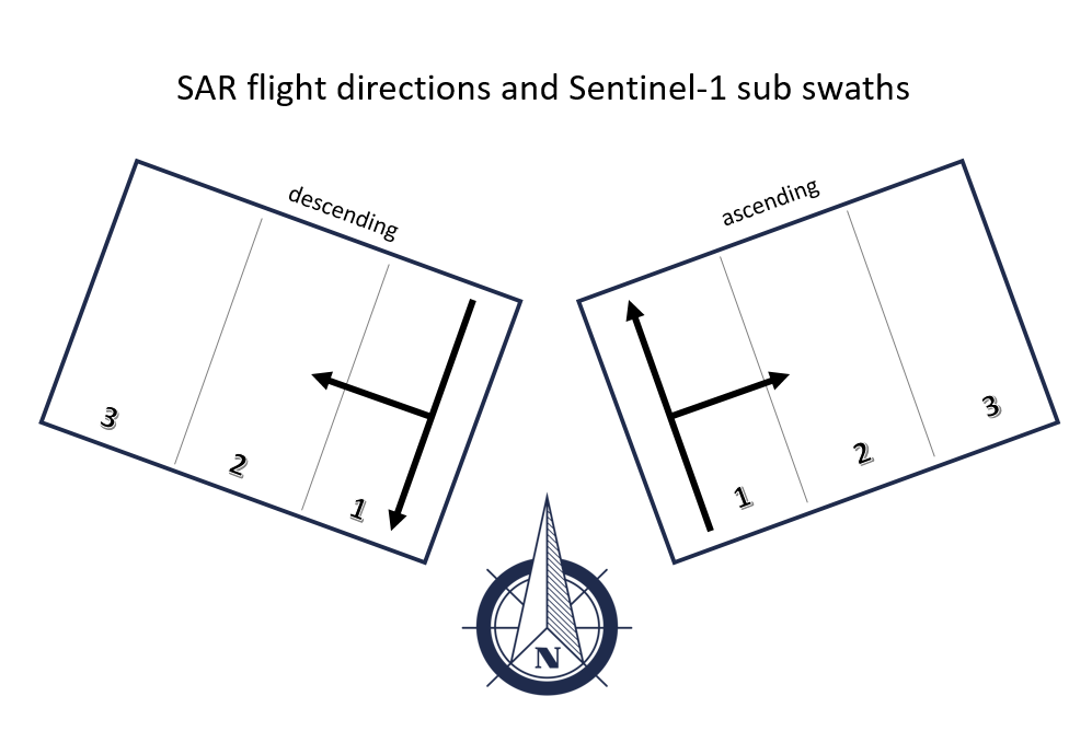
Sir i have downloaded the SAR data from scihub, now i dont remember either the data is ascending or descending path, now how can i check it??

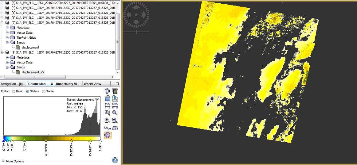
the product is of descending path, and what is -1E-6 value for the displacement. and kindly gave me an easy way of displacement change into cm from meters
this is the scientific notation for -0.000001 (basically 0)
1 meter is 100 centimeters. Not much to convert ![]()
Sir may i have your personal email? i need to share out put results and wanna to discus with you.
I’m afraid I cannot give private consultation, sorry. You can share your ideas here and collect more people’s opinions.
Sir, i have processed both ascending and descending data. in the descending the displacement is -0.162 and the same area and same date data of ascending shows the displacement about -0.087 kindly tell me that what is the displacement of the area that i can write in my project or thesis. thank you
they can be both correct because they describe the subsidence along the line of sight.
1 Like
now how can i describe that what is the subsidence? and what is line of sight?
I think, you should have a look at some basics first. Otherwise you generate results without knowing about their meaning. Also dealing with uncertainties is impossible if you don’t know them.
2 Likes
kindly, explain it little bit. thank you
let me clear that can we call this process InSAR time series?
Hello
the coregistration is’t successful.it is red,how to resolve this?
please help me
thank you in advance
increase the number of GCPs, maybe also apply coarse registration.
thank you for your kind.i have slc-iw data and i apply coregistration from radar==> coregistration==>s1tops coregistration
how can I increase the number of GCPs?
sorry, I didn’t know that you were working with S1 IW data, here it is different. You can select SRTM 1 Sec (AutoDownload) in the BackGeocoding and run again. Also make sure that you reduce the number of bursts to the smallest coverage possible.
If you want to check at which step the slave image was lost, you can also perform the steps for coregistration separately as described in this tutorial: http://step.esa.int/docs/tutorials/S1TBX%20TOPSAR%20Interferometry%20with%20Sentinel-1%20Tutorial_v2.pdf
thank you very much for your kind.
Pardon me, kind of basic question
Do the Same satellite may revisit the same area once in an ascending orbit and another time in a descending orbit ? Or are there two SAR satellites of the same type but designed with opposite orbital trajectory?