Does anyone know if it is possible to extract information about the swath number and the burst ids that intersect with a polygon (AOI) without loading the scene to SNAP and manually checking it?
The input would be a raw SLC scene and AOI vector. The output - just a string like e.g. ‘IW1, 6, 7’. (here, IW1 - swath; 6 - firstBurstIndex, 7 - lastBurstIndex).
I have several polygons distributed worldwide and I would like to keep only a split subset of the SLC scene and delete the original files. For that I need to automate the process of splitting using ‘S-1 TOPS Split’. This is due to the storage space issues.
Enter the SLC scene ID and input your Copernicus Scihub username/password and you can view or download the GeoJSON file which allows you to use the SLC bursts in common GIS software.
I have plans to implement what you are trying to do but I have been busy. If you are familiar with Python and the geopandas library it’s kind of a quick thing to implement.
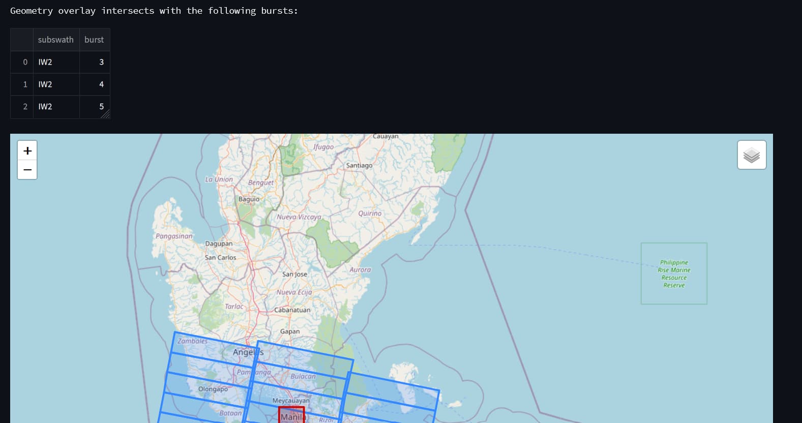
Hi, I’ve updated the app so that you can check the intersecting bursts and subswaths. You need to specify the polygon in WKT format which you can get from here: https://geojson.io
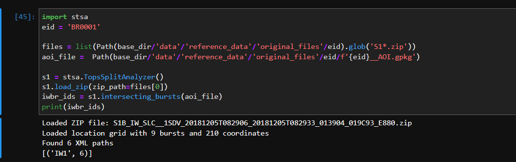
Or if you are familiar with Python you can just use stsa.intersecting_bursts() method. More documentation on the github repo.
Hello, I am new to the STEP forum, this post looks similar to the question I have, tough is not the same. In S1 released MPC test datasets all bursts of IW products are given by their serial ID from 1 to 375887. How do I relate this numbering to S1 burst “internal” numbering from 1 to 9 required by TOPSAR Split function?
Thank you very much for any help!
Massimo
Those two numbers are not related. The burst ID is an absolute identifier, while the one used in TOPSAR split refers to the numbering of bursts within a slice. S-1 data takes are cut into slices to limit the size of the resulting data products. This latter process is not fully pre-defined in space so the slice boundaries vary.
I think you are wrong, according to S1 documentation: “Sentinel-1 performs systematic acquisition of bursts in both IW and EW modes. The bursts overlap almost perfectly between different passes and are always located at the same place. With the deployment of the SAR processor S1-IPF 3.4, a new element has been added to the products annotations: the Burst ID, which should help the end user to identify a burst area of interest and facilitate searches.”
I think I have figured it out how the relation between absolute identifier and slice identifier works, which should be (target id) - (first id of the orbit) modulo 9, but please let someone who knows for sure to eventually confirm.