I need to extract the footprint of Sentinel-2 imagery (potentially S1 and S3 but not now). So far, I have been deriving this taking into account the projection of the product but I wonder if:
this information can be obtained BEFORE downloading the image
this information is accesible in the metadata of the product once it is downloaded
I wonder if SNAP derives the information for the World Map tool or if it is stored somewhere in the metadata of a S2 product as a polygon or something similar. So far, I have seen
in fact, for Sentinel-2 it should be quite easy since the products are released using specific tiles. So, you can see where is the tile (that you can find in the product name) using the tiling grid in kml format for example: https://sentinel.esa.int/web/sentinel/missions/sentinel-2/data-products
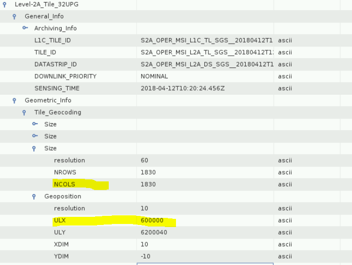
On the other hand, you can also use the granule metadata inside the product (MTD_TL.xml). You can find there the UTM zone and the upper left coordinates (as you show in the image) and using the number of pixels and the pixel size (that are always the same) you can calculate the other coordinates of the footprint.
Another option could be to use the detector footprint masks that are available inside the QI_DATA folder. Perhaps this option is more useful if you need the “true” footprint, since some times the products have only data in a region of the tile.