I need to remove the phase noise belong to topography so what remain is volume decorrelation. (I tested both of topo removal and without topo removal but I still have problem).
My DEM contain ground elevation.
I also check the box of EGM in topo removal but the results are frustrating.
I see. If the DEM used for the removal of topographic phase is ground elevation, theoretically all other phase variation is resulting from the objects on the ground.
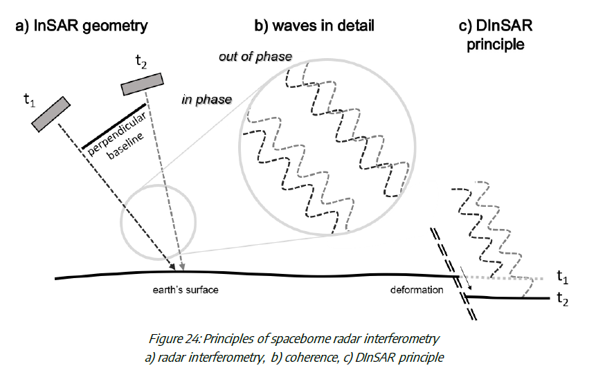
Volume decorrelation means that the phase information is no longer correct because the master of slave are out-of-phase. Accordingly, using phase information to retrieve foret height from a single image pair is not always possible, because the canopies constantly move.
I know my question is boring but I confuse always. When we compute an interferogram in SNAP, we have real part (q), imaginary part (i), coherency and phase.
Is the coherency magnitude of i and q?
Is the phase arctan i and q?
So, when we speak about coherency as a complex number with magnitude from 0 to 1 and angle as a phase, is it similar to what we obtain as a coherency and phase in SNAP?
how I can compute coherence as a complex number in matlab using phase and coherence that we obtained in interferogram generation step in SNAP?