Hi,
I use HH-TDM-X data for forest height estimation. I did bellow processing:
Interferogram formation with flat earth removal (I ignored topography phase removal because I thought it is applied in deformation process only. Is it true?)
Multilooking
Phase unwrapping using snaphu plugin in SNAP (I used statistical-cost mode of TOPO. Is it true?)
Phase to height
Terrain correction
Finally my height map looks illogical with values of about -279, -378 etc. meter.
What are Wrongs? I couldn’t use from Cygwin in Unwrapping.
Please help me.
Best regards
I haven’t heard about such approach to be used for the purpose mentioned.
The forests are highly incoherent so I guess the interferogram shall not be a good estimate.
Phase to height does not produce absolute heights, but simply converts the unwrapped radians to meters. But this requires that the phase is usable over the forest area. This is mostly not the case because of rapid decorrelation of the forest canopy.
You can plot a profile across the forest area to check if the height profile is feasible.
this is tricky. If you use a DEM to remove the topographic phase, you potentially remove some forest height as well (because it is partly contained in SRTM data, for example). On the other hand, unwrapping is less prone to errors when topographic phase is removed.
It’s not so easy to extract forest heights from single bistatic image pairs…
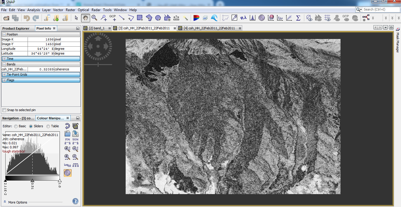
Could you please show a screenshot of your coherence scaled between 0 and 1?
I could imagine that unwrapping this area leads to many unwanted ramps and noise-induced errors. Especially the forest areas will have low phase quality, despite of the bistatic data.
Would you mind sharing the interferogram, wrapped and unwrapped, too?
Most studies dealing with forest height and TanDEM-X data make use of polarimetric information (here
and here), coherence (here and here), or larger time series of TDX (here and here)
I am not convinced that it is possible with a single image pair.
The coherence estimation window is probaly too small - remember that the estimator is biased quite badly at low cohrence values when the window is small.
Hi,
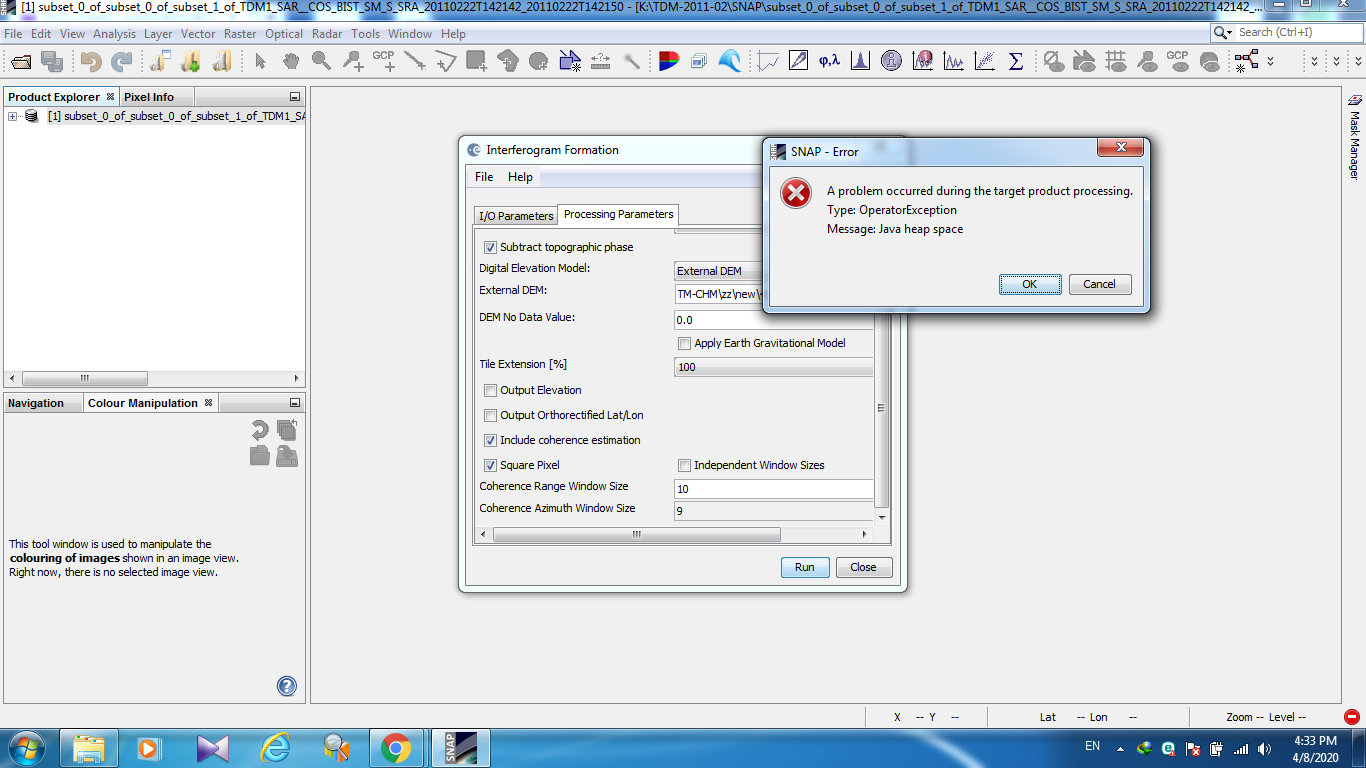
Why I can’t complete this process while removing topographic phase? You see the error on the image.
What is the difference between checking topography phase removal box in the interferogram formation step rather than topography phase removal as separate step?
Hi,
I tried with larger window for interfrogram formation (+flat earth and topo phase removal) but its takes along more than one day and from near to middle process has stopped.
Is it OK this slow time processing for topography phase removal? and not complete process?
It is worth mention that I use from high resolution DEM with covering area less than TDM window.
Hi again.
I try more with unwrapping but I still have problem. I also use from high quality coherence data but after unwrapping, I have negative value. It is worth mention that this new data have been tested for canopy height model with high accuracy.
Without removing topo phase or with it, the result isn’t changed very and problem exist.
.
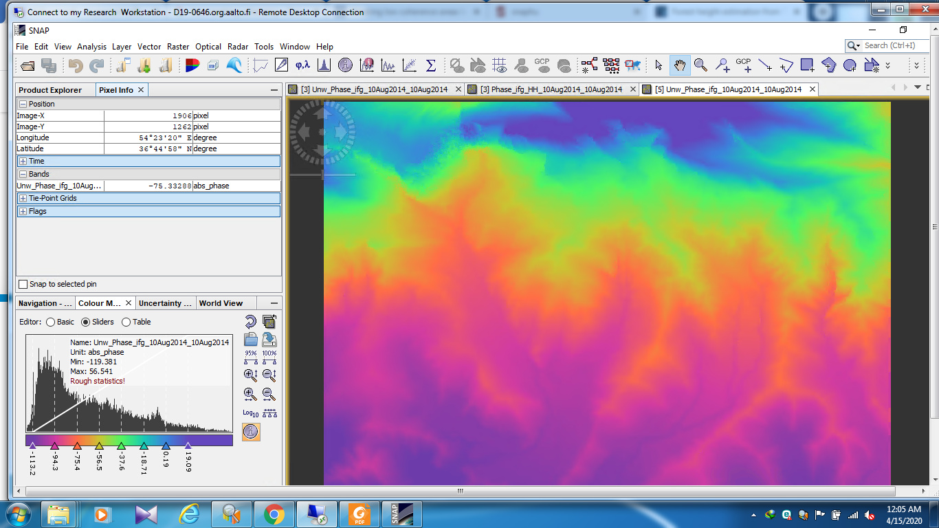
The above image created by following steps:
interferogram formation and flat earth removal
filtering
snaphu export
unwrapping in cmd
snaphu import
Thanks in advance
the workflow is not done after unwrapping. You have to apply “Phase To Elevation” afterwards.
This tutorial refers to Sentinel-1 data, but also acquired in Stripmap mode, so most of the contents are comparable: Sentinel-1 Stripmap Interferometry