hello,
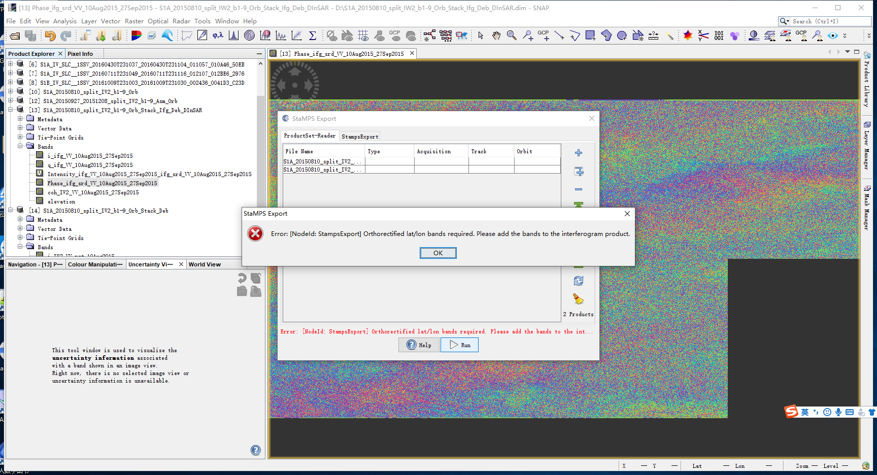
I just want to know how to add this band,thanks a lot in advance
usually, this is selected during the interferogram generation
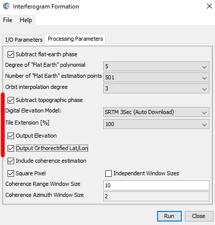
You can add them afterwards, but this is prone to errors for the later StaMPS processing.
Please also note that you need a stack of at least 15 images for a proper PS analysis.
Thanks a lot. For the first time, I read the instruction that it is a stack and an interferogram. You know, if You want to make a stack of 15 interferograms, you get 16 stamps. I have also read relevant books, but the software does not know how to operate in detail, I am very confused,Could you explain it in detail,thank you very much
please have a look at theres instructions, they are the best available at the moment: https://gitlab.com/Rexthor/gis-blog/-/blob/master/StaMPS/2_stamps_workflow.md
I’m so appreciate for your help ! thanks