dear madam/ sir
good evening
1- Excuse me, may I know how I can fusion between s1 and s2 to work with the river surface elevations?
2- Which tools can I use in SNAP to measure the widths of rivers from Sentinel-1 images?
3- Which tools can use in SNAP to get the river surface elevations with the sentinel-3 image
Thank you in advance.
Hello
there are two documents dealing with data fusion from different satellite platforms.
You can find them in the tutorial section of the STEP website.
You might find other interesting tutorials there.
A measurement tool is included in SNAP. With this you can measure the width.

To any product, which is georeferenced, you can add an elevation band.
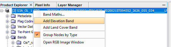
And you can select from multiple DEMs.
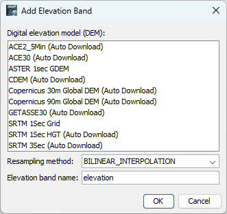
Afterwards you can see the elevation values in the PixelInfo View.
3 Likes
May I ask please, can monitor the river discharge by Sentinel-3, if yes, how?
Thanks.
Good afternoon, sir
Sir, I apologize for disturbing you, but how can I display an image of Sentinel-1 to measure the width of a particular river by measuring a ruler?
I’ve already downloaded it, but please tell me which one I should open to measure the width.
If it’s possible, is there any video or tutorial about this issue?
Thanks
Please download S-1 GRD data and terrain correct it. You should consult the basic SAR tutorials on how to do this to get acquainted with SAR data.
Thank you so much, sir. I appreciate your support.