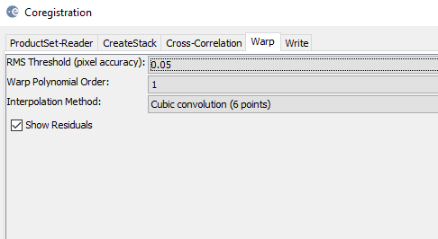
ENVISAT and ERS-1/2 SLC data, coregistration does not dump GCPS. But it works for geocoded products.
Old software NEXT (before SNAP) shows nicely when we click ground_control_points in vector data. In the SNAP, it is empty as shown below.
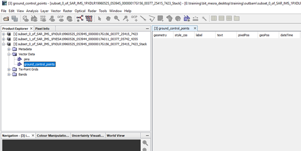
I think the ground_control_points file under “Vector data” only stores the manually created ones from the GCP manager. If you want to get the GCPs of the coregistration you have to open View > Tool Windows > Radar > InSAR Stack